
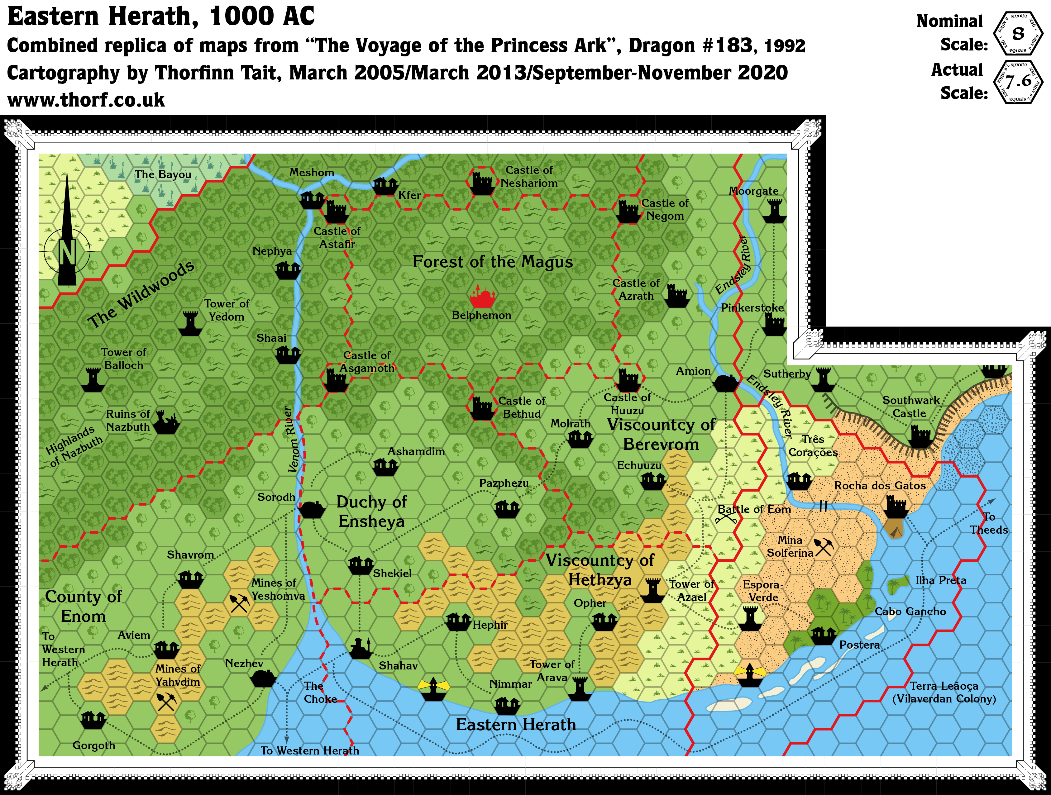
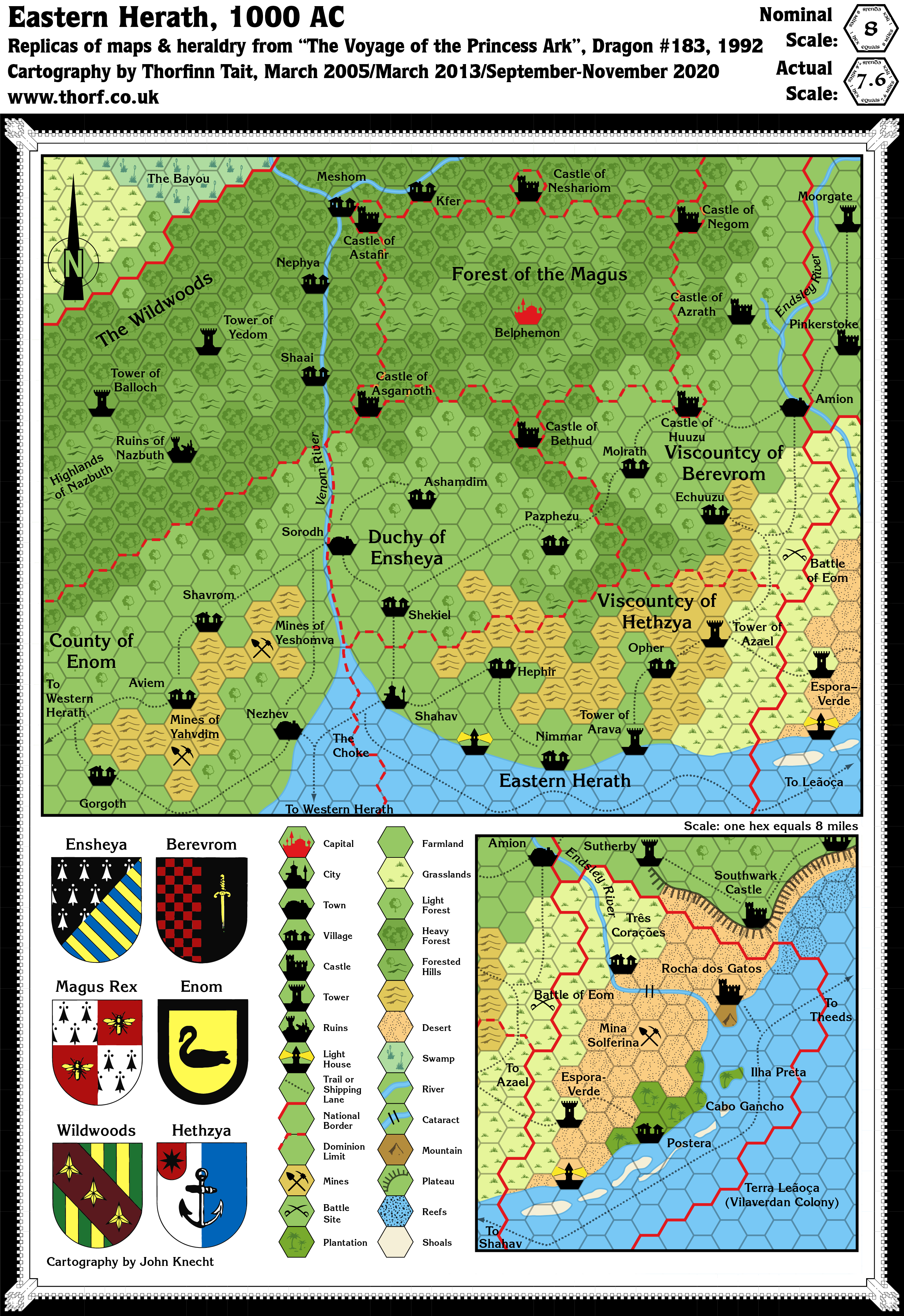
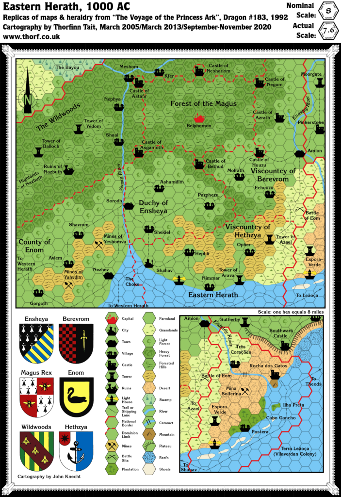
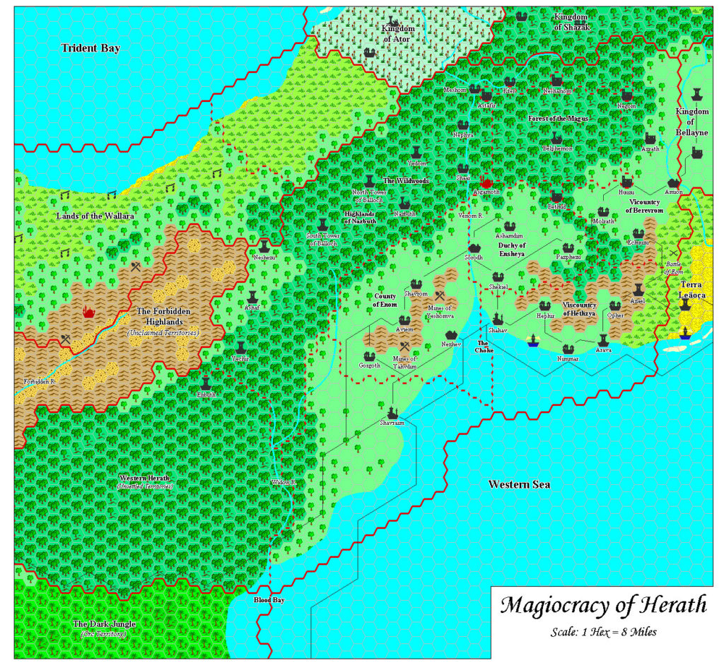
Dragon 183 Eastern Herath, 8 miles per hex
Herath is the gateway to the Orc’s Head Peninsula, with the Wildwoods at the centre of the neck connecting the peninsula to the rest of the Savage Coast. It’s a fascinating nation of wizards that hides a dark secret. The map in Dragon 183 was labelled “Eastern Herath”; the western region appeared in Dragon 196, but only at 24 miles per hex. It was never fully mapped at 8 miles per hex, although much of it was detailed in Red Steel in 1994.
The map introduced two new innovations: shoals, marked by a cream coloured terrain; and a mountain hex with a single lone peak. While shoals would appear again in future Princess Ark maps, the lone mountain hex only ever appeared on this map.
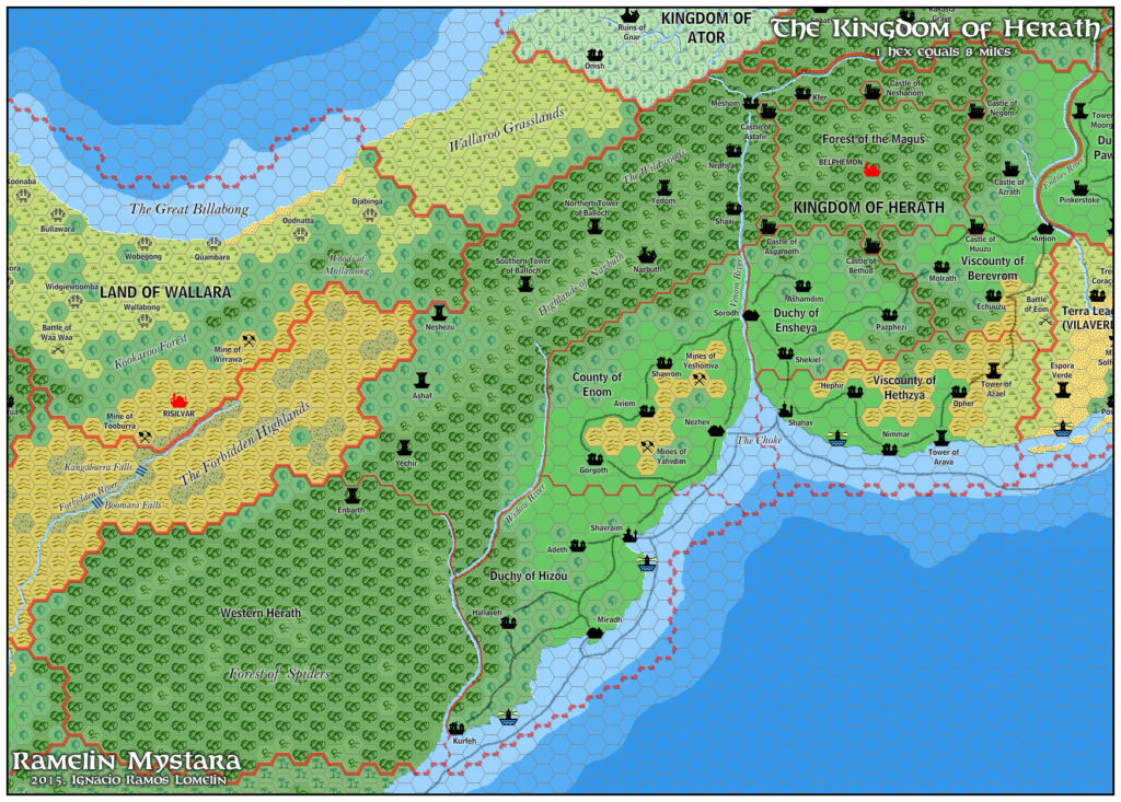
Replica Map (November 2020)
Sources
- The Voyage of the Princess Ark Part 30: Web of the Wizard-King, Dragon 183 (July 1992)
- Page 47 map, inset map, and key (Cartography by John Knecht)
Chronological Analysis
This is Map 190. It was published in July 1992. The updated version of this map has not yet been released. See also Appendix C for annual chronological snapshots of the area. For the full context of this map in Mystara’s publication history, see the upcoming Let’s Map Mystara 1992.
The following lists are from the Let’s Map Mystara project. Additions are new features, introduced in this map. Revisions are changes to previously-introduced features. Hex Art & Fonts track design elements. Finally, Textual Additions are potential features found in the related text. In most cases, the Atlas adopts these textual additions into updated and chronological maps.
Under Construction! Please check back again soon for updates.
Additions
- Settlements —
Revisions
- Settlements —
Hex Art & Fonts
- Hex Art —
- Fonts —
Textual Additions (Dragon 183, July 1992)
- Settlements —
")
")
