
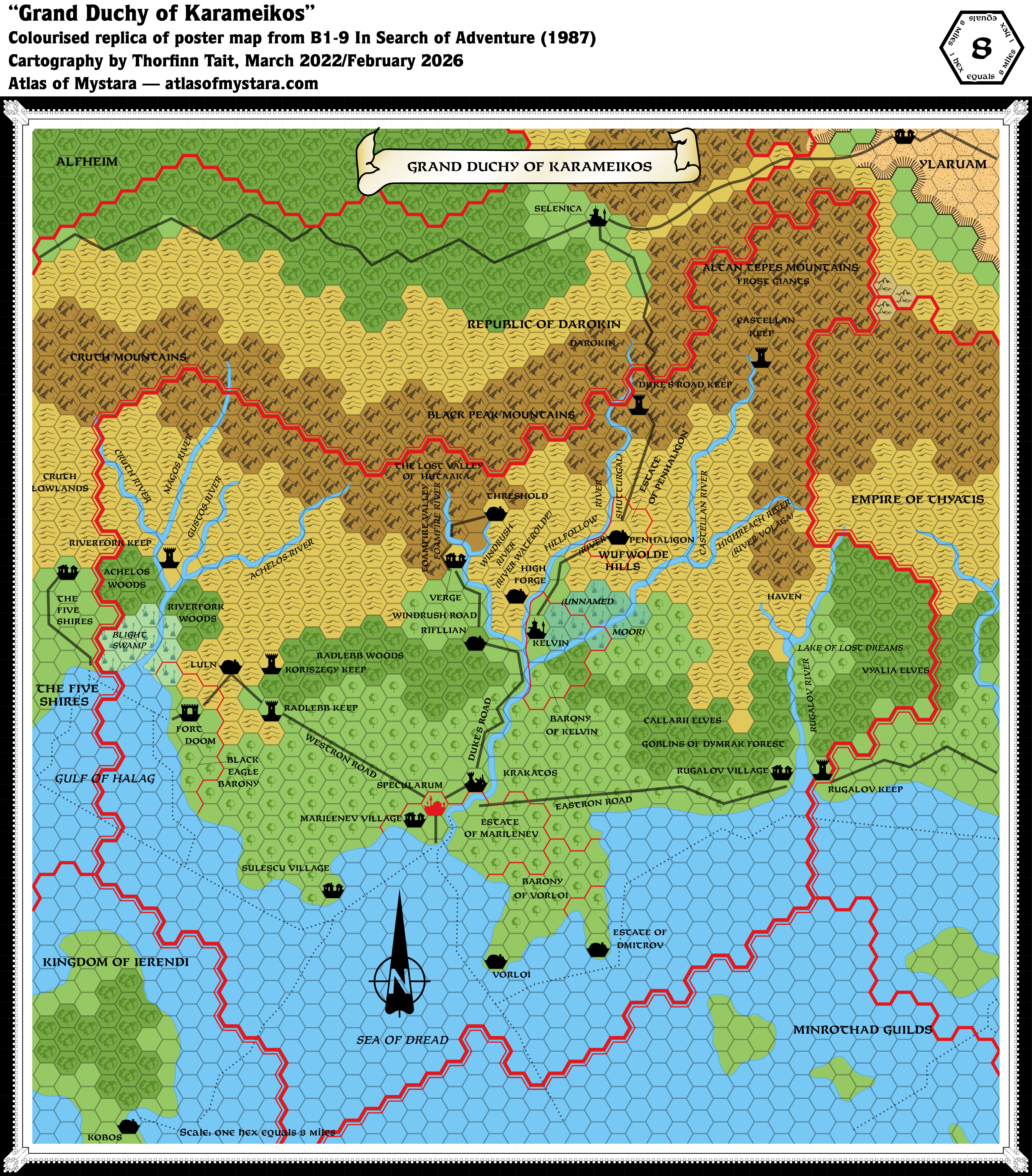
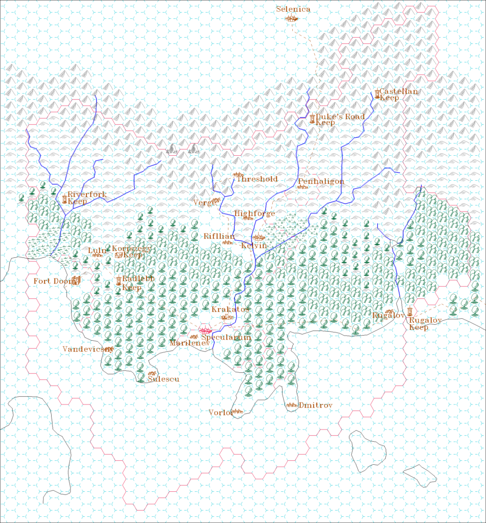
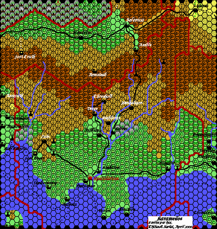
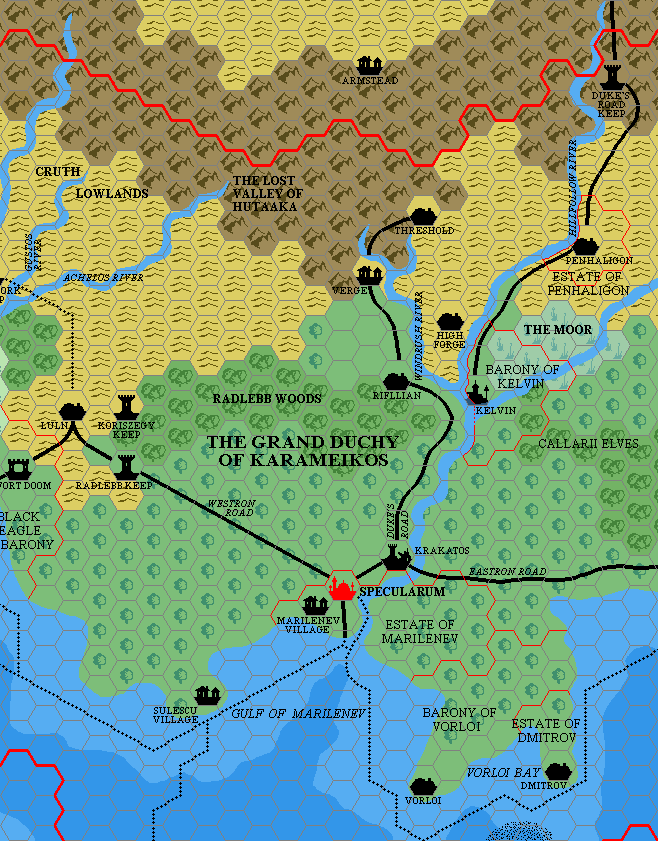
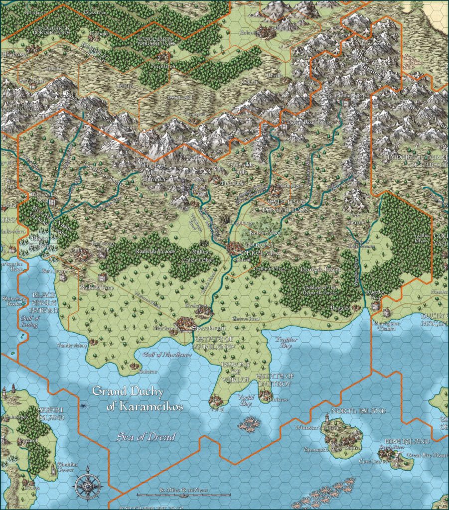
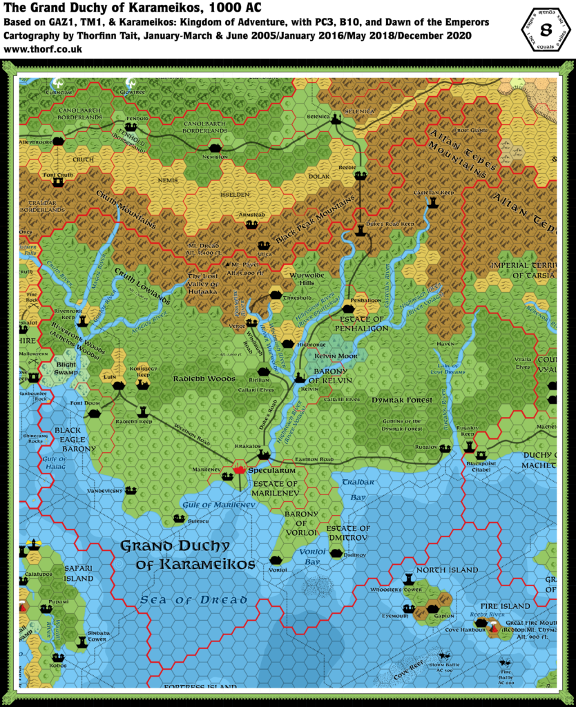
B1-9 Karameikos, 8 miles per hex
This map appeared in the B1-9 In Search of Adventure super module. It was released just two months after GAZ1 The Grand Duchy of Karameikos, and it’s mostly just a very close replica of GAZ1’s Karameikos map. The borders of this one have been expanded ever so slightly. The original was in black and white, so I have used the colours from GAZ1’s map to provide terrain types for white hexes.
Replica Map (March 2022)
Sources
- B1-9 In Search of Adventure (1987) (PDF at DriveThruRPG)
- Pages 130-131 map
Chronological Analysis
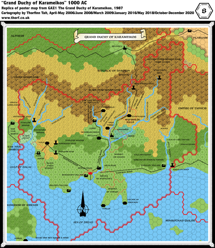
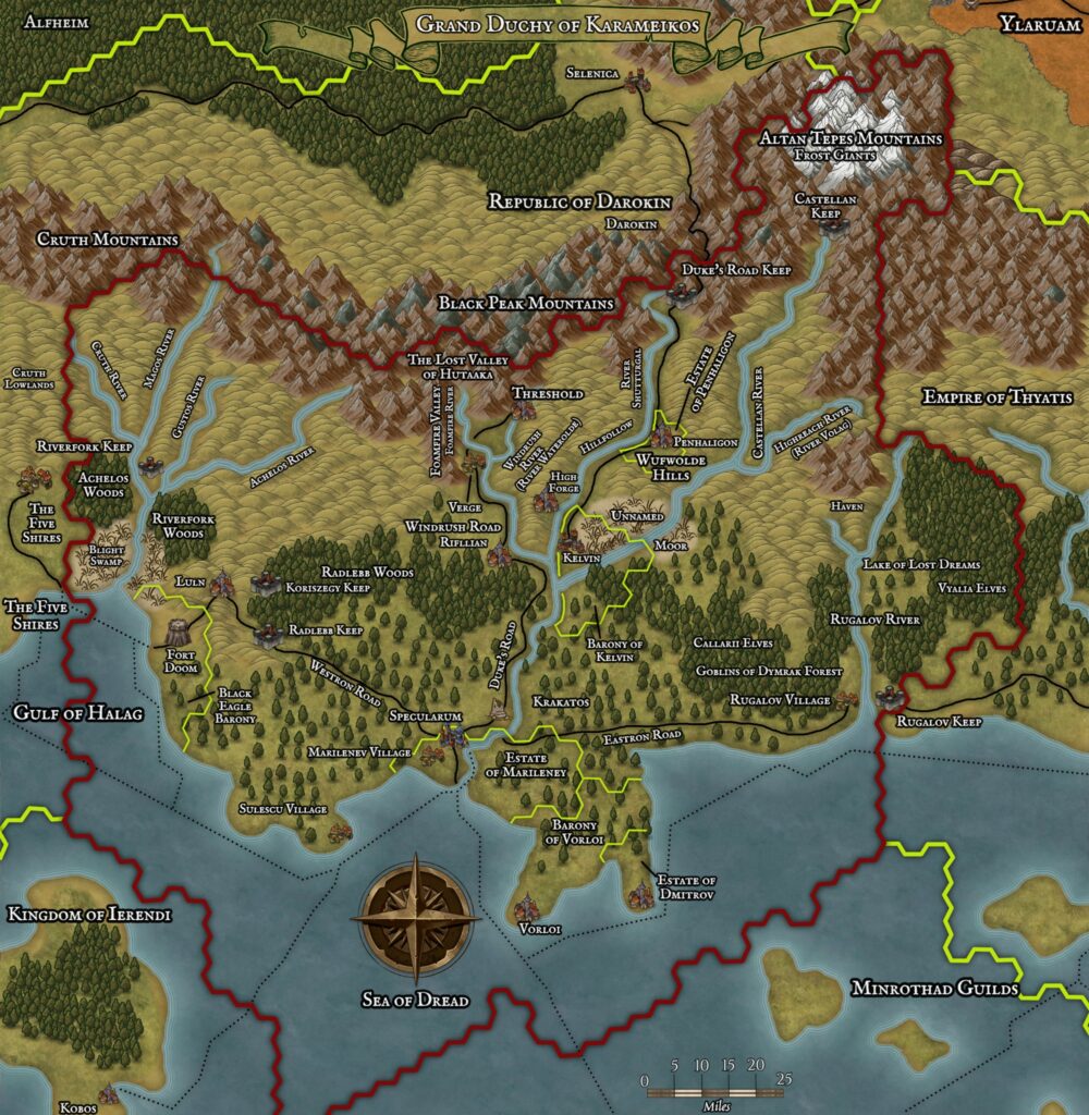
This is Map 58. It was published in July 1987. The updated version of this map is Karameikos, 8 miles per hex. See also Appendix C for annual chronological snapshots of the area. For the full context of this map in Mystara’s publication history, see Let’s Map Mystara 1987.
The following lists are from the Let’s Map Mystara project. Additions are new features, introduced in this map. Revisions are changes to previously-introduced features. Hex Art & Fonts track design elements. Finally, Textual Additions are potential features found in the related text. In most cases, the Atlas adopts these textual additions into updated and chronological maps.
Hex Art & Fonts
- Hex Art — Black and white version of the Gazetteer standard.
- Fonts — Feinen throughout.
Analysis
Nothing to see here. If the original map hadn’t been black and white, I would have simply treated it as a reprint. Most likely this was a reproduction of GAZ1’s map without the coloured background layer, because the content of the map is very nearly identical.
Textual Additions (B1-9, July 1987)
- Features — B1-9 provides locations for a number of previously published modules.
- The Old Antilles Castle is located “five miles west of Threshold” (B1-9 page 5b). This is Castle Caldwell from B9. Page 7b then says it is “a few miles out of town”. It is later referred to as Caldwell Castle (B1-9 page 13c).
- There’s “a large raiding party of orcs” led by “a renegade cleric named Elwyn” “three days ride to the east” of Threshold (b1-9 page 5b).
- The adventure Rahasia, and thus the village of Kota-Hutan as well as the Temple of Gray Mountain, is “northward out of Karameikos”, “along the Duke’s Road” (B1-9 page 6c).
- A “small hamlet only a day’s ride to the east” was destroyed by hobgoblins (B1-9 page 13c).
- The Forest of Carm is “several hours travel” north of Threshold (B1-9 page 14c). This refers to B8 Journey to The Rock. This location clashes badly with B10’s maps. See TraverseTravis’s thread at The Piazza and his research document for an analysis of this and the placements given in B8 itself.
- Guido’s Fort is located downstream from where the characters were sent after Haven… which unfortunately is not specified. Assuming the closest river to Haven, it must be somewhere upstream on the Highreach/Volaga River. It’s noted that if the PCs don’t stop at Guido’s Fort, they will pass through Kelvin, so this also fits with that river. (All B1-9 page 61a) Therefore Guido’s Fort must be located somewhere along the Volaga, between Kelvin and the river’s source. Perhaps southeast of Penhaligon, between Xitaqa and the logging camp of Sielo would be a reasonable location. Having said this, it could also be somewhere along the Castellan River, or even the Hillfollow/Shutturga.
")
")
")
16 March 2022 @ 11:03 pm
Darn I was hoping it was the revised B1-9 with all the module placements and everything 🙂
16 March 2022 @ 11:05 pm
All in good time. I’ll get there, don’t worry.