
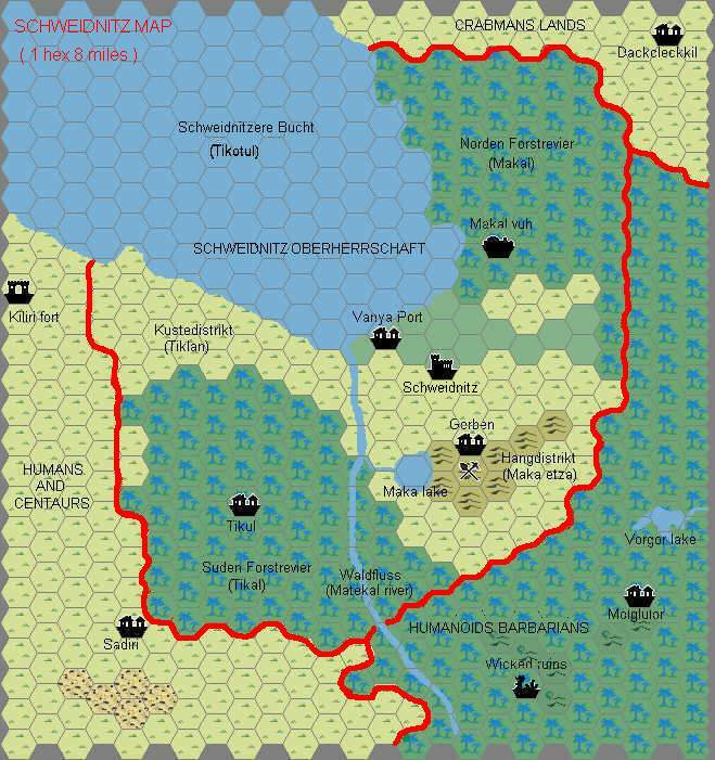
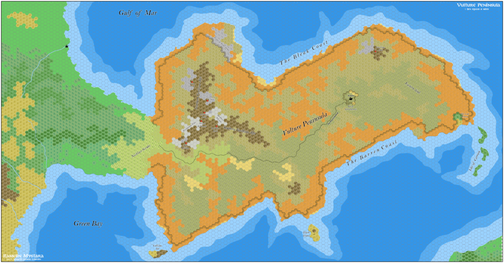
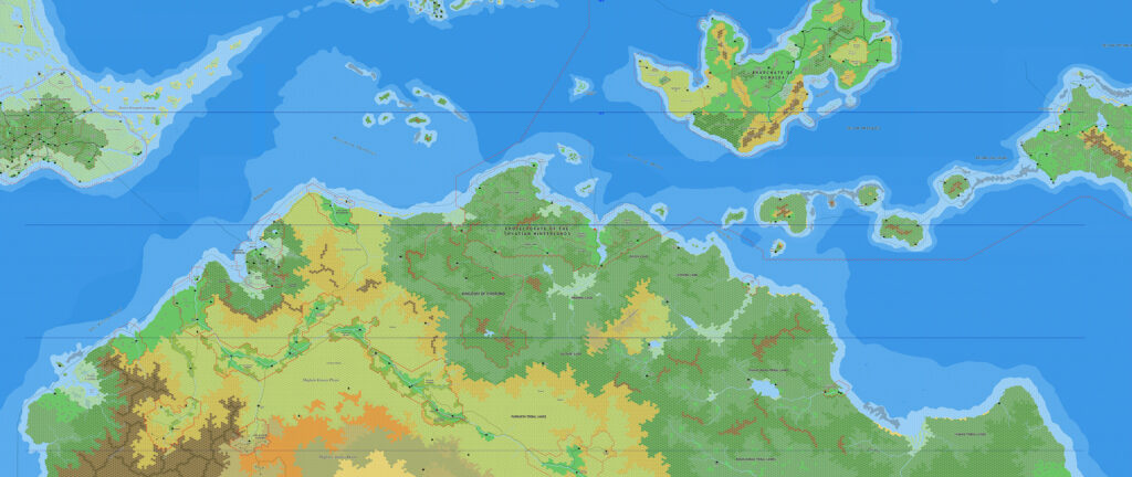
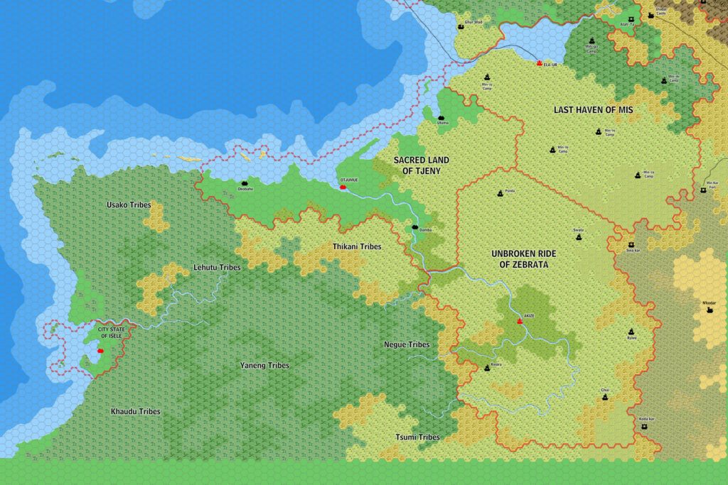
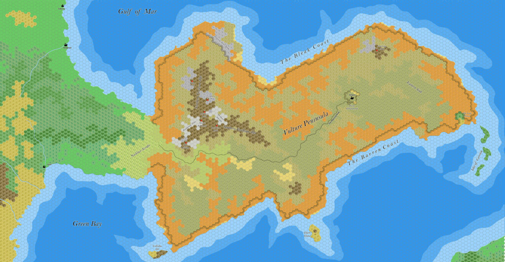
Ramelin’s Aryptian Peninsula, 8 miles per hex
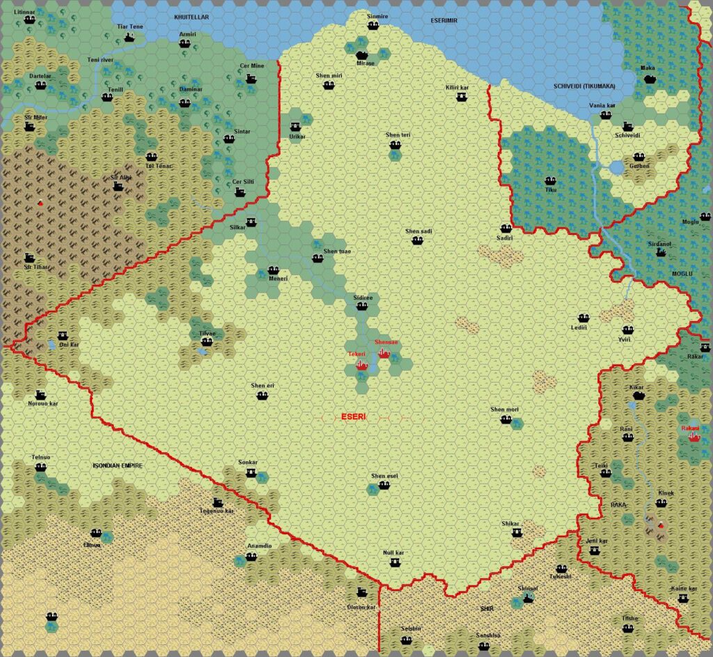
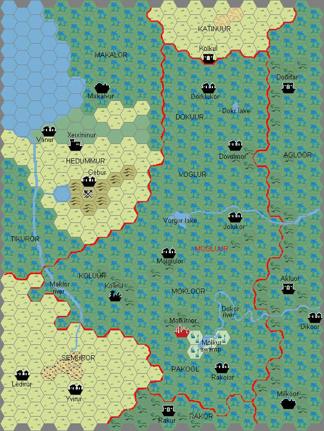
This map marked a triumphant return to Jose’s expansion in Davania, this time moving east from the Jungle Coast. The two maps don’t quite fit together, and it would be a few months before he finished a larger map showing the join between these areas.
Everything on this map except for Cestia (in the southeastern corner) was new, appearing here for the first time in Ramelin Mystara. As usual, Jose brought in all the details and information from other sources he could find — although in terms of maps, these were (and still are) few and far between. The primary source was Thibault’s Eastern Davania, 8 miles per hex, which had a lot of very nice detailing for all of the Aryptian Savannah.
Jose added many little things of his own, including more rivers and lakes, and he also expanded upon the features of other cartographers. As we had come to expect, it’s a tour de force in Mystaran mapmaking.
At the same time he also completed a map of the Gulf of Mar region to the south, extending coverage down to the Vulture Peninsula.
Fan-made Map by Jose Ignacio Ramos Lomelin (November 2017)
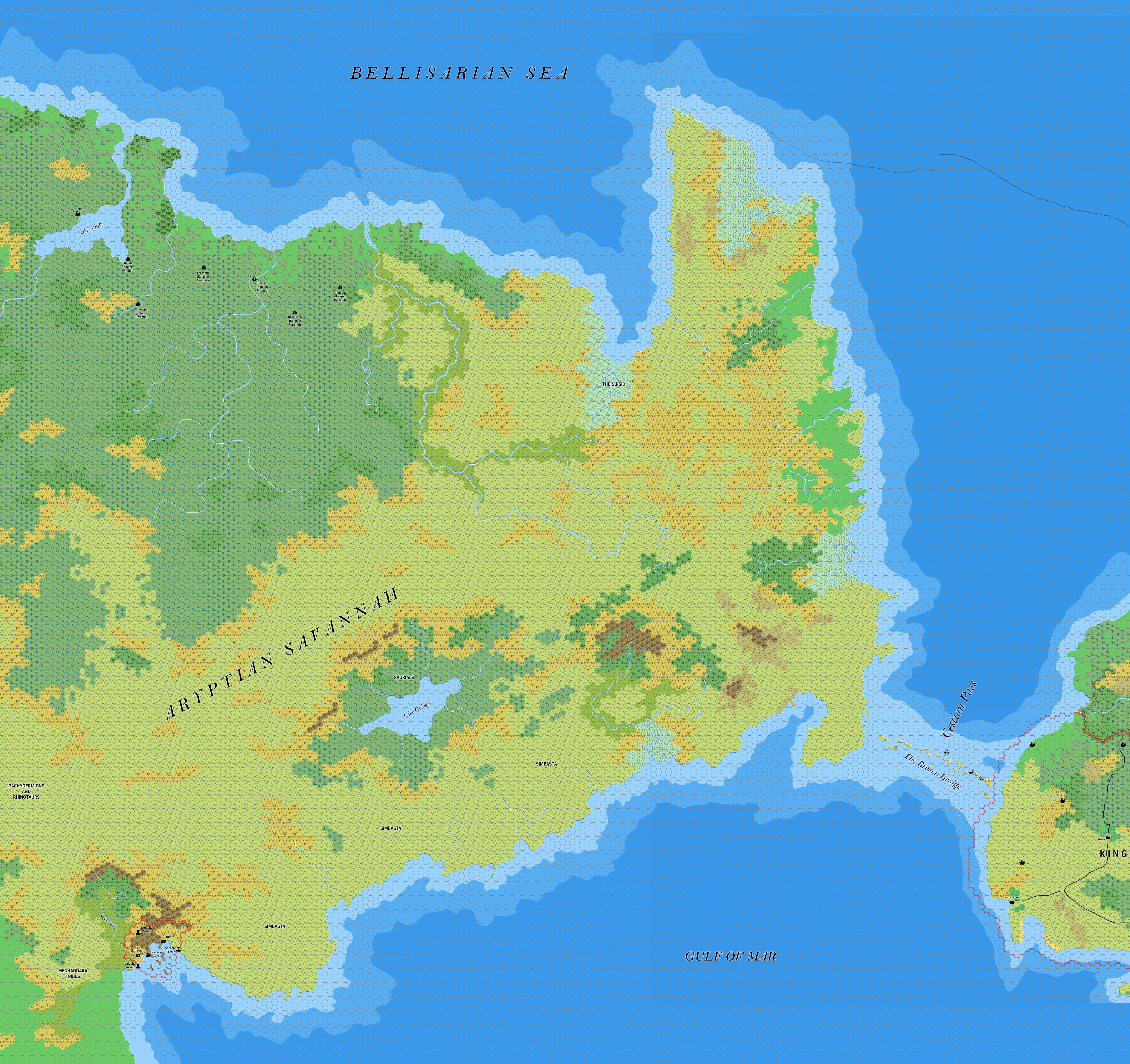
This is an original map created by one of Mystara’s excellent fan cartographers. For more information on the cartographer, including a gallery of all their maps, see also Appendix M: Mappers of Mystara.
Sources
- Master Rules Set (1985) (PDF at DriveThruRPG)
- The Voyage of the Princess Ark Part 4: Capture, surrender, and — death?, Dragon #156 (April 1990)
- The Voyage of the Princess Ark Part 5: As they fed on a nation, so were they cursed, Dragon #157 (May 1990)
- Hollow World Campaign Set (1990) (PDF at DriveThruRPG)
Fan Sources
- Thibault’s Eastern Davania, 8 miles per hex (May 2004)
References
- All of Jose’s maps at the Atlas of Mystara
- Jose’s entry in Appendix M: Mappers of Mystara (upcoming)
- Jose’s author page at the Vaults of Pandius
Chronological Analysis
This is a fan-made map. It was published in November 2017. The updated Atlas version of this map is not yet available. See also Appendix C for annual chronological snapshots of the area. For the full context of this map in Mystara’s publication history, see the upcoming Let’s Map Mystara 2017.
The following lists are from the Let’s Map Mystara project. Additions are new features, introduced in this map. Revisions are changes to previously-introduced features. Hex Art & Fonts track design elements. Finally, Textual Additions are potential features found in the related text. In most cases, the Atlas adopts these textual additions into updated and chronological maps.
Under Construction! Please check back again soon for updates.
Additions
- Settlements —
Revisions
- Settlements —
Hex Art & Fonts
- Hex Art — Ramelin Mystara standard.
- Fonts — Bell MT (major geographic and all water labels), Bell Centennial (all other labels), Feinen (titling).

")

