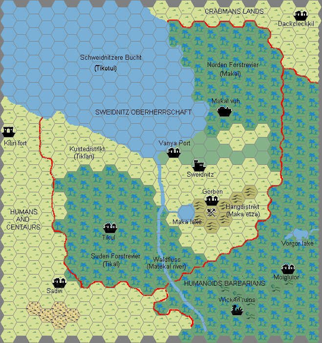
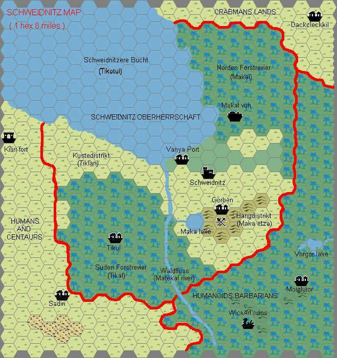
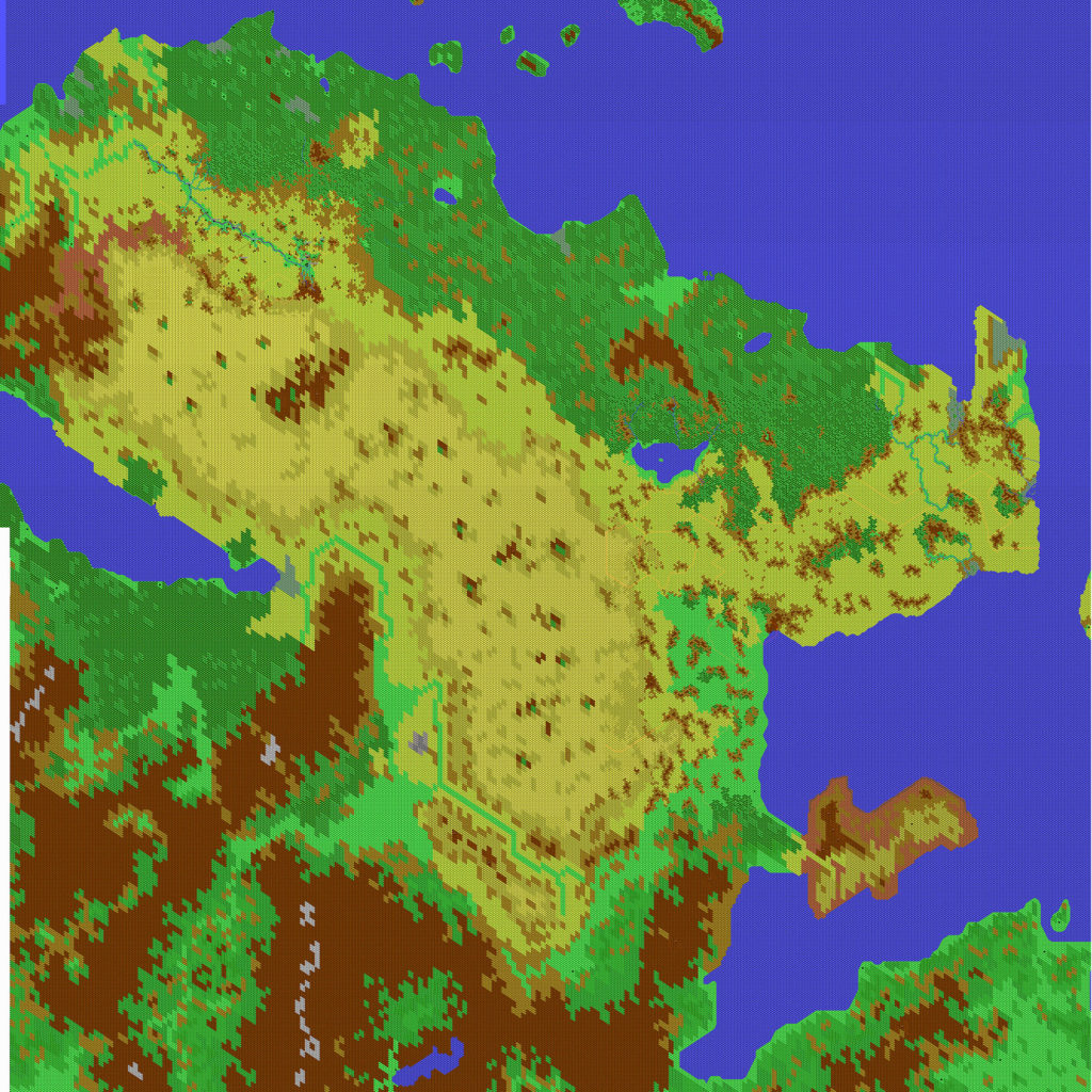
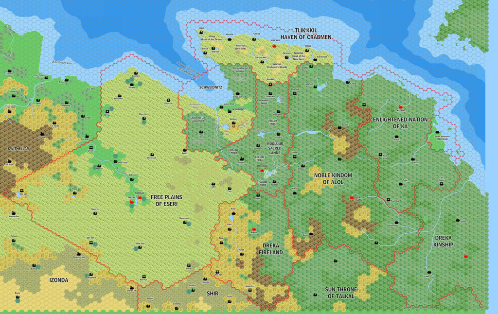
Ramelin’s Fricana, 8 miles per hex v1
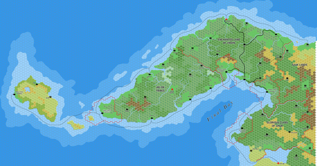
February 2018 heralded a huge leap forward for Jose’s Davania maps, and an amazing milestone for the Mystara community as a whole. He completed not just one but three different maps of northern Davania, encompassing the entire northern part of the vast continent.
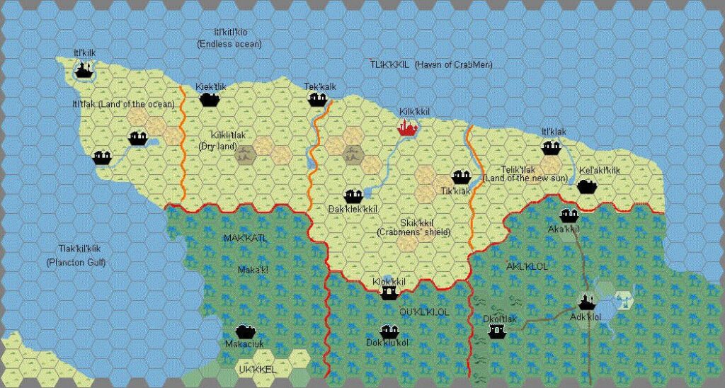
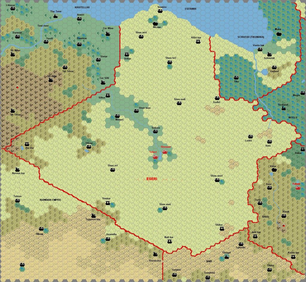
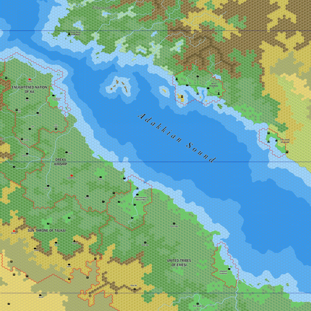
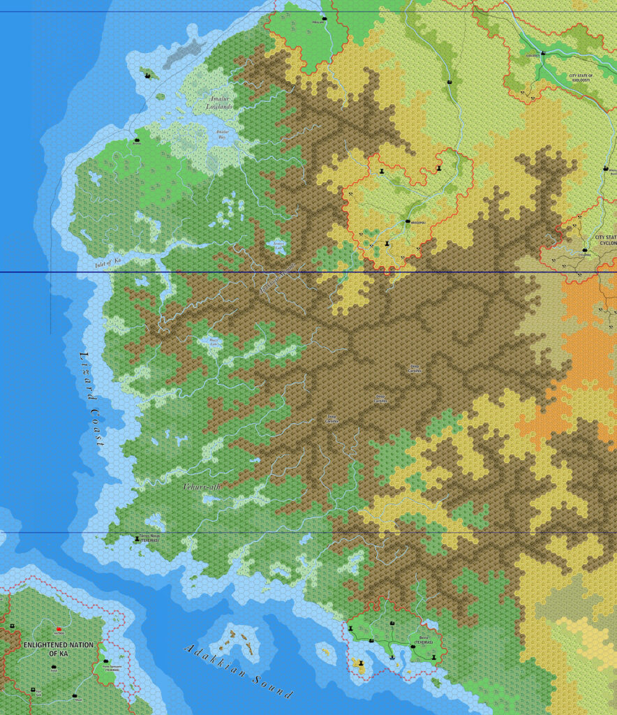
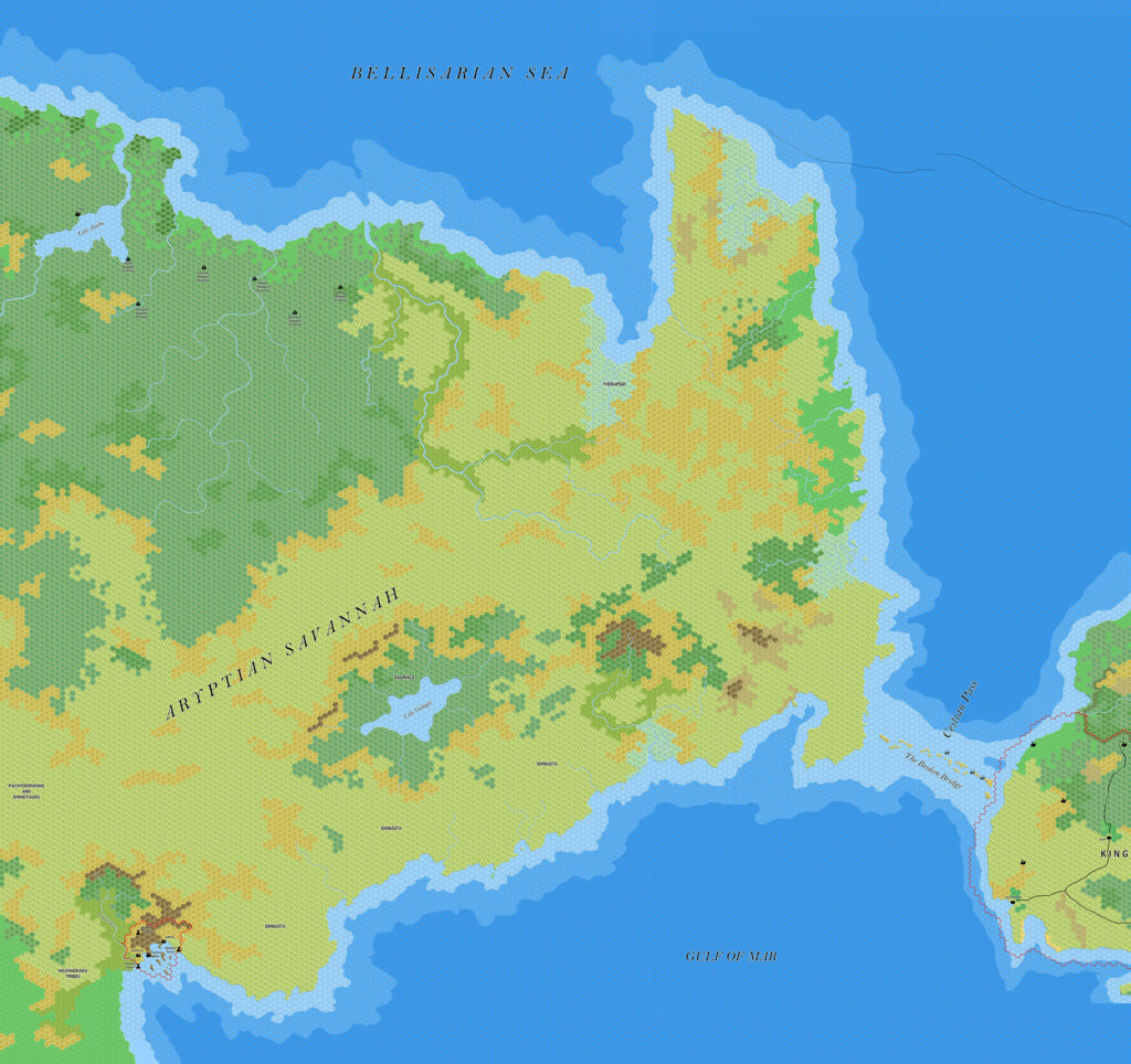
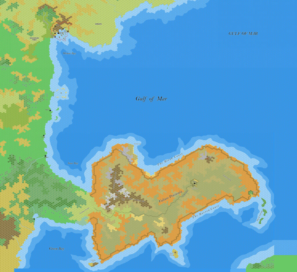
This map focused on the northeastern part, which he named Fricana. I have been unable to find any references to this name outside of Ramelin Mystara, but it seems fitting as this part of Davania was based on Jurassic Africa.
Of course, this map didn’t just spring into existence. Jose had been gradually building up his coverage of Davania over two years. All told, about a third of the featured area was new in this map: the central part of the map south from the Bogdashkan Tribal Lands label, connecting the Meghales Amosses Desert with the Deep Aryptian Basin; the bottom strip of land encompassing everything from the edge of the map through the Adakkian Wood and east to the Deep Aryptian Basin; and the area of empty sea in the northeast. Everything else came from previous maps.
Jose would revisit this map in 2021, mainly to crop it slightly. While this may sound inconsequential, the sheer size of this map means that any reduction in area is very welcome from a usage perspective.
Fan-made Map by Jose Ignacio Ramos Lomelin (February 2018)

This is an original map created by one of Mystara’s excellent fan cartographers. For more information on the cartographer, including a gallery of all their maps, see also Appendix M: Mappers of Mystara.
The map above is a lower resolution preview. To download the full size version, please follow the link (right click and choose “Save Link As…” or equivalent). Mobile Users, please note that it may not be possible to view the full resolution image on your device due to its large size.
Sources
- Hollow World Campaign Set (1990) (PDF at DriveThruRPG)
Fan Sources
- Ramelin’s Davanian Hinterlands, 8 miles per hex (February 2016)
- Ramelin’s Adakkian Sound North, 8 miles per hex (September 2017)
- Ramelin’s Amalur, 8 miles per hex (September 2017)
- Ramelin’s Pearl Islands, 8 miles per hex v2 (September 2017)
- Ramelin’s Aryptian Peninsula, 8 miles per hex (November 2017)
- Ramelin’s Gulf of Mar, 8 miles per hex (November 2017)
- Ramelin’s Meghales Amosses Desert, 8 miles per hex (January 2018)
- Ramelin’s Aryptian Basin, 8 miles per hex (February 2018)
References
- All of Jose’s maps at the Atlas of Mystara
- Jose’s entry in Appendix M: Mappers of Mystara (upcoming)
- Jose’s author page at the Vaults of Pandius
Chronological Analysis
This is a fan-made map. It was published in February 2018. The updated Atlas version of this map is not yet available. See also Appendix C for annual chronological snapshots of the area. For the full context of this map in Mystara’s publication history, see the upcoming Let’s Map Mystara 2018.
The following lists are from the Let’s Map Mystara project. Additions are new features, introduced in this map. Revisions are changes to previously-introduced features. Hex Art & Fonts track design elements. Finally, Textual Additions are potential features found in the related text. In most cases, the Atlas adopts these textual additions into updated and chronological maps.
Under Construction! Please check back again soon for updates.
Additions
- Settlements —
Revisions
- Settlements —
Hex Art & Fonts
- Hex Art — Ramelin Mystara standard.
- Fonts — Bell MT (major geographic and all water labels), Bell Centennial (all other labels), Feinen (titling).