
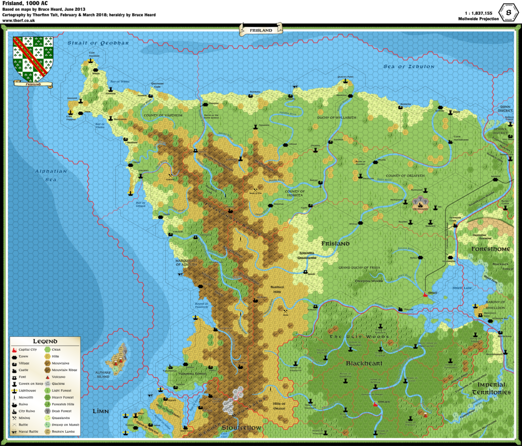
Ramelin’s Frisland, 8 miles per hex
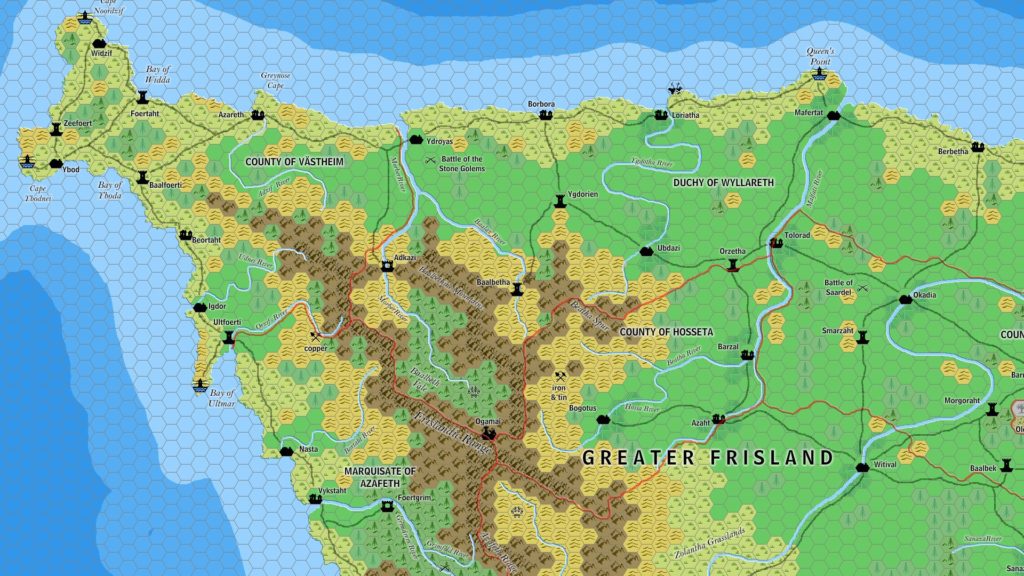
Jose Ignacio Ramos Lomelin is one of Mystara’s most prolific mappers of recent years. He started posting maps in November 2015, though in fact he had already been mapping for many years, so that by 2015 he had already mapped out large swathes of Mystara. This excerpt from his take on Bruce Heard’s Frisland is the earliest example of Jose’s mapping that remains to us, dating back to February 2015. At that time he was likely working towards the public release of his maps, but he kept a lid on all of it until later in the year.
Although a comparison with Jose’s later versions of Frisland will show that this map was not quite complete, it nevertheless shows off many elements of his style that were already present at this point. His original inspiration was Mark Howard’s clean, crisp mapping style. To that he added some tweaks of his own, such as the 3D style bevel or shadow on the coasts and rivers, refining it until he arrived at his present mapping style.
Fan-made Map by Jose Ignacio Ramos Lomelin (February 2015)

This is an original map created by one of Mystara’s excellent fan cartographers. For more information on the cartographer, including a gallery of all their maps, see also Appendix M: Mappers of Mystara.
Sources
- Bruce Heard’s Alphatia (2012-2013)
References
- All of Jose’s maps at the Atlas of Mystara
- Jose’s entry in Appendix M: Mappers of Mystara (upcoming)
- Jose’s author page at the Vaults of Pandius
Chronological Analysis
This is a fan-made map. It was published in February 2015. The updated Atlas version of this map is Frisland, 8 miles per hex. See also Appendix C for annual chronological snapshots of the area. For the full context of this map in Mystara’s publication history, see the upcoming Let’s Map Mystara 2015.
The following lists are from the Let’s Map Mystara project. Additions are new features, introduced in this map. Revisions are changes to previously-introduced features. Hex Art & Fonts track design elements. Finally, Textual Additions are potential features found in the related text. In most cases, the Atlas adopts these textual additions into updated and chronological maps.
Under Construction! Please check back again soon for updates.
Additions
- Settlements —
Revisions
- Spellings — Jose made the following changes to spelling from the original maps. In all likelihood most of these were errors rather than deliberate choices.
- Grimflod River became Grimfold River.
- Morbek River became Morber River.
Hex Art & Fonts
- Hex Art — Ramelin Mystara standard.
- Fonts — Bell MT (major geographic and all water labels), Bell Centennial (all other labels).

")
")