
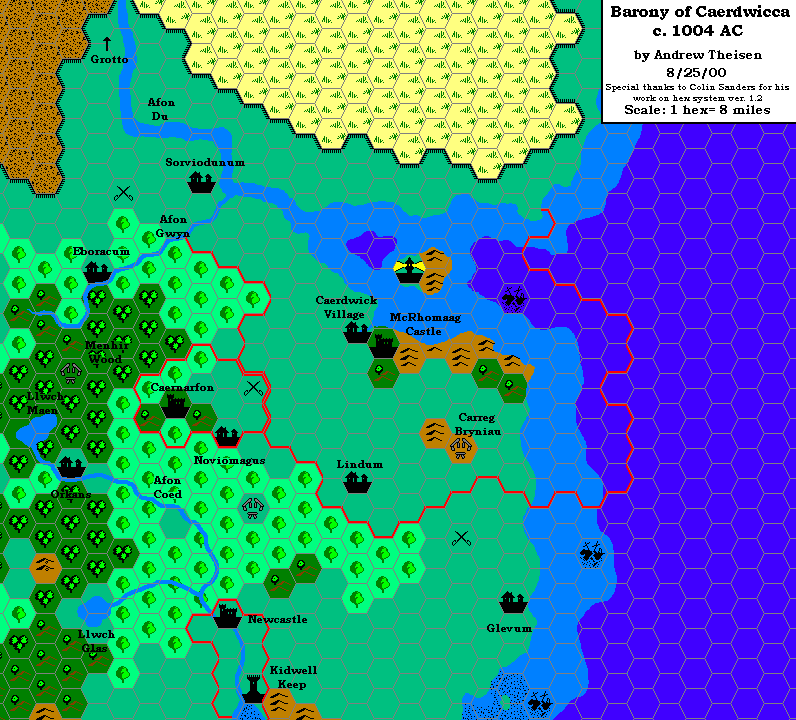
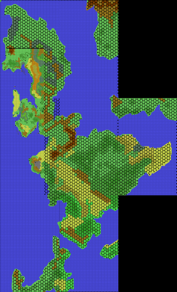
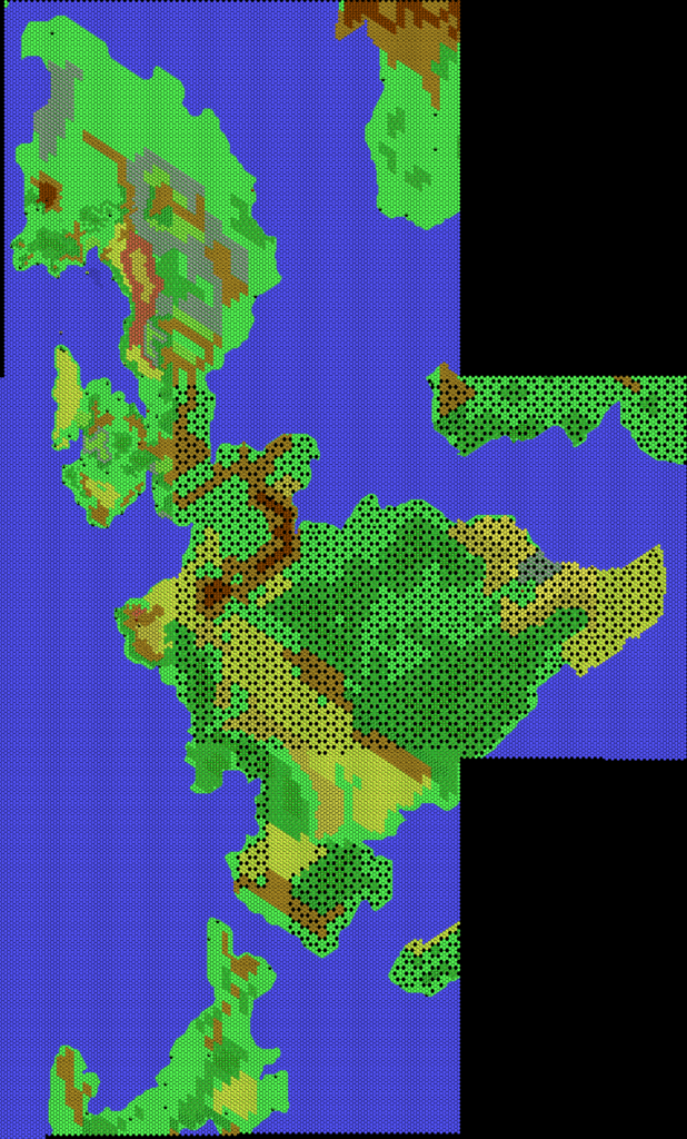
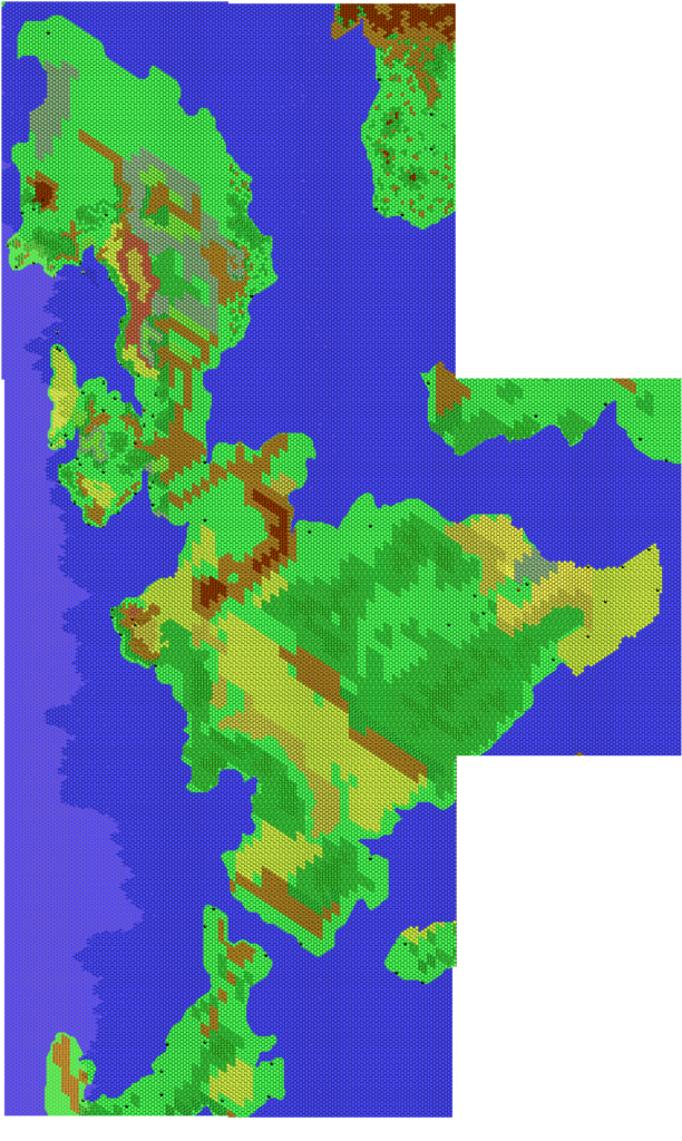
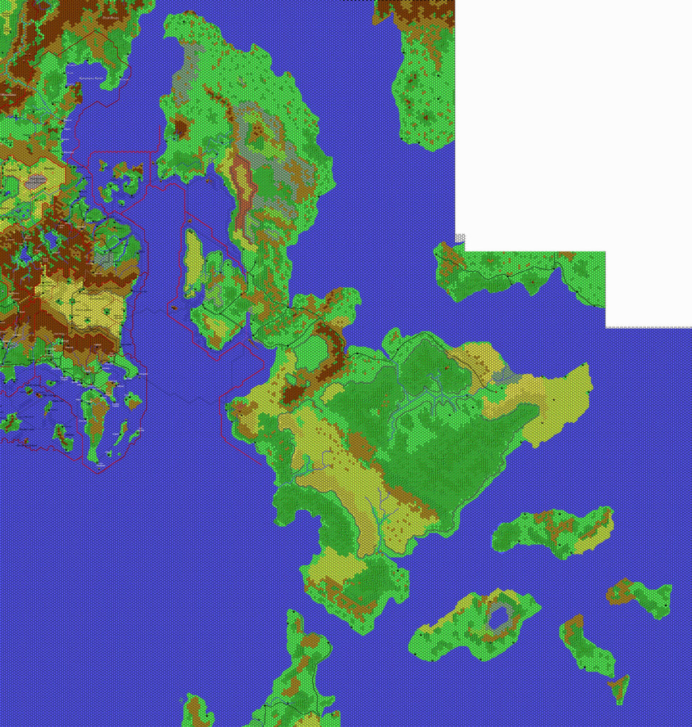
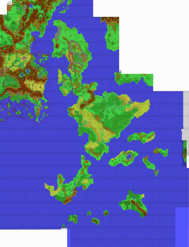
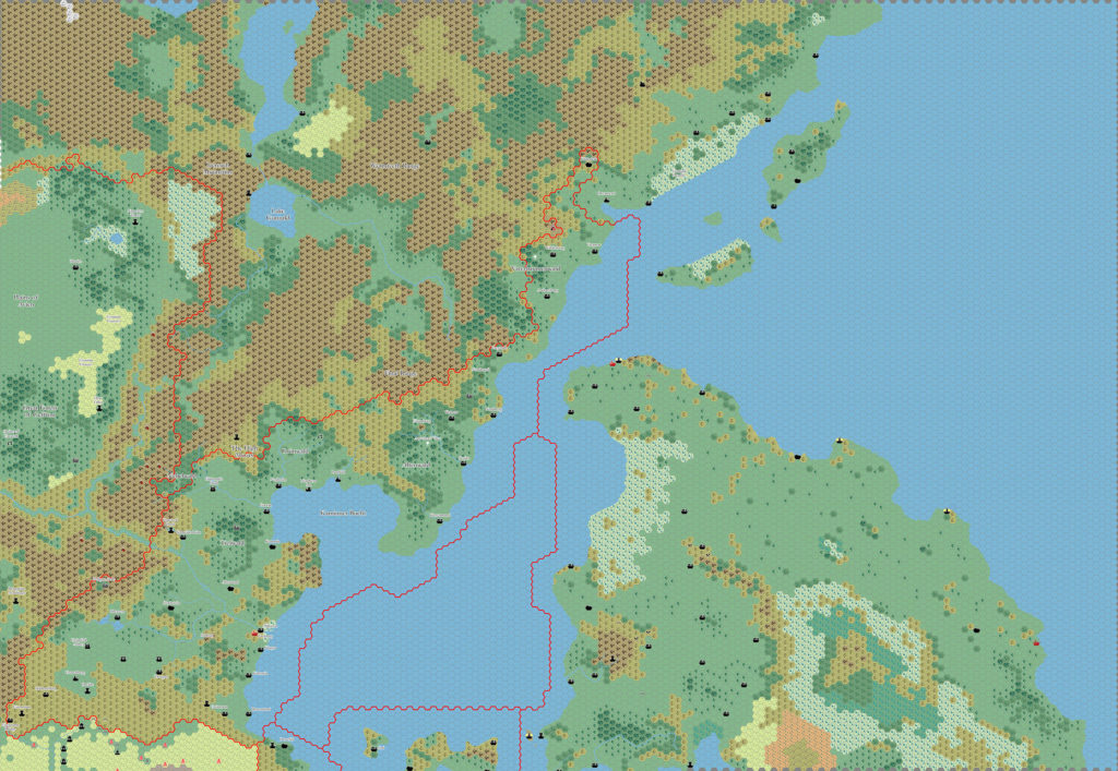
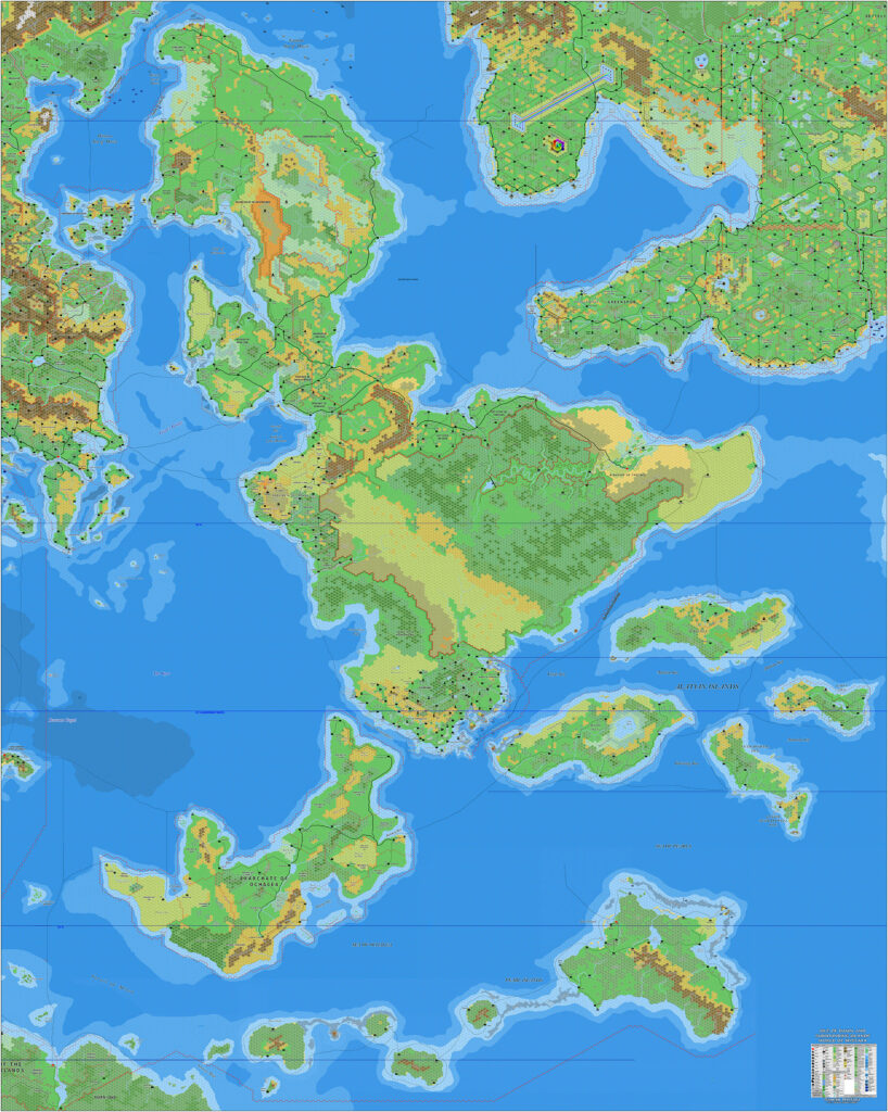
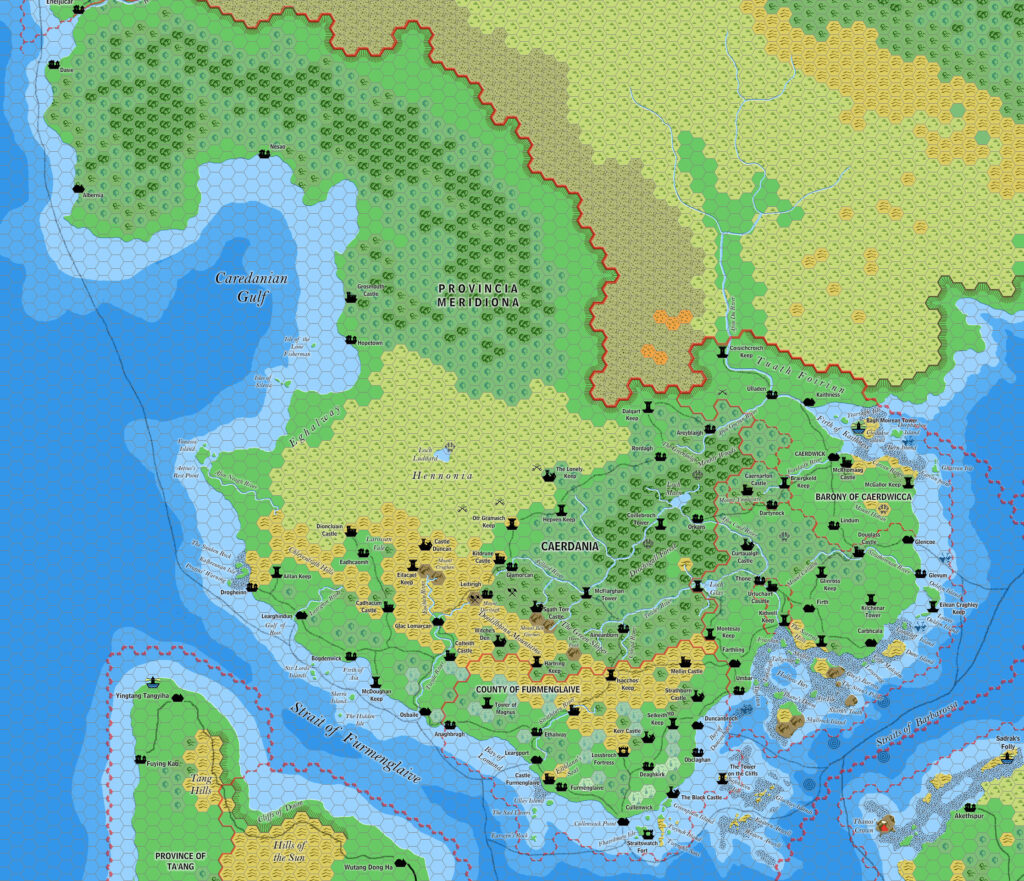
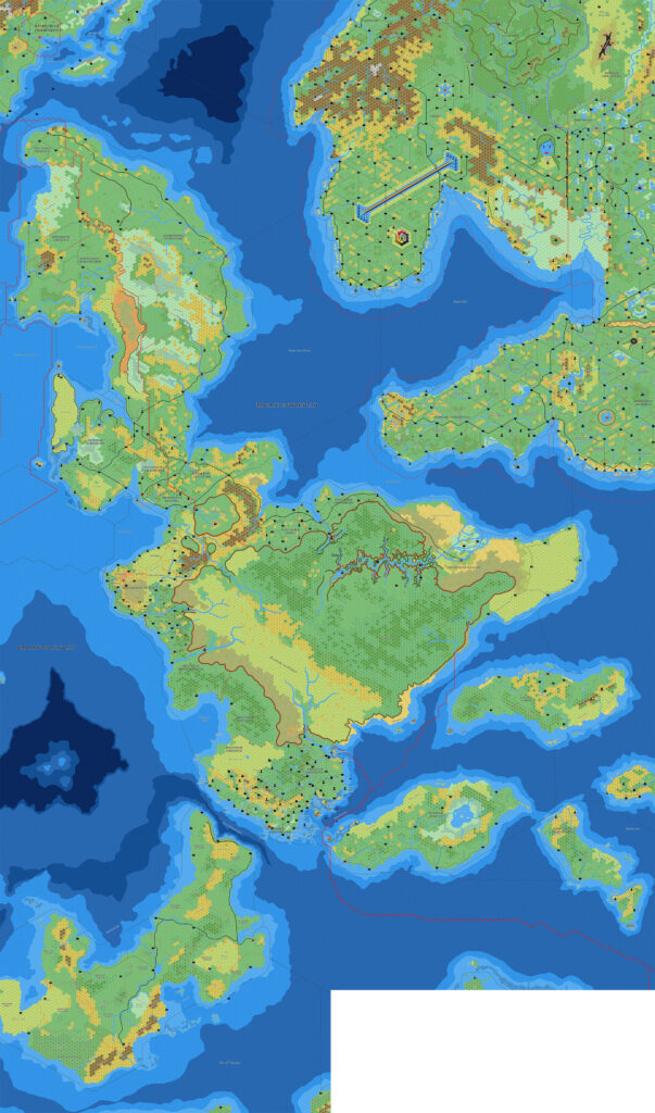
Ramelin’s Isle of Dawn, 8 miles per hex
Following Jose’s first full map of the Isle of Dawn in his larger Sea of Dawn Islands map in March 2017, he produced and shared this tighter map of just the Isle of Dawn in November of the same year. However, whereas the previous map merely brought all the disparate parts together, this one instituted what can only be described as a flurry of additions throughout the Isle of Dawn.
All provinces had their capitals changed to red icons, meaning that even the most well-developed areas, such as Caerdania and Ispana, had small updates. Less dense areas were given new named settlements and outposts. And finally, likely as placeholders for a future update, Jose added numerous small dots along many of the trade routes.
As of this writing, he has not yet returned for another version of the Isle of Dawn, although he has released smaller provincial maps; most of these appear to be excerpts from this one.
Fan-made Map by Jose Ignacio Ramos Lomelin (November 2017)
This is an original map created by one of Mystara’s excellent fan cartographers. For more information on the cartographer, including a gallery of all their maps, see also Appendix M: Mappers of Mystara.
Sources
- TM2 The Eastern Countries (1989) (PDF at DriveThruRPG)
- And many others…
Fan Sources
- Ramelin’s Alatian Islands, 8 miles per hex v1 (November 2015)
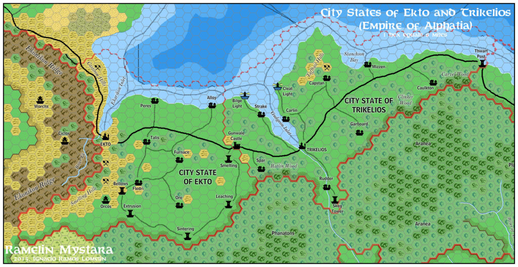
- Ramelin’s Ekto and Trikelios, 8 miles per hex v1 (November 2015)
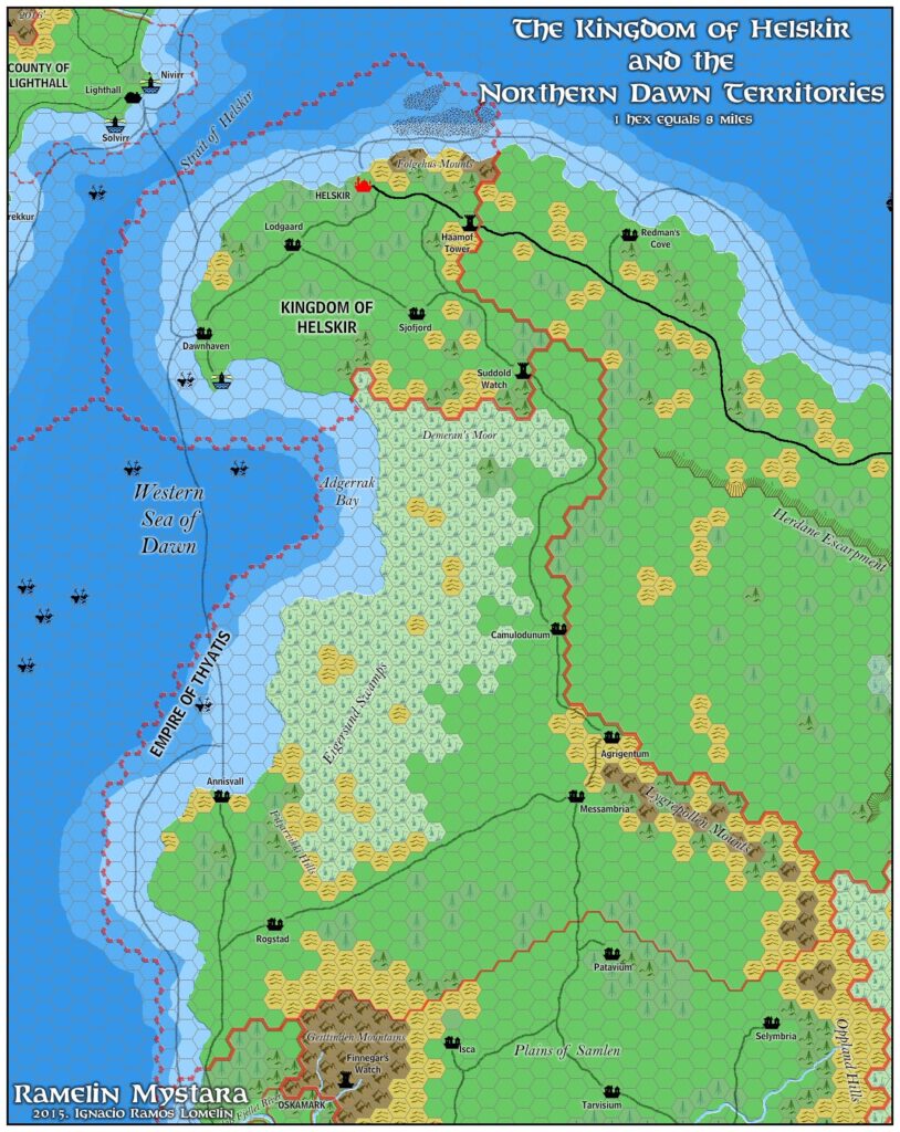
- Ramelin’s Helskir, 8 miles per hex (November 2015)
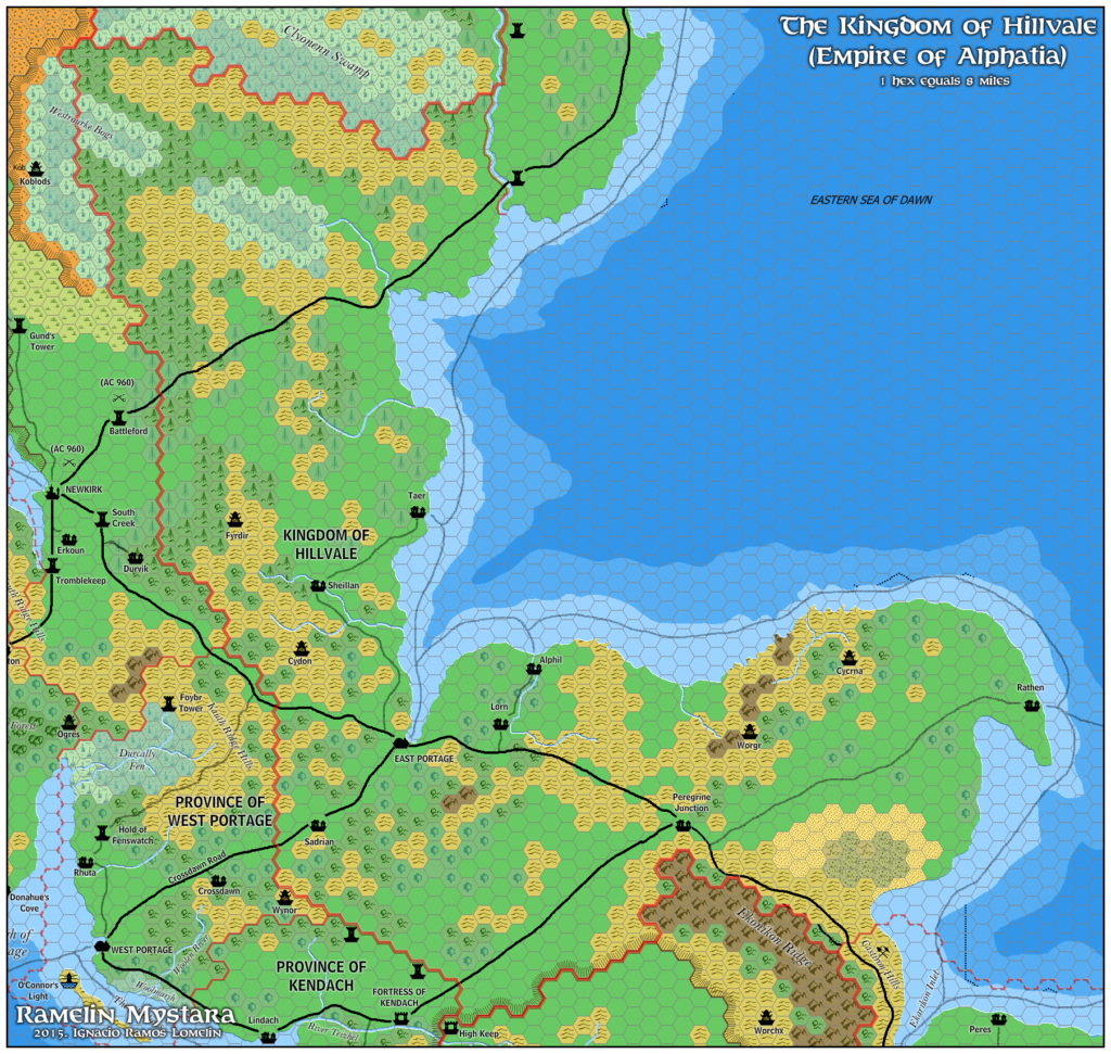
- Ramelin’s Hillvale, 8 miles per hex (November 2015)
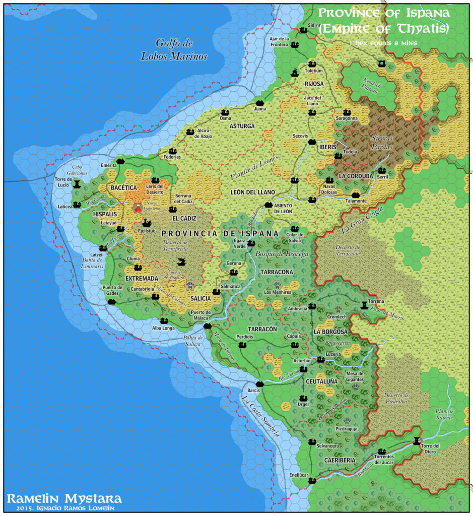
- Ramelin’s Ispana, 8 miles per hex v1 (November 2015)
- Ramelin’s Ochalea, 8 miles per hex v1 (November 2015)
- Ramelin’s Pearl Islands, 8 miles per hex v1 (November 2015)
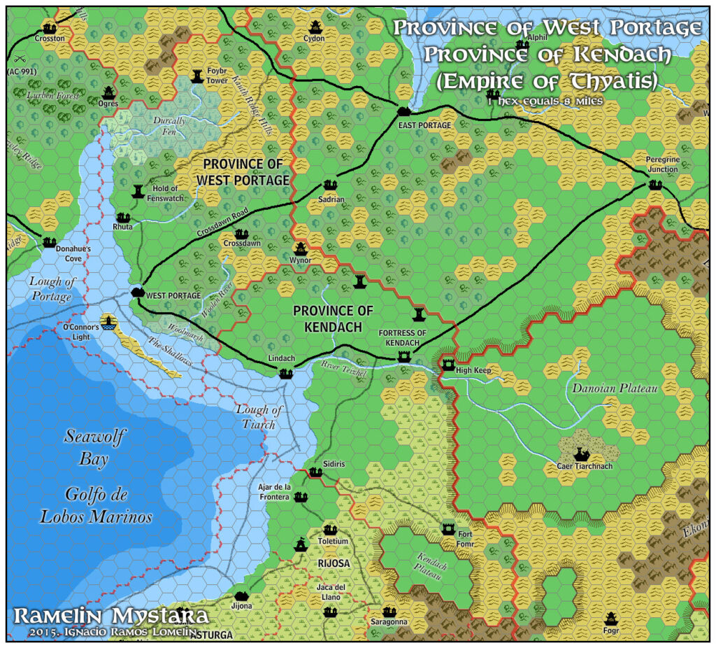
- Ramelin’s Kendach, 8 miles per hex (January 2016)
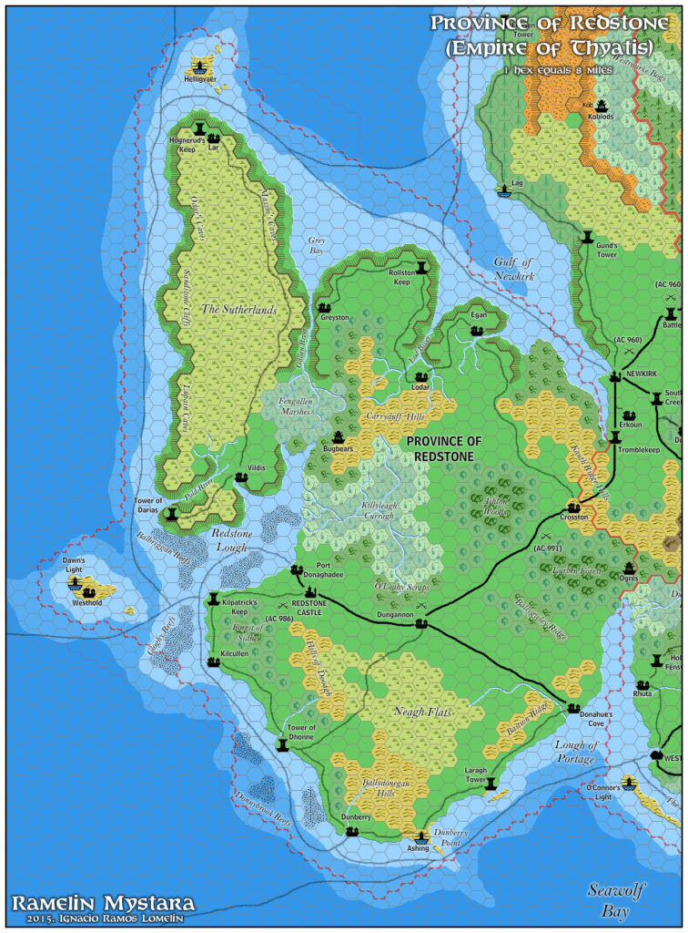
- Ramelin’s Redstone, 8 miles per hex (February 2016)
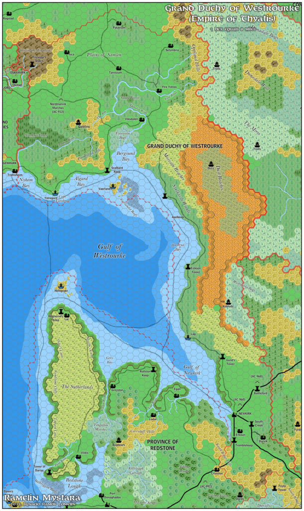
- Ramelin’s Westrourke, 8 miles per hex (February 2016)
- Ramelin’s Davanian Hinterlands, 8 miles per hex (February 2016)
- Ramelin’s Known World, 8 miles per hex v1 (March 2017)
- Ramelin’s Northeastern Brun, 8 miles per hex v4 (March 2017)
- Ramelin’s Sea of Dawn Islands, 8 miles per hex (March 2017)
- Ramelin’s Alatian Islands, 8 miles per hex v2 (July 2017)
- Ramelin’s Caerdania and Meridiona, 8 miles per hex v1 (October 2017)
References
- All of Jose’s maps at the Atlas of Mystara
- Jose’s entry in Appendix M: Mappers of Mystara (upcoming)
- Jose’s author page at the Vaults of Pandius
Chronological Analysis
This is a fan-made map. It was published in November 2017. The updated Atlas version of this map is not yet available. See also Appendix C for annual chronological snapshots of the area. For the full context of this map in Mystara’s publication history, see the upcoming Let’s Map Mystara 2017.
The following lists are from the Let’s Map Mystara project. Additions are new features, introduced in this map. Revisions are changes to previously-introduced features. Hex Art & Fonts track design elements. Finally, Textual Additions are potential features found in the related text. In most cases, the Atlas adopts these textual additions into updated and chronological maps.
Under Construction! Please check back again soon for updates.
Additions
- Settlements —
Revisions
- Settlements —
Hex Art & Fonts
- Fonts — Bell MT (major geographic and all water labels), Bell Centennial (all other labels), Feinen (titling).
- Hex Art — Ramelin Mystara standard.
")
")
")