
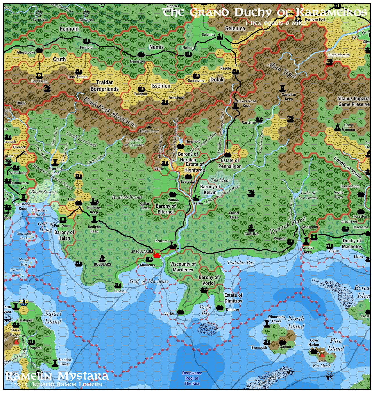
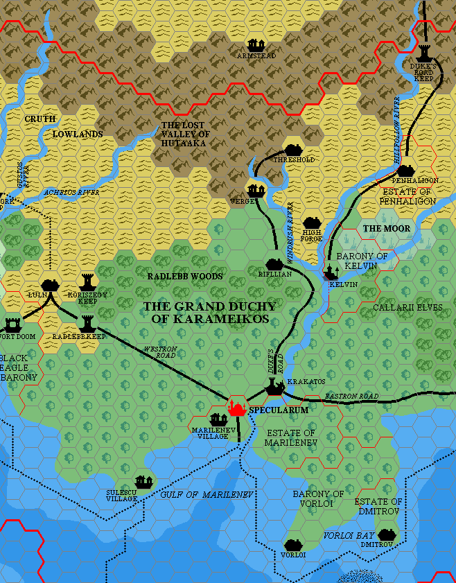
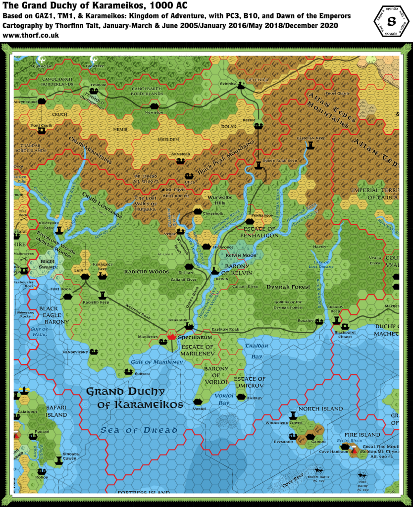
Ramelin’s Karameikos, 8 miles per hex
November 2015 was a momentous month for Jose’s project, as he shared more than thirty individual maps to his Pinterest page over a couple of days. The first set covered most of the Known World, while the second finished that off and then moved west to cover the Serpent Peninsula and the Savage Coast.
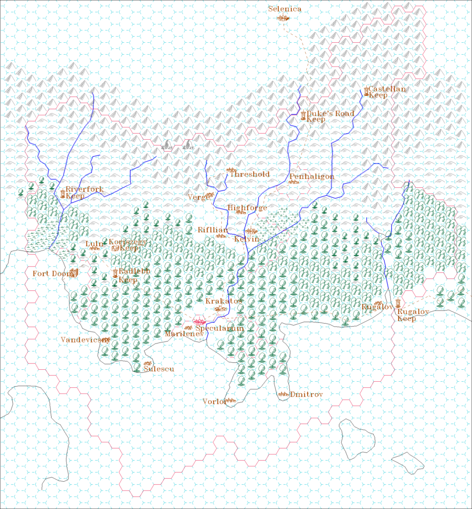
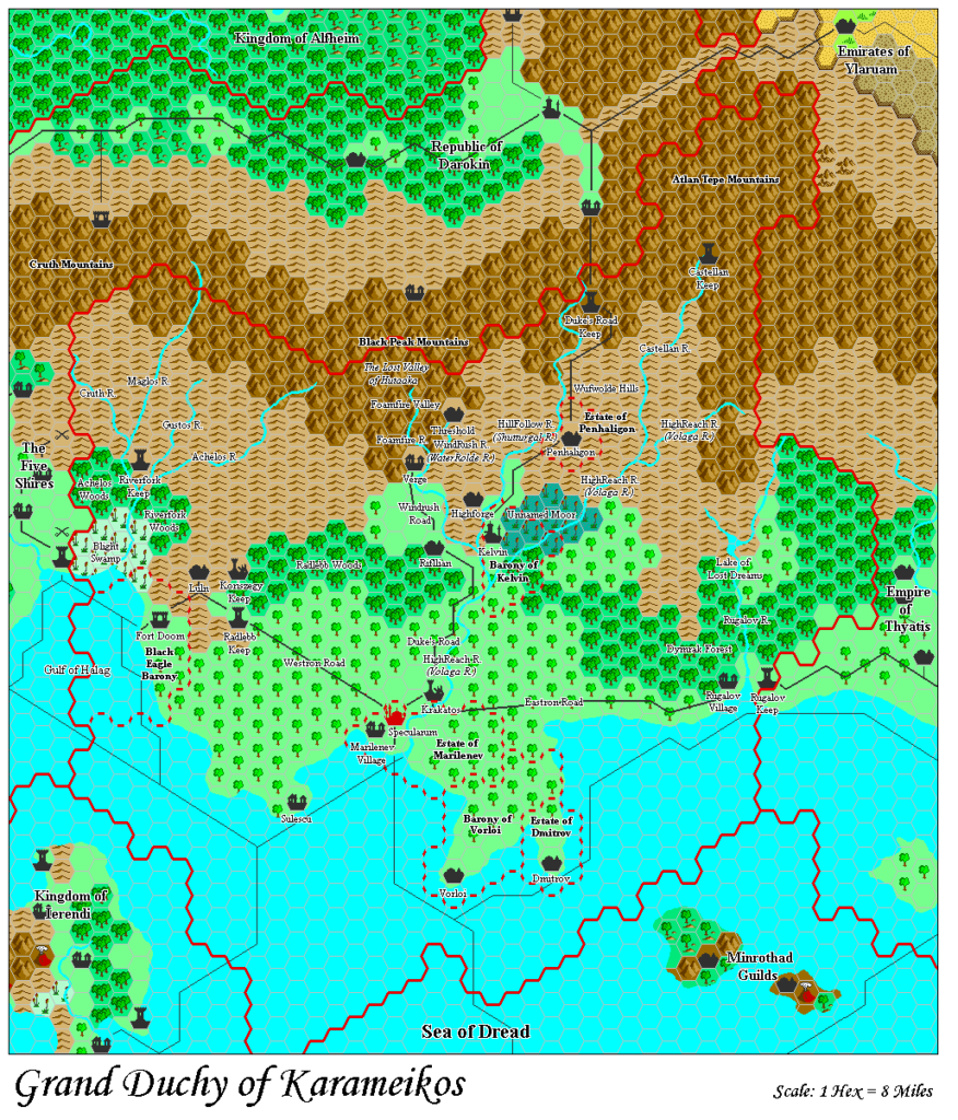
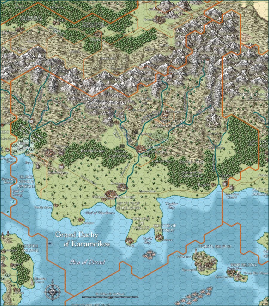
Jose’s Karameikos was based firmly on Atlas of Mystara Karameikos, albeit using my old variant with a lot more forests across the nation. Other changes included the addition of mountain ridges; the relocation of the Lost Valley of Hutaaka; the renaming of dominions and some settlements; and the addition of a few new villages.
Although the change was not drastic, Jose varied the naming of some dominions so that they did not share the same name as their main settlement. Thus Threshold became the Barony of Haralan (likely a typo of Halaran), the town of Highforge became Evereska, and the Estate of Rifllian became the Barony of Elfarnel. The last two of these seem to be new names, although Jose stated that he took them from other fan works. It would appear that both names come from the Forgotten Realms originally.
This was the first map Jose shared on Facebook in February 2016, as well as the first he posted to his new DeviantArt profile in February 2017.
In his own words (from the Vaults of Pandius):
Differences with Canon Material: mostly cosmetic in nature. Added a border.
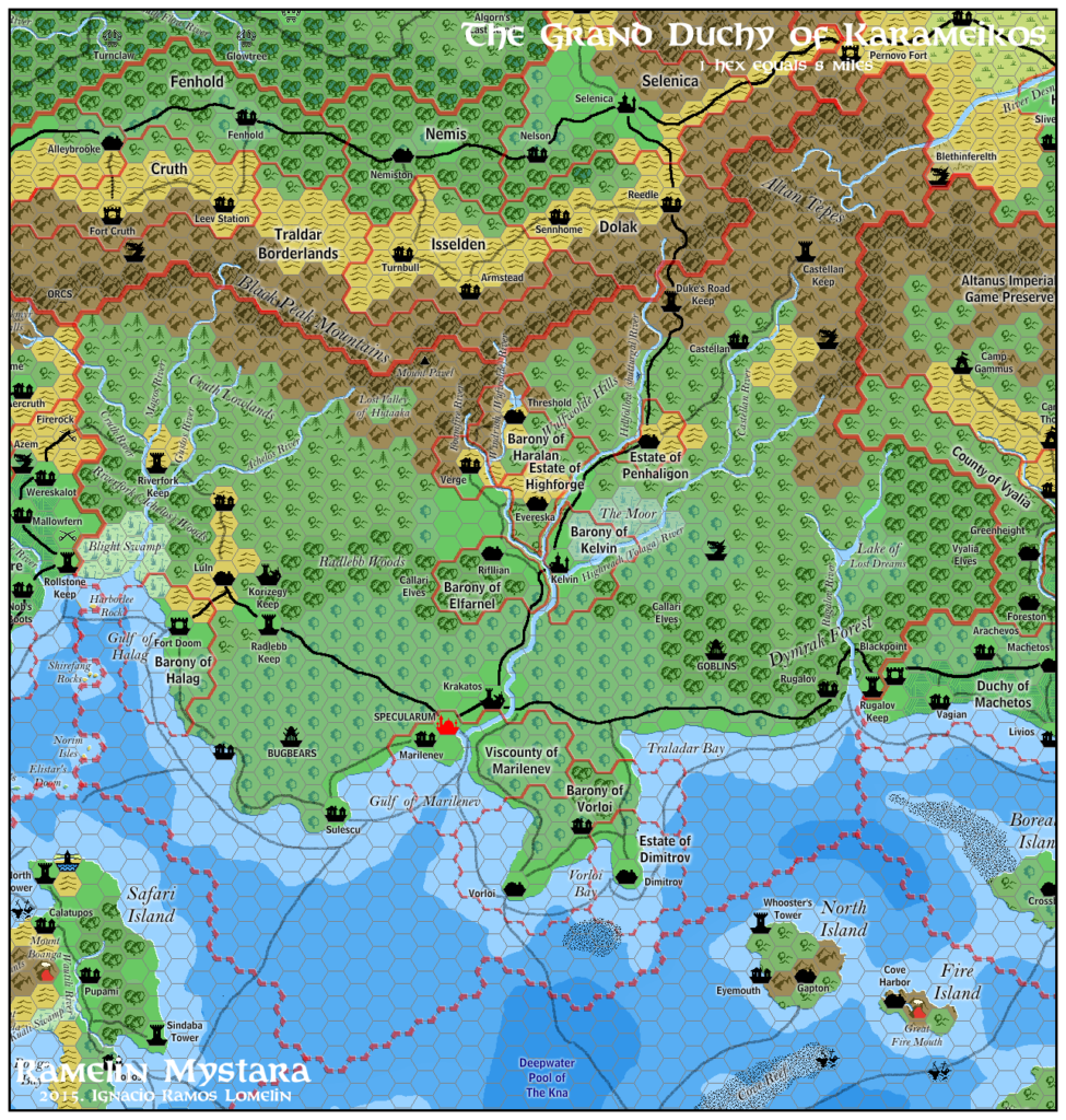
As the main focus of the known world, The Grand Duchy of Karameikos needs very few changes or modifications. Furthermore it is so heavily detailed that I do not feel I could add to it.
Therefore I detailed mountain ranges, added the border for the barony of Sherlane Haralan (inexplicably absent) and added some geographical labels.
Fan-made Map by Jose Ignacio Ramos Lomelin (November 2015)
This is an original map created by one of Mystara’s excellent fan cartographers. For more information on the cartographer, including a gallery of all their maps, see also Appendix M: Mappers of Mystara.
Sources
- GAZ1 The Grand Duchy of Karameikos (1987) (PDF at DriveThruRPG)
Fan Sources
- Atlas of Mystara (2005-present)
References
- All of Jose’s maps at the Atlas of Mystara
- Jose’s entry in Appendix M: Mappers of Mystara (upcoming)
- Jose’s author page at the Vaults of Pandius
- Grand Duchy of Karameikos post at Pinterest (November 2015)
- Grand Duchy of Karameikos post at Mystara Cartographic Society on Facebook (February 2016)
- RM KW Karameikos at DeviantArt (February 2017)
Chronological Analysis
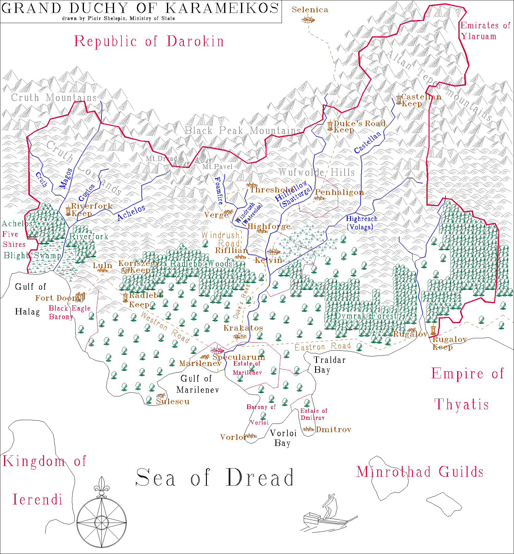
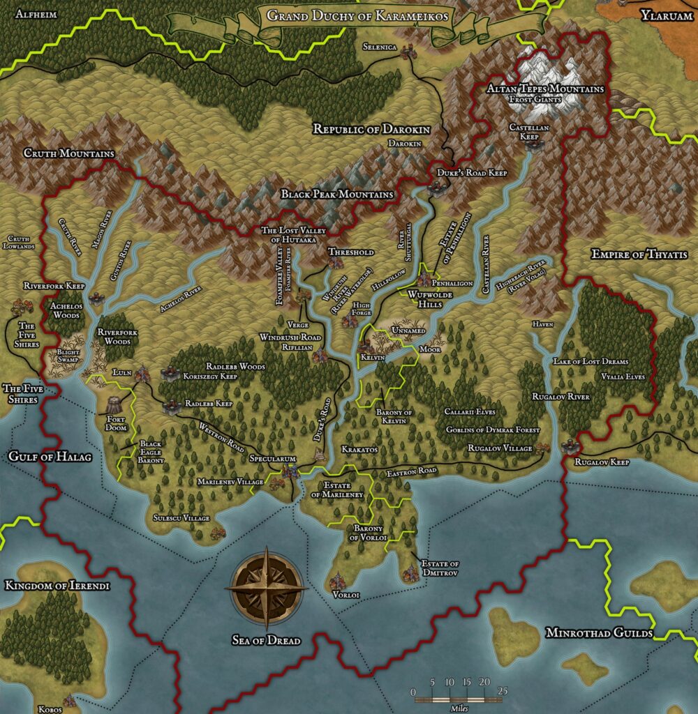
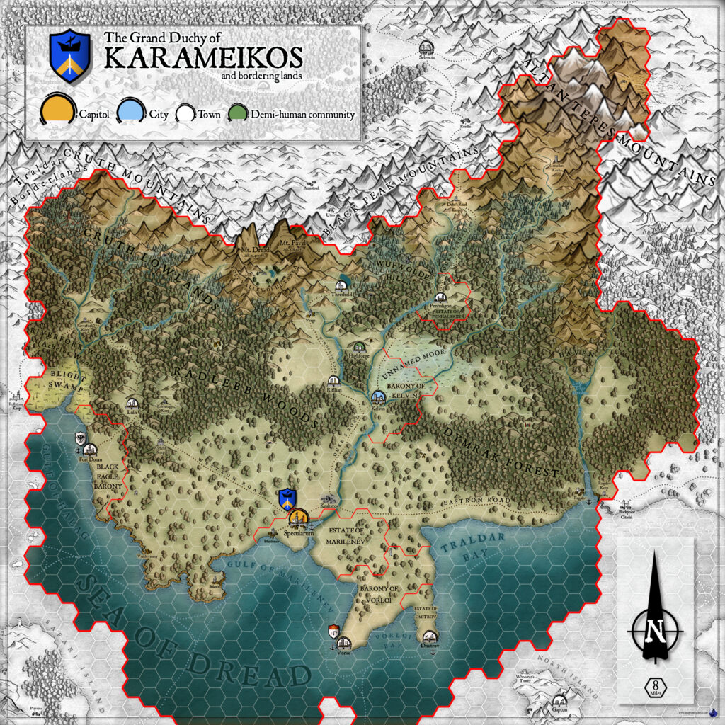
This is a fan-made map. It was published in November 2015. The updated Atlas version of this map is Karameikos, 8 miles per hex. See also Appendix C for annual chronological snapshots of the area. For the full context of this map in Mystara’s publication history, see the upcoming Let’s Map Mystara 2015.
The following lists are from the Let’s Map Mystara project. Additions are new features, introduced in this map. Revisions are changes to previously-introduced features. Hex Art & Fonts track design elements. Finally, Textual Additions are potential features found in the related text. In most cases, the Atlas adopts these textual additions into updated and chronological maps.
Under Construction! Please check back again soon for updates.
Additions
- Settlements — A village called Castellan between Penhaligon and Castellan Keep. An unnamed village in the centre of the Barony of Vorloi. Another on the trail between Luln and Riverfork Keep.
Revisions
- Dominions — The Estate of Marilenev became the Viscounty of Marilenev. The Estate of Rifllian became the Barony of Elfarnel (see also Settlements below). The Barony of Threshold became the Barony of Haralan (presumably after Baron Halaran, though the spelling is different).
- Forests — Jose adopted the Forested Hills variant map from the Atlas of Mystara, making most of Karameikos’s hills forested as per the text of GAZ1.
- Settlements — Highforge became Evereska. Jose explained on Facebook that this and the Barony of Elfarnel next door were not his own idea, but that he found them in the work of other fans. I have not been able to track these down.
- Spellings — Jose made the following changes to spelling from the original maps. Some of these were likely errors rather than deliberate choices. (See also Dominions above.)
- The Callarii Elves became Callari Elves.
- Dmitrov became Dimitrov.
- Highforge became Evereska.
- Koriszegy Keep became Korizegy Keep.
- Shutturga River (B10, GAZ1 text) became Shutturgal River (GAZ1 map).
- Traldar Bay became Traladar Bay.
- Terrain — The Lost Valley of Hutaaka was moved southwest so that it is firmly within the borders of Karameikos.
Hex Art & Fonts
- Hex Art — Ramelin Mystara standard.
- Fonts — Bell MT (major geographic and all water labels), Bell Centennial (all other labels), Feinen (titling).
Revised 9th February 2026 — drastically expanded the map overview, adding examples of Jose’s new labels as well as a quotation.
")
")
")