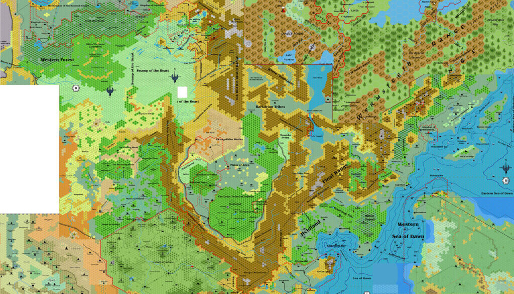
Chimpman’s Known World North, 8 miles per hex WIP
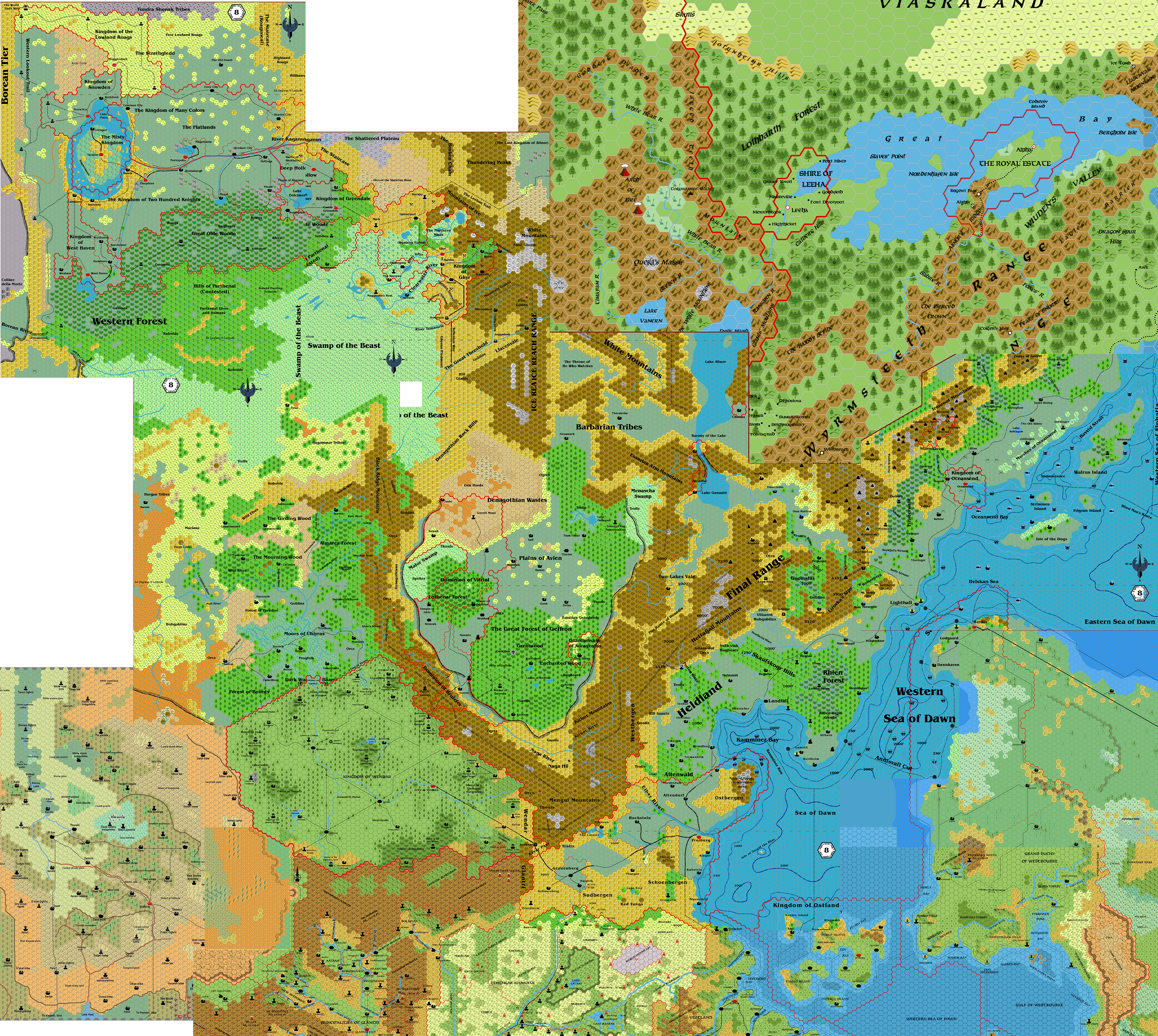
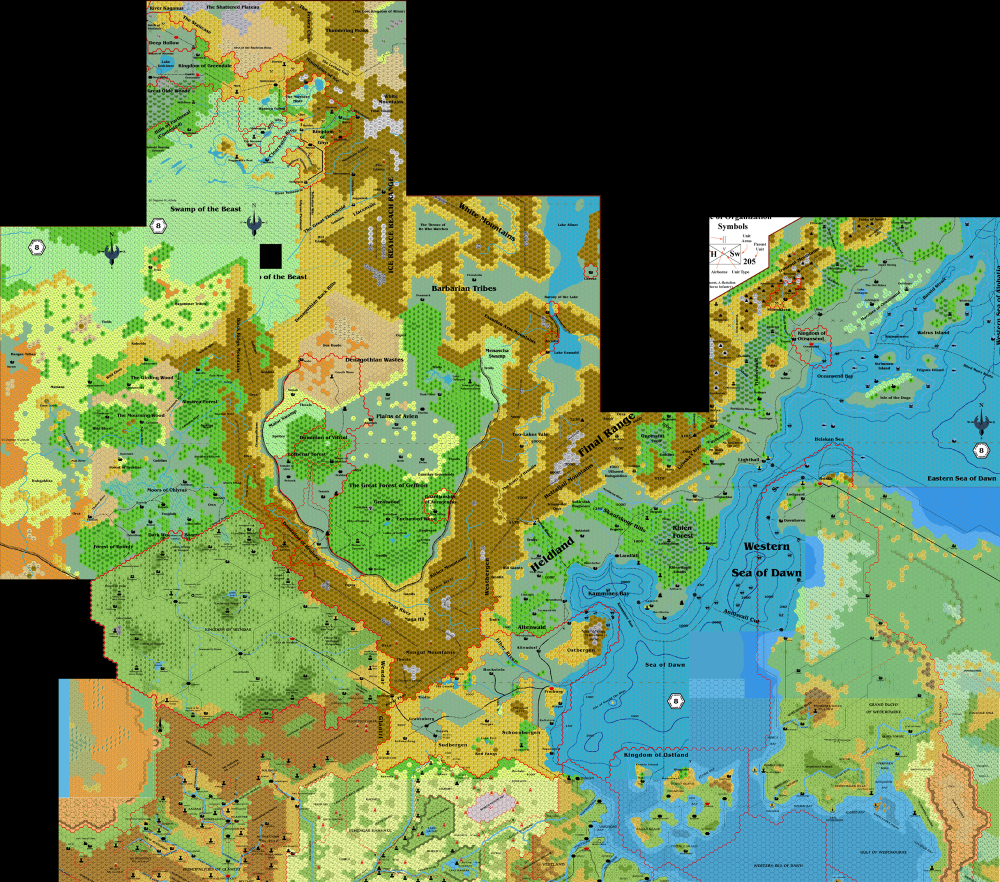
In November 2010, John posted in the GazF subforum at The Piazza asking about a unified map of the area covered in the series. When none was forthcoming, he started to put together his own. Naturally, his interest lay in how the region would look in 2300 BC, and his filename reflected this: KnownWorldNorth_2300BC_8mph.png. However, as he himself noted, this map was just the first, work-in-progress step towards making a 2300 BC map of the area, and in fact all of the maps in this collage were set around 1000 AC.
John used a wide selection of maps, starting with the GazF series, with my TM1/TM2 combined replica as well as Simone Neri’s Norwold, and some others besides.
The second map below is the only surviving copy from the original thread. It looks like it was the last updated map posted; the others are lost to us.
First below is an export of John’s own file from just a few days afterwards. As you can see, he had included many more sources by this point.
The primary purpose of these maps was to develop Antalia for 2300 BC, focusing on the area around the Kamminer Bay. He prepared a work-in-progress map of Antalia at the same time as he was working on the maps in this thread. Sadly, that is as far as he has gone with this area thus far.
Fan-made Maps by John Calvin (November 2010)
This is an original map created by one of Mystara’s excellent fan cartographers. For more information on the cartographer, including a gallery of all their maps, see also Appendix M: Mappers of Mystara.
Sources
Fan Sources
- Unified Map? discussion thread at The Piazza (November 2010)
Chronological Analysis
This is a fan-made map. It was published in November 2010. The updated Atlas version of this map is not yet available. See also Appendix C for annual chronological snapshots of the area. For the full context of this map in Mystara’s publication history, see the upcoming Let’s Map Mystara 2010.
The following lists are from the Let’s Map Mystara project. Additions are new features, introduced in this map. Revisions are changes to previously-introduced features. Hex Art & Fonts track design elements. Finally, Textual Additions are potential features found in the related text. In most cases, the Atlas adopts these textual additions into updated and chronological maps.
Under Construction! Please check back again soon for updates.