Zendrolion’s Karameikos, 8 miles per hex Demographic
After a flurry of mapping activity from 2006-2008 or so, Simone spent the next four or five years on other projects, producing only a handful of maps. Then he returned in style, contributing a whole new series of both demographic and historical maps to Threshold Magazine #1 in September 2013.
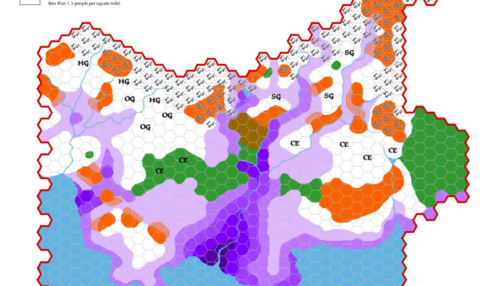
This map illustrated Simone’s article about populations, The Demography of Karameikos. The article comprised an update to his previous take of the area in his Demografia Mystarana. He introduced it as follows:
In this article we provide an overview of the population of Karameikos– how many people inhabit the Grand Duchy, which races, how the population is spread among the country, population density, and so on. First, we will see how Karameikos is described in official supplements, then we will suggest a different approach to the issue of Karameikan population, based on population figures inspired by a comparison with real-world demographic data in the Middle Ages. The goal is to present figures which are more in line with those of European Middle Age countries, while preserving the low-magic, mostly-wilderness character that identifies the Karameikan region.
He approached his map in a similar way to how he handled his Denagoth maps of 2006. However, in the intervening years Simone’s skills as a cartographer had grown, resulting in a more attractive map with a high degree of polish. Really, it was a pleasure to behold. Instead of conforming exactly to the hex grid, he used more organic-looking shapes that mostly coincided with it. This technique avoided making the map look too artificial while still making it relatively easy to count hexes.
While his maps of this period all follow a similar style, this was the only one to tackle demography directly; all of his other maps focused on history.
Fan-made Map by Simone Neri (September 2013)
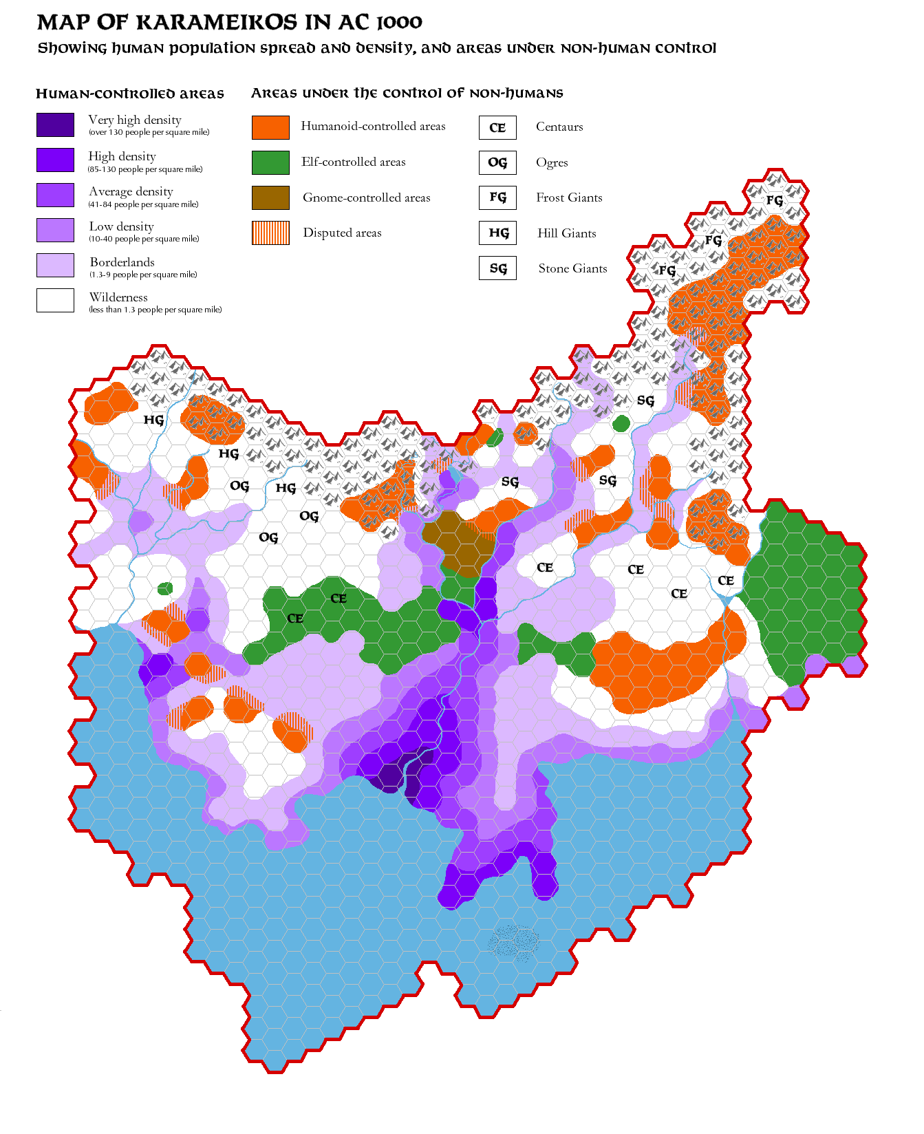
This is an original map created by one of Mystara’s excellent fan cartographers. For more information on the cartographer, including a gallery of all their maps, see also Appendix M: Mappers of Mystara.
Sources
- GAZ1 The Grand Duchy of Karameikos (1987) (PDF at DriveThruRPG)
Fan Sources
- The Demography of Karameikos from Threshold Magazine at the Vaults of Pandius (September 2013)
References
- All of Simone’s maps at the Atlas of Mystara
- Simone’s entry in Appendix M: Mappers of Mystara (upcoming)
- Simone’s author page at the Vaults of Pandius
Chronological Analysis
This is a fan-made map. It was published in September 2013. The updated Atlas version of this map is not yet available. See also Appendix C for annual chronological snapshots of the area. For the full context of this map in Mystara’s publication history, see the upcoming Let’s Map Mystara 2013.
The following lists are from the Let’s Map Mystara project. Additions are new features, introduced in this map. Revisions are changes to previously-introduced features. Hex Art & Fonts track design elements. Finally, Textual Additions are potential features found in the related text. In most cases, the Atlas adopts these textual additions into updated and chronological maps.
Under Construction! Please check back again soon for updates.
Additions
- XXX —
Revisions
- XXX —
Hex Art & Fonts
- Hex Art —
- Fonts —