Zendrolion’s Mystara 3,850 to 3,000 BC
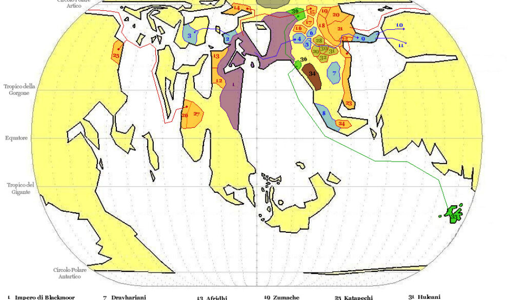
This was the fourth map in Simone’s mostly unpublished series of five historical Blackmoor maps. It was also the only one he seems to have published online; he referenced it in a thread at The Piazza in 2010 about the location of Blackmoor. In his post there, which was on the rather complex and elusive subject of Blackmoor’s position in the world, he wrote:
So, in short, there is not any Blackmoor on Brun “as per ‘Italian’ map”, as larry puts it; according to LoZompatore, and I agree with him, Blackmoor (the empire’s core, and the city) was on Skothar. Then the empire expanded and conquered and colonized lands on Brun, establishing Dragonwatch Keep (from Dragonlord Trilogy, at the now-northern tip of the Endworld Line), the city of Urzud (likely an advanced outpost for the crusaders going to fight the Beastmen), and perhaps other communities. I’d rather exclude the ruined city in Fenhold’s swamp (from CM9), just becouse it’d seat under the arctic icecap before BC 3,000, and also becouse its Blackmoorian origins are given by CM9 as a possibility, not as a fact.
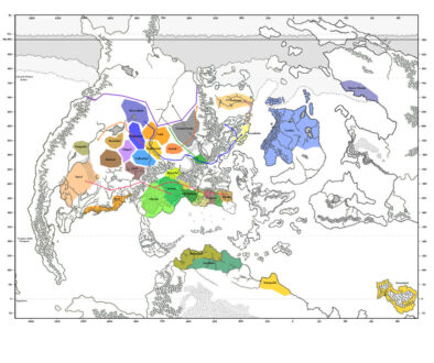
We can see Simone’s conception of Blackmoor very well in this map, with it situated in what would be northern Skothar in the modern world, with colonies or territories stretching into what would be northern Brun in the modern world.
Note that I have two versions of this map. The first below is the one that Simone sent me with the others in the set, while the second below is the original map from the thread at The Piazza. There were two main differences between these maps: the size of the Yannifey area (3 on the maps) and the presence of an elven colony in the Sylvan Realm, in what would later be northwestern Brun. I can’t tell which version was newer conclusively, though I have marked the version with the Sylvan Realm colony as the newer version.
Fan-made Maps by Simone Neri (February 2008)
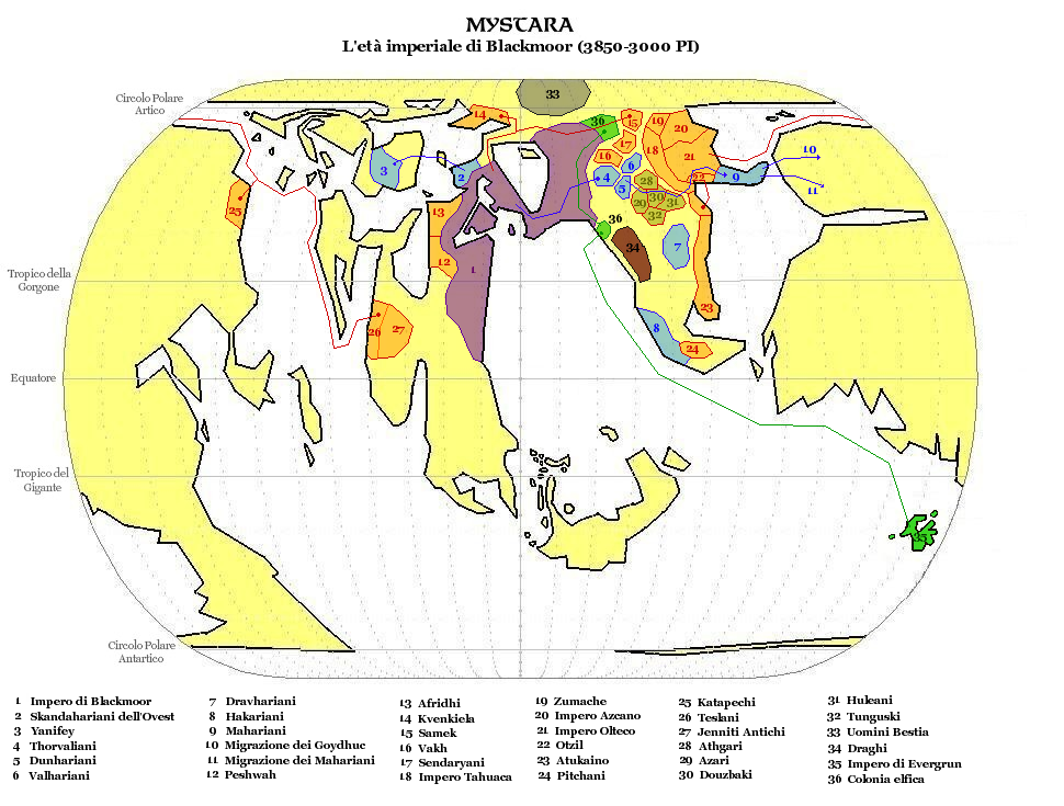
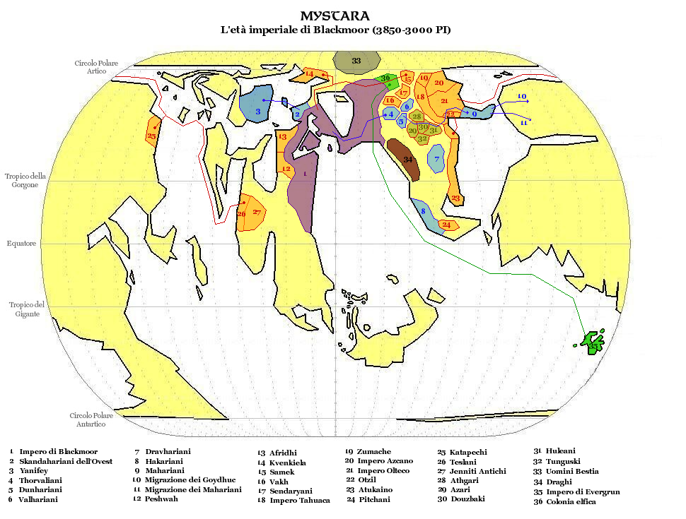
This is an original map created by one of Mystara’s excellent fan cartographers. For more information on the cartographer, including a gallery of all their maps, see also Appendix M: Mappers of Mystara.
Sources
Fan Sources
- Zendrolion’s Mystara 50,000 to 8,500 BC (February 2008)
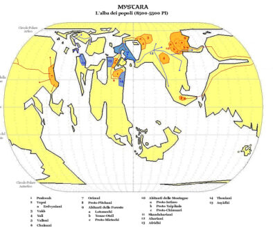
- Zendrolion’s Mystara 8,500 to 5,500 BC (February 2008)
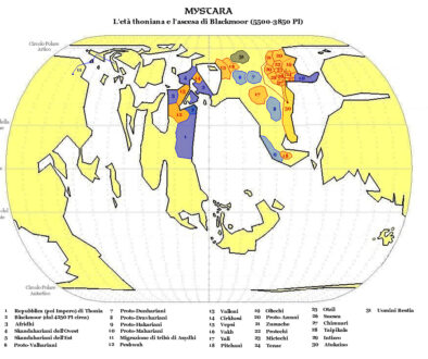
- Zendrolion’s Mystara 5,500 to 3,850 BC (February 2008)
- Where was Blackmoor discussion thread at The Piazza (August 2010)
References
- All of Simone’s maps at the Atlas of Mystara
- Simone’s entry in Appendix M: Mappers of Mystara (upcoming)
- Simone’s author page at the Vaults of Pandius
Chronological Analysis
This is a fan-made map. It was published in February 2008. The updated Atlas version of this map is not yet available. See also Appendix C for annual chronological snapshots of the area. For the full context of this map in Mystara’s publication history, see the upcoming Let’s Map Mystara 2008.
The following lists are from the Let’s Map Mystara project. Additions are new features, introduced in this map. Revisions are changes to previously-introduced features. Hex Art & Fonts track design elements. Finally, Textual Additions are potential features found in the related text. In most cases, the Atlas adopts these textual additions into updated and chronological maps.
Under Construction! Please check back again soon for updates.
Additions
- XXX —
Revisions
- XXX —
Hex Art & Fonts
- Hex Art —
- Fonts —