LoZompatore’s Outer World Precataclysmic Physical
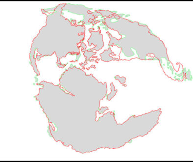
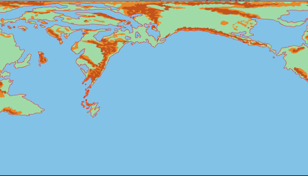
Continuing the story of Michele’s Pre-Cataclysmic Mystara article, with the land differences now incorporated into the coastlines, he next set himself to adapting the terrain — which in this case meant mountains and hills. He explained:
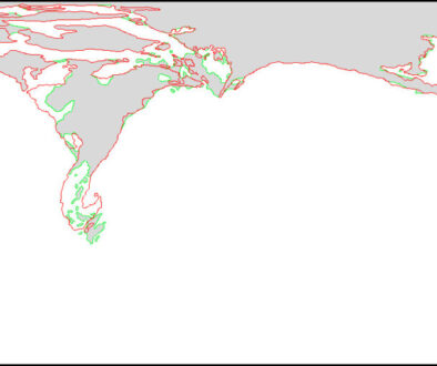
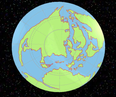
Using Figure 7 as the basic picture of pre-GROF world mountains and hills can be easily added from Figure 4 above, by considering only the mountain chains and hills which where on dry land before the Cataclysm (island chains could be added where mountains will be present after the Great Rain of Fire).
This would be a two-stage process, of which this was the first step: adapting the modern terrain to the revised coastlines. The next step would bring in the Hollow World Set Precataclysmic map’s terrain, too.
Fan-made Map by Michele Carpita (January 2018)
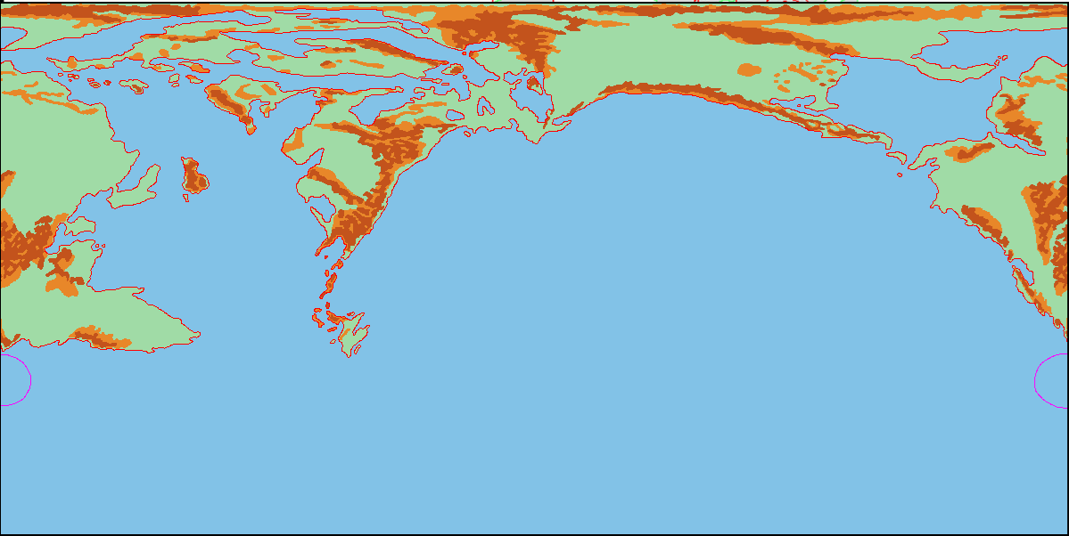
This is an original map created by one of Mystara’s excellent fan cartographers. For more information on the cartographer, including a gallery of all their maps, see also Appendix M: Mappers of Mystara.
Sources
- Master Rules Set (1985) (PDF at DriveThruRPG)
- Hollow World Campaign Set (1990) (PDF at DriveThruRPG)
Fan Sources
- Lining Up Mystara XIX by Thorfinn Tait (February 2016)
- Pre-Cataclysmic Mystara article by Michele Carpita (January 2018)
- LoZompatore’s Outer World (January 2018)
- LoZompatore’s Outer World Ethengar as North Pole (January 2018)
- LoZompatore’s Outer World Precataclysmic Land Differences (January 2018)
References
- All of Michele’s maps at the Atlas of Mystara
- Michele’s entry in Appendix M: Mappers of Mystara (upcoming)
- Michele’s author page at the Vaults of Pandius
Chronological Analysis
This is a fan-made map. It was published in January 2018. The updated Atlas version of this map is not yet available. See also Appendix C for annual chronological snapshots of the area. For the full context of this map in Mystara’s publication history, see the upcoming Let’s Map Mystara 2018.
The following lists are from the Let’s Map Mystara project. Additions are new features, introduced in this map. Revisions are changes to previously-introduced features. Hex Art & Fonts track design elements. Finally, Textual Additions are potential features found in the related text. In most cases, the Atlas adopts these textual additions into updated and chronological maps.
Under Construction! Please check back again soon for updates.
Additions
- XXX —
Revisions
- XXX —
Hex Art & Fonts
- Hex Art —
- Fonts —