
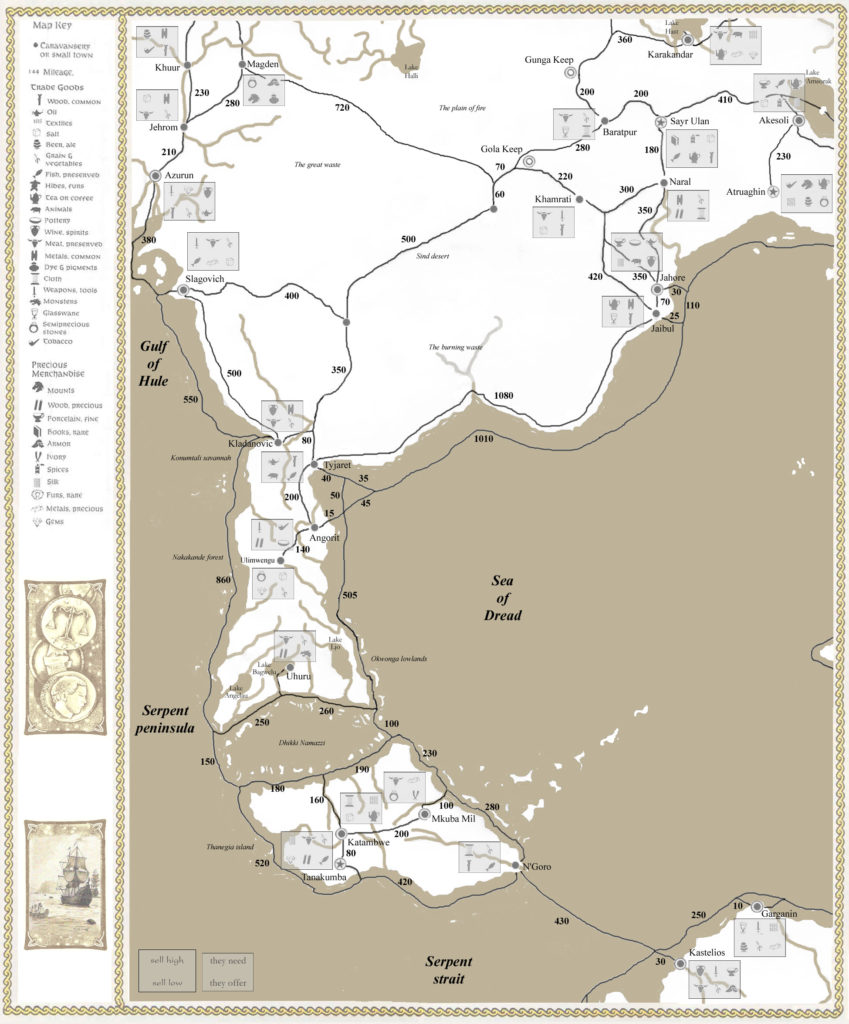
GAZ11 Major Trading Routes
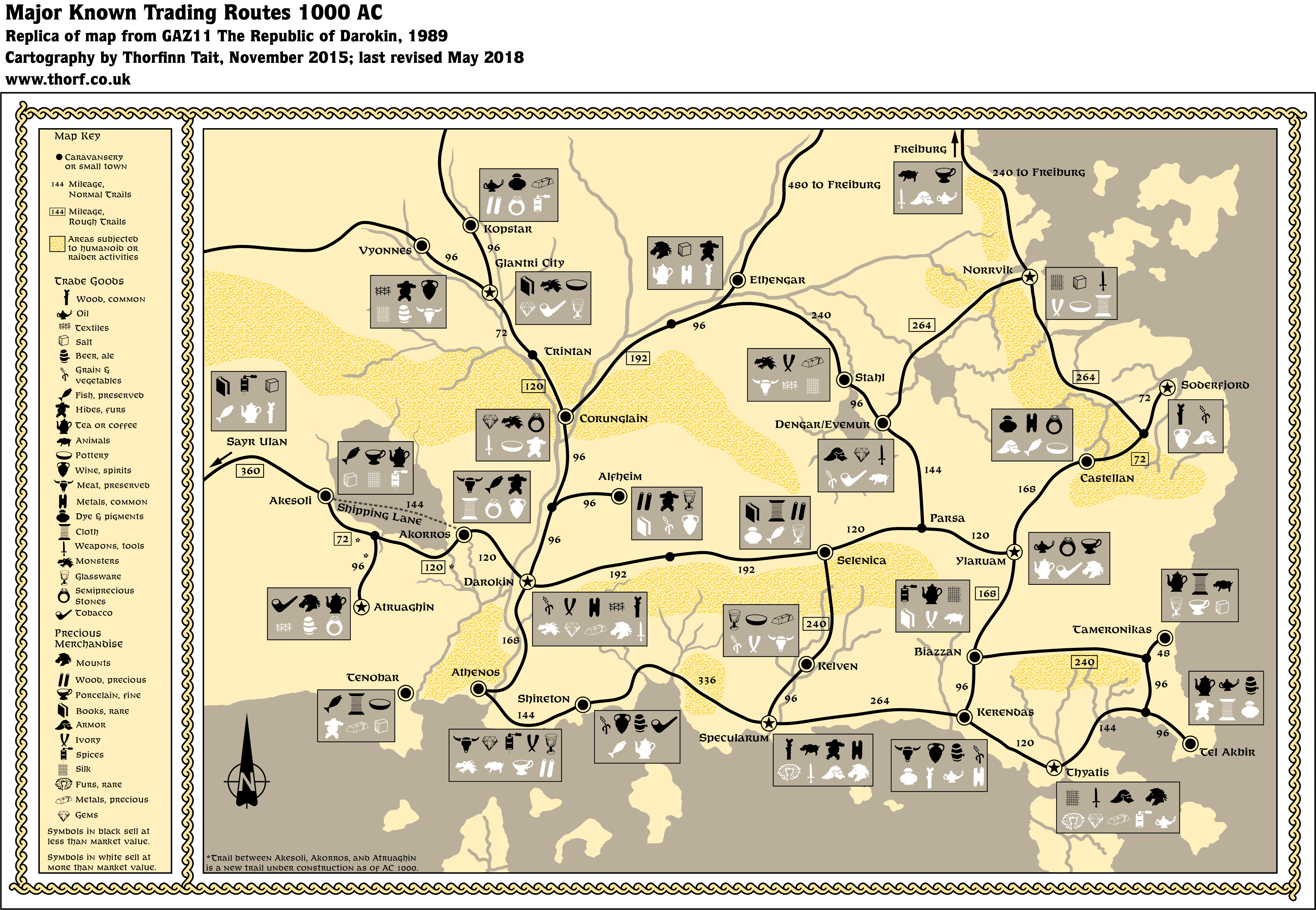
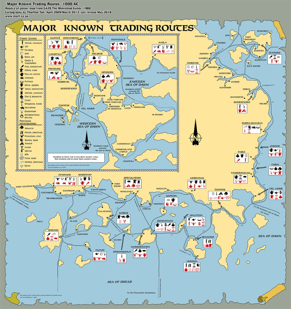
Following on from GAZ9’s map of shipping routes, GAZ11 The Republic of Darokin mapped out the land routes of the Known World. Together the two maps provide a comprehensive economic overview of the area.
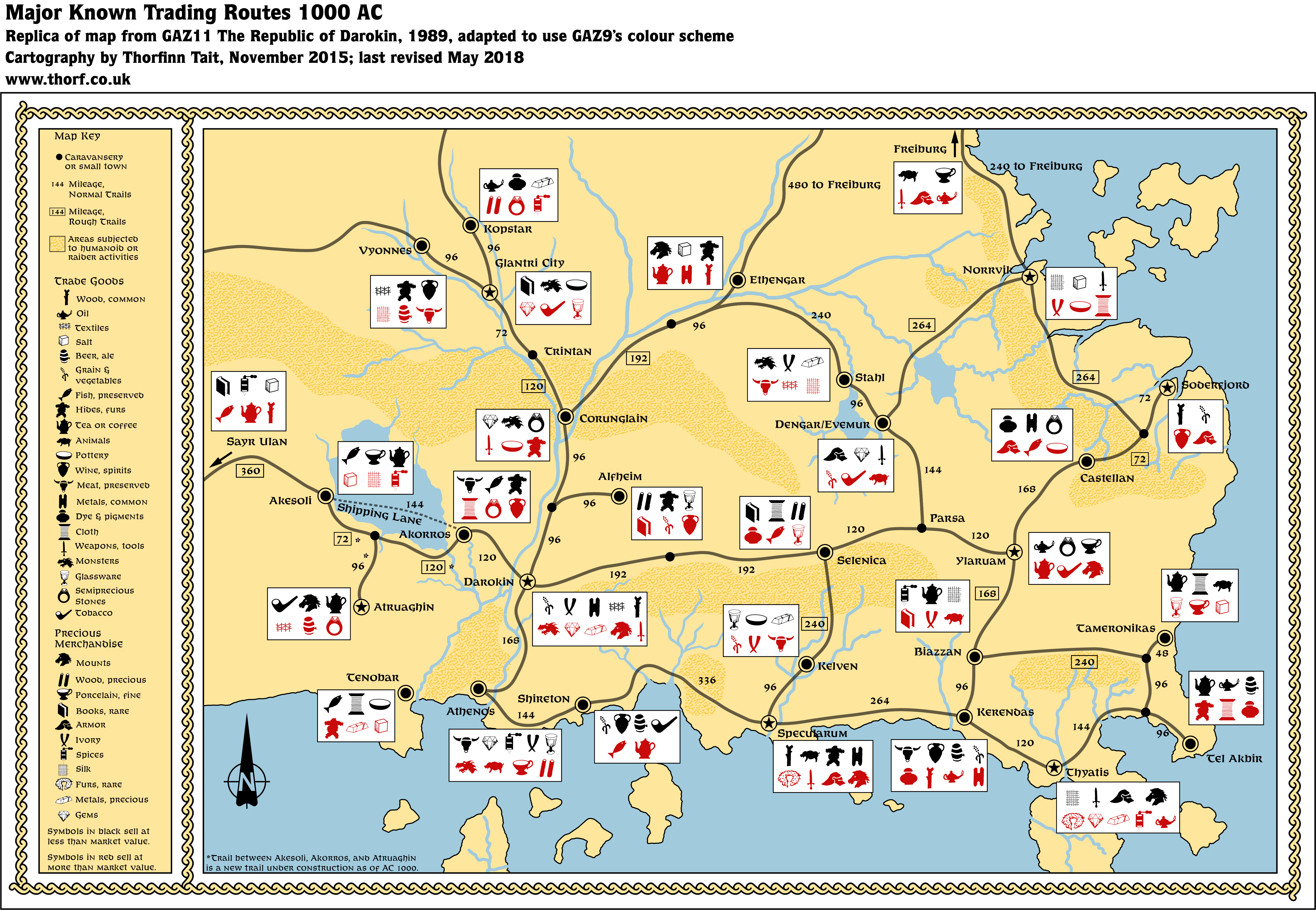
Since GAZ11’s map was printed inside the book, the Atlas provides two versions of the replica map: one with the original colour scheme, and another that uses GAZ9’s full colour palette.
Replica Map (May 2018)
Sources
- GAZ11 The Republic of Darokin (1989) (PDF at DriveThruRPG)
- Players’ Guide, pages 16-17
Chronological Analysis
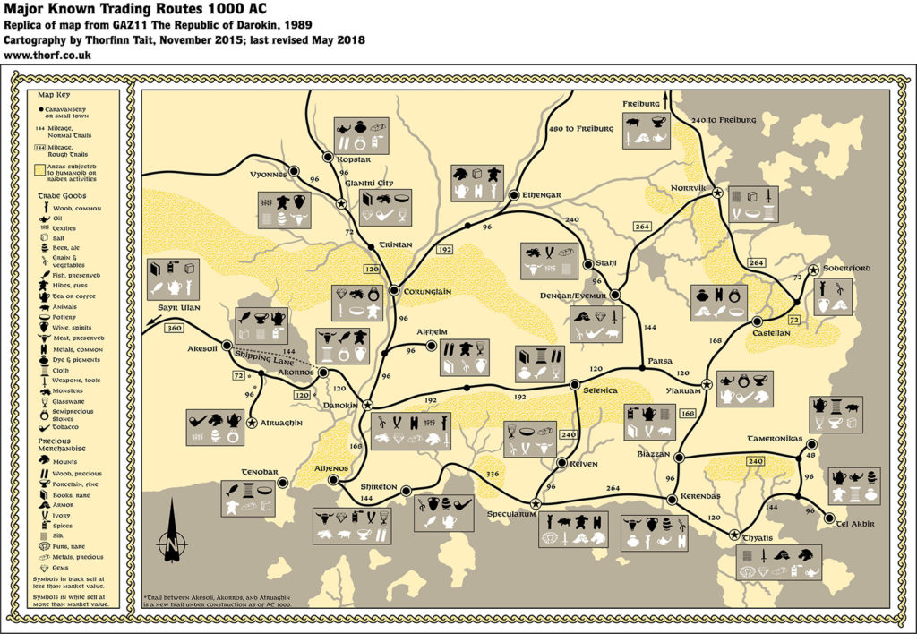
This is Map 108. It was published in March 1989. The updated version of this map has not yet been released. See also Appendix C for annual chronological snapshots of the area. For the full context of this map in Mystara’s publication history, see the upcoming Let’s Map Mystara 1988.
The following lists are from the Let’s Map Mystara project. Additions are new features, introduced in this map. Revisions are changes to previously-introduced features. Hex Art & Fonts track design elements. Finally, Textual Additions are potential features found in the related text. In most cases, the Atlas adopts these textual additions into updated and chronological maps.
Additions
- Settlements —
Revisions
- Settlements —
Hex Art & Fonts
- Hex Art —
- Fonts —
Textual Additions
- Settlements —
")

")