
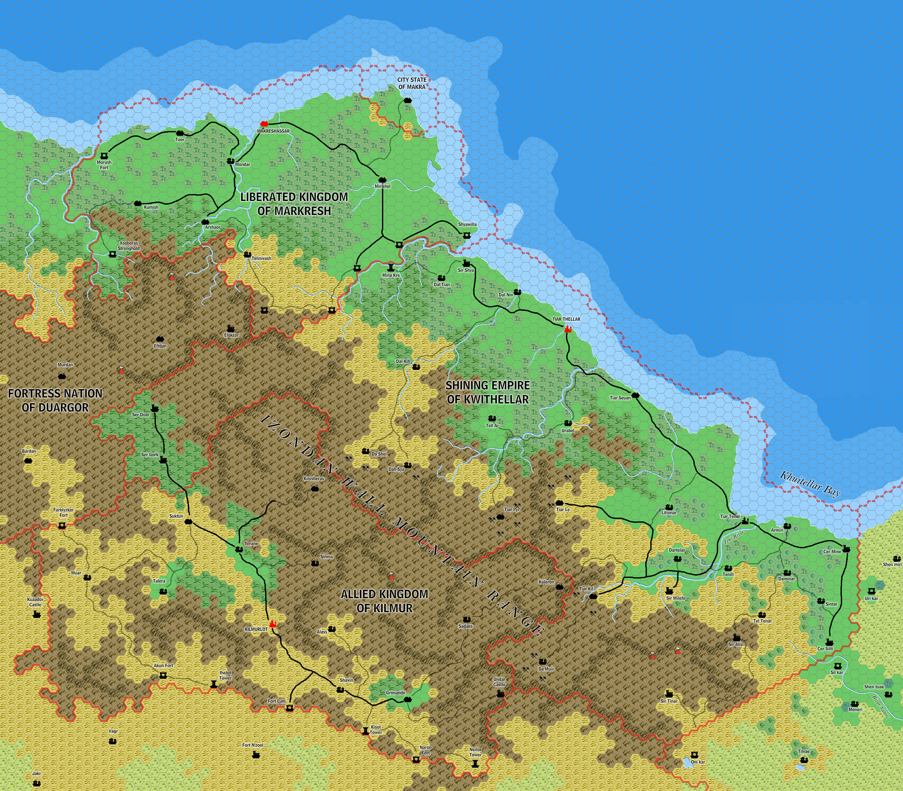
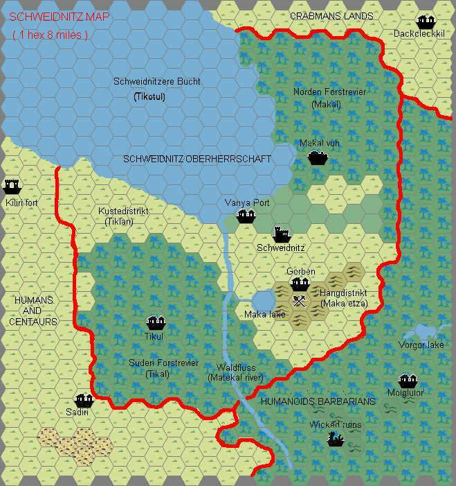
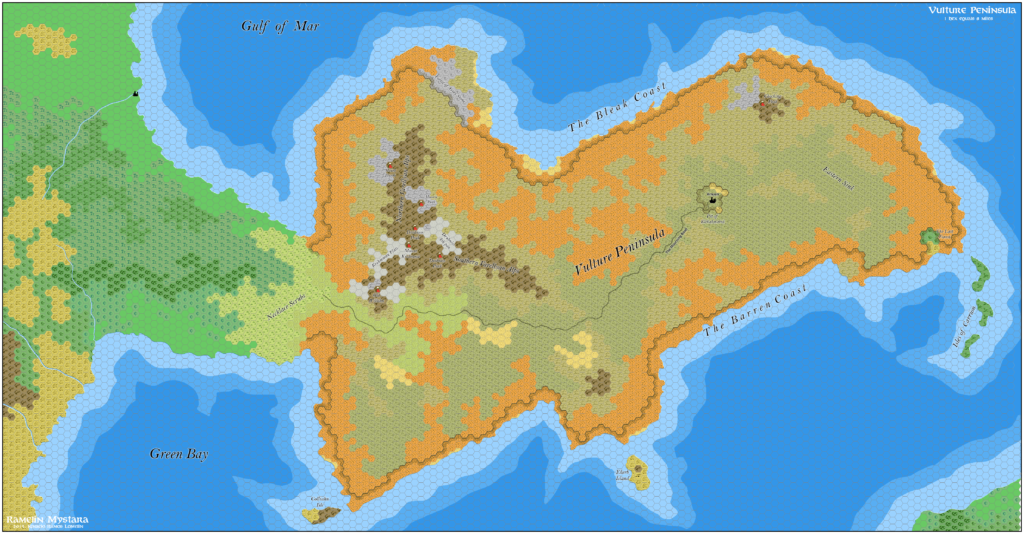
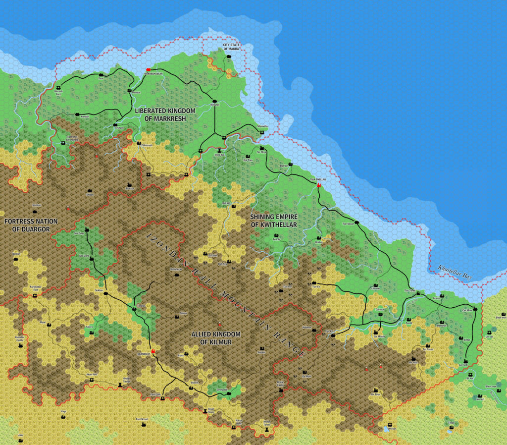
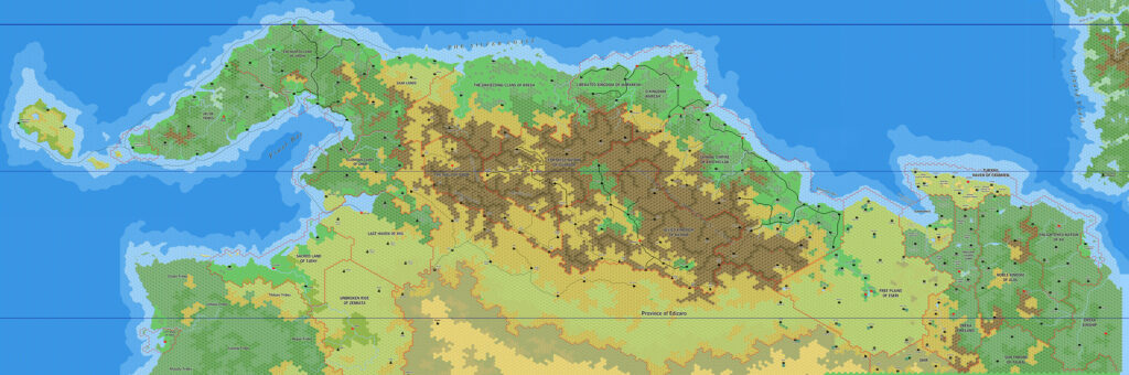
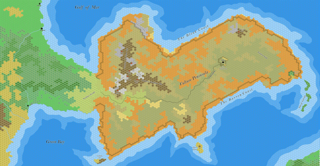
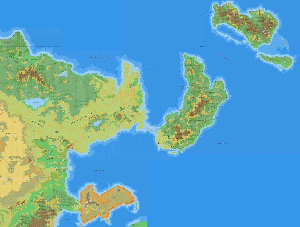
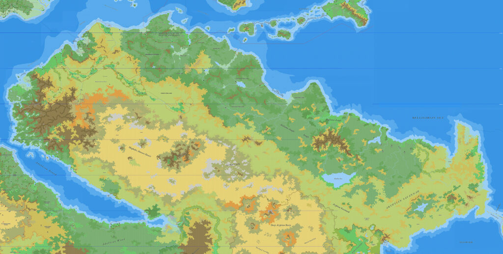
Ramelin’s Kwythellar, Markresh and Kilmur, 8 miles per hex
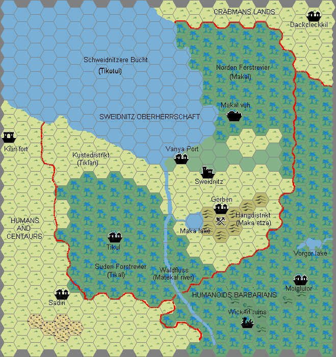
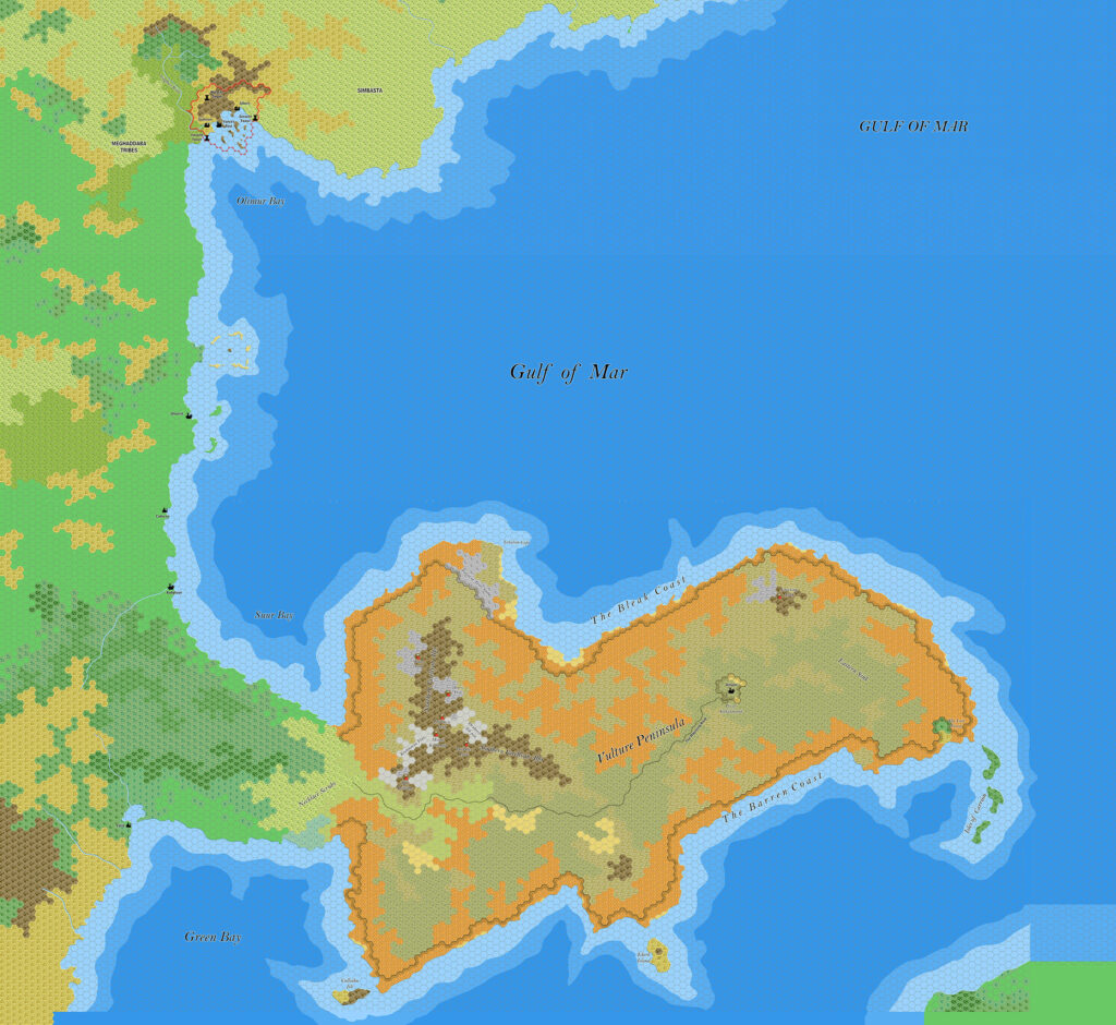
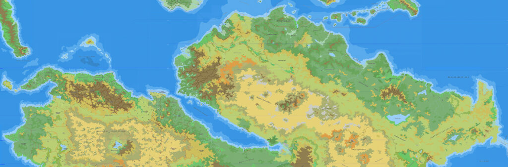
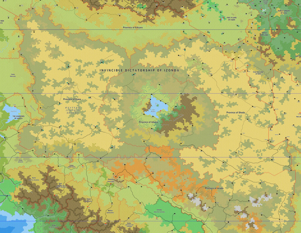
At the same time as he finalised his Eseri, Alol and Ka map, Jose also created this map of Eseri’s neighbours to the west. This region is mainly the work of Francesco Defferrari, with the larger region known as the Silver Coast; this is the central part of the coast. Though part of Kwythellar appeared on Francesco’s original 2003 map, this was the first time the full nation and its neighbours had been mapped at 8 miles per hex.
The settlements are all from Francesco’s map, although Jose added new names for three previously unlabelled villages. Aside from the Eseri map, there is only one other source for Kwythellar, which is Francesco’s 2011 map of Izonda-Pelatan. Unfortunately, the labels on these two maps don’t always agree, and there is some inconsistency between them. Jose’s labels add another level to this, sometimes revising the original labels. Without a full gazetteer for the region, there is no authoritative source on the region to check.
Nonetheless, Kwythellar and the Silver Coast have become a popular and long-running part of fan expansions to Mystara, and more detailed maps of the area are most welcome. The best source of descriptions for these nations is Francesco’s article in Threshold Magazine #5.
Fan-made Map by Jose Ignacio Ramos Lomelin (May 2017)
This is an original map created by one of Mystara’s excellent fan cartographers. For more information on the cartographer, including a gallery of all their maps, see also Appendix M: Mappers of Mystara.
Sources
- None
Fan Sources
- Sturm’s Eseri, 8 miles per hex (February 2003)
- Sturm’s Izonda & Pelatan, 24 miles per hex (March 2011)
- Threshold #5 (1 October 2014) (Vaults of Pandius)
References
- All of Jose’s maps at the Atlas of Mystara
- Jose’s entry in Appendix M: Mappers of Mystara (upcoming)
- Jose’s author page at the Vaults of Pandius
Chronological Analysis
This is a fan-made map. It was published in May 2017. The updated Atlas version of this map is not yet available. See also Appendix C for annual chronological snapshots of the area. For the full context of this map in Mystara’s publication history, see the upcoming Let’s Map Mystara 2017.
The following lists are from the Let’s Map Mystara project. Additions are new features, introduced in this map. Revisions are changes to previously-introduced features. Hex Art & Fonts track design elements. Finally, Textual Additions are potential features found in the related text. In most cases, the Atlas adopts these textual additions into updated and chronological maps.
Under Construction! Please check back again soon for updates.
Additions
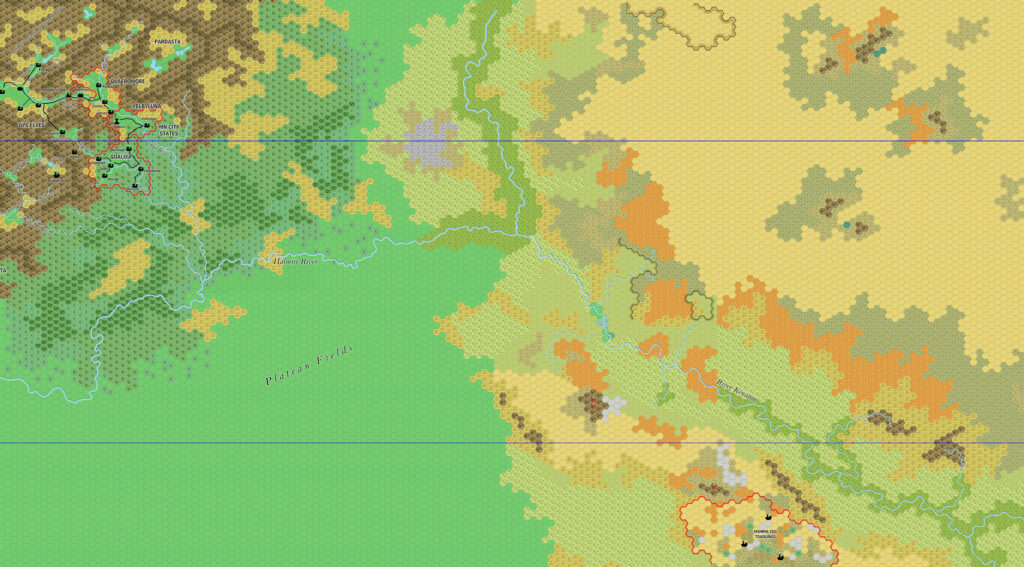
- Settlements — Jose named some villages Francesco had marked but left unlabelled: Talera, Tell Ar and Urabel.
Revisions
- Settlements — Kinor (a fort south of Kuaador Castle) was removed or left out.
- Spellings — Revisions to spellings and names:
- Akun became Akun Fort.
- Dah Say became Dah Sya.
- Daltelal became Dartelar.
- Elukzor became Elokzor.
- Farblyzkor became Farblyzkor Fort.
- Ihelot became Ihelot Tower.
- Izondian Wall became Izondan Wall Mountain Range.
- Kisot became Kisot Tower.
- Kwaador became Kuaador Castle.
- Lum became Fort Lum.
- Morush became Morush Fort.
- Naron became Naron Fort.
- Neilot became Neilor Tower.
- N’zool became Fort N’zool.
- River Sateri became Sateri River.
- Silkar became Sil Kar.
- Sir Gork became Ser Gork.
- Sir Miler became Sir Milehr. (Francesco has used both spellings.)
- Tiar Tene became Tiar Tenel. (Francesco has used both spellings.)
- Undar became Undar Castle.
- Urikar became Uri Kar.
- Xoshoras became Xoshoras Stronghold.
Hex Art & Fonts
- Hex Art — Ramelin Mystara standard.
- Fonts — Bell MT (major geographic and all water labels), Bell Centennial (all other labels), Feinen (titling).
")

