
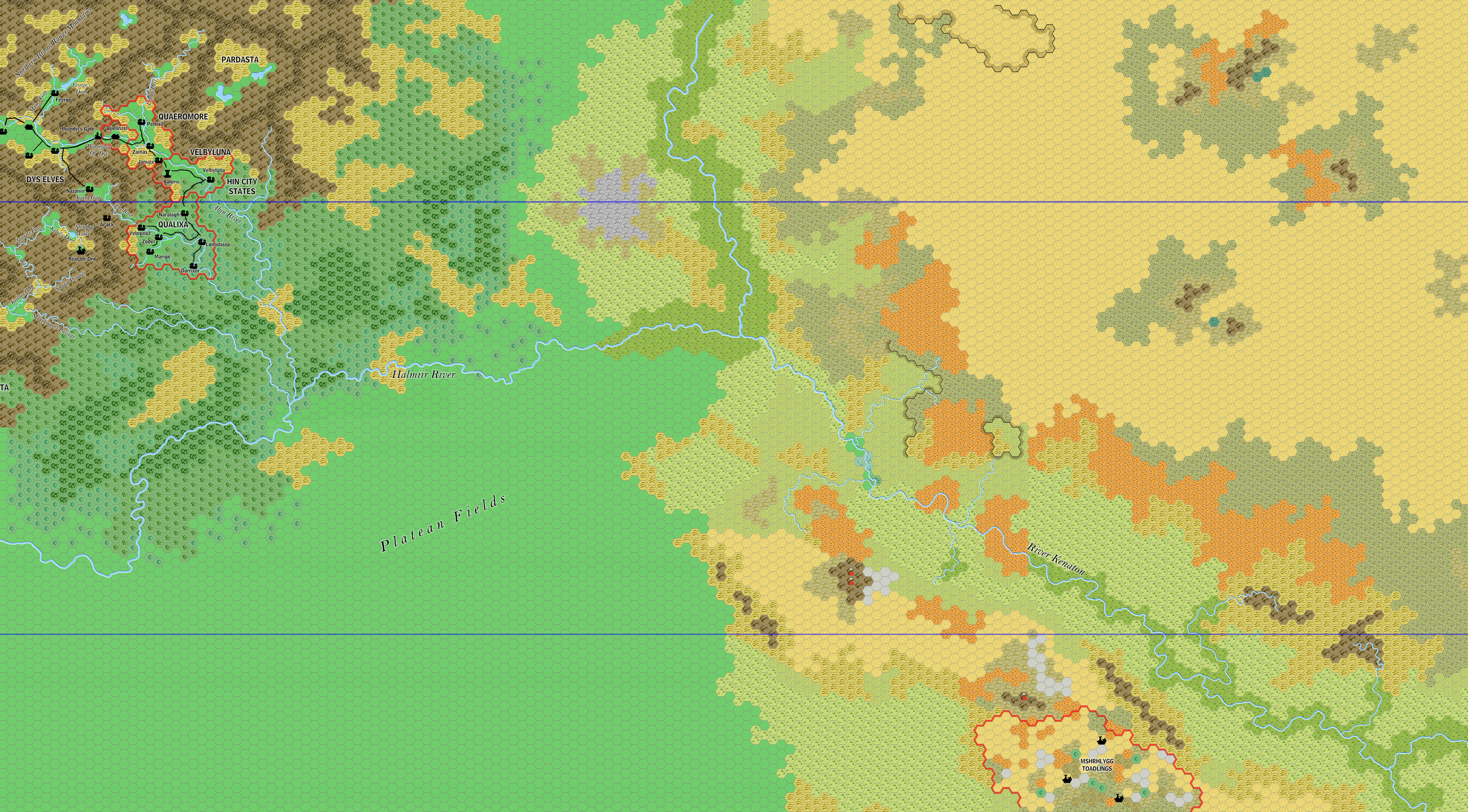
Ramelin’s Platea, 8 miles per hex
The only map Jose finished in 2020 was this map of Michele Carpita’s Platea region of Davania. Michele created Platea as a collaborative fan project, and it saw a fair bit of work, but remains unfinished to this day. Perhaps as a result of this, Jose’s version was similarly rather bare in places, but well-developed in others.
Regardless, it was another stepping stone on the way to full coverage of Davania — a Herculean task if ever there was one.
Fan-made Map by Jose Ignacio Ramos Lomelin (November 2020)
This is an original map created by one of Mystara’s excellent fan cartographers. For more information on the cartographer, including a gallery of all their maps, see also Appendix M: Mappers of Mystara.
Sources
Fan Sources
- LoZompatore’s Platea, 72 miles per hex (October 2010)
References
- All of Jose’s maps at the Atlas of Mystara
- Jose’s entry in Appendix M: Mappers of Mystara (upcoming)
- Jose’s author page at the Vaults of Pandius
Chronological Analysis
This is a fan-made map. It was published in November 2020. The updated Atlas version of this map is not yet available. See also Appendix C for annual chronological snapshots of the area. For the full context of this map in Mystara’s publication history, see the upcoming Let’s Map Mystara 2020.
The following lists are from the Let’s Map Mystara project. Additions are new features, introduced in this map. Revisions are changes to previously-introduced features. Hex Art & Fonts track design elements. Finally, Textual Additions are potential features found in the related text. In most cases, the Atlas adopts these textual additions into updated and chronological maps.
Under Construction! Please check back again soon for updates.
Additions
- Settlements —
Revisions
- Settlements —
Hex Art & Fonts
- Hex Art — Ramelin Mystara standard.
- Fonts — Bell MT (major geographic and all water labels), Bell Centennial (all other labels), Feinen (titling).
")

