Ashtagon’s Darokin, 8 miles per hex Labels
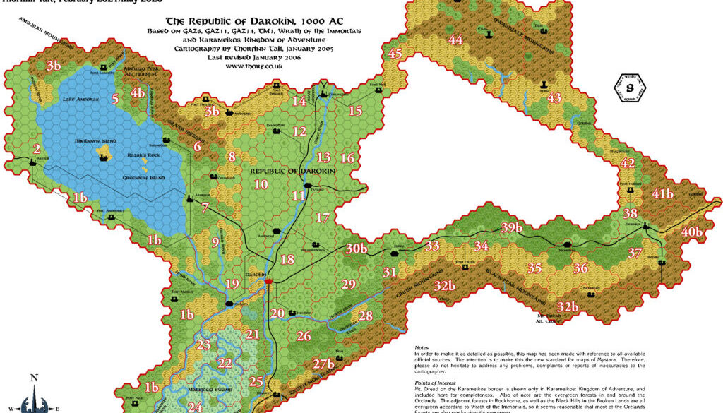
Emma’s first posted map was a very useful annotation on one of my maps. She added numbered labels to my 8 mile per hex conversion of GAZ11’s Darokin Borderlands map, thus enabling the community to begin the process of naming all the provinces. It was a really useful thing to have in the discussion.
The original map is lost to the years, but Sheldon Morris used Emma’s map as a base for his own map during the discussion, and that map is still with us. I have therefore reconstructed Emma’s original map; it’s my reconstruction that appears below. In a break from my usual Replica map conventions, I elected to keep Emma’s numbers and styling while increasing their size to make them more legible. Twenty years have not been kind to my eyesight…
If anyone out there reading this has a copy of Emma’s original map, please let me know.
Reconstruction of Fan-made Map by Emma Rome (January 2006)
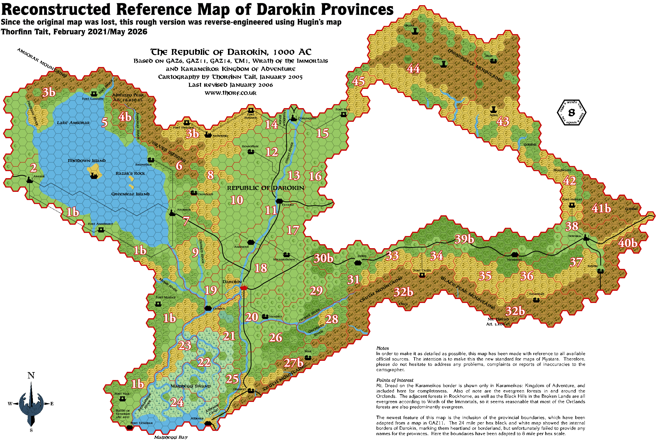
(Reconstructed by Thorfinn Tait, May 2026)
This is an original map created by one of Mystara’s excellent fan cartographers. For more information on the cartographer, including a gallery of all their maps, see also Appendix M: Mappers of Mystara.
Sources
- GAZ11 The Republic of Darokin (1989) (PDF at DriveThruRPG)
Fan Sources
- Darokin Provinces discussion thread at the Mystara Message Board (archived)
References
- All of Emma’s maps at the Atlas of Mystara
- Emma’s entry in Appendix M: Mappers of Mystara (upcoming)
- Emma’s author page at the Vaults of Pandius
Chronological Analysis
This is a fan-made map. It was published in January 2006. The updated Atlas version of this map is not yet available. See also Appendix C for annual chronological snapshots of the area. For the full context of this map in Mystara’s publication history, see the upcoming Let’s Map Mystara 2006.
The following lists are from the Let’s Map Mystara project. Additions are new features, introduced in this map. Revisions are changes to previously-introduced features. Hex Art & Fonts track design elements. Finally, Textual Additions are potential features found in the related text. In most cases, the Atlas adopts these textual additions into updated and chronological maps.
Under Construction! Please check back again soon for updates.