Zendrolion’s Lower Norwold, 8 miles per hex WIP
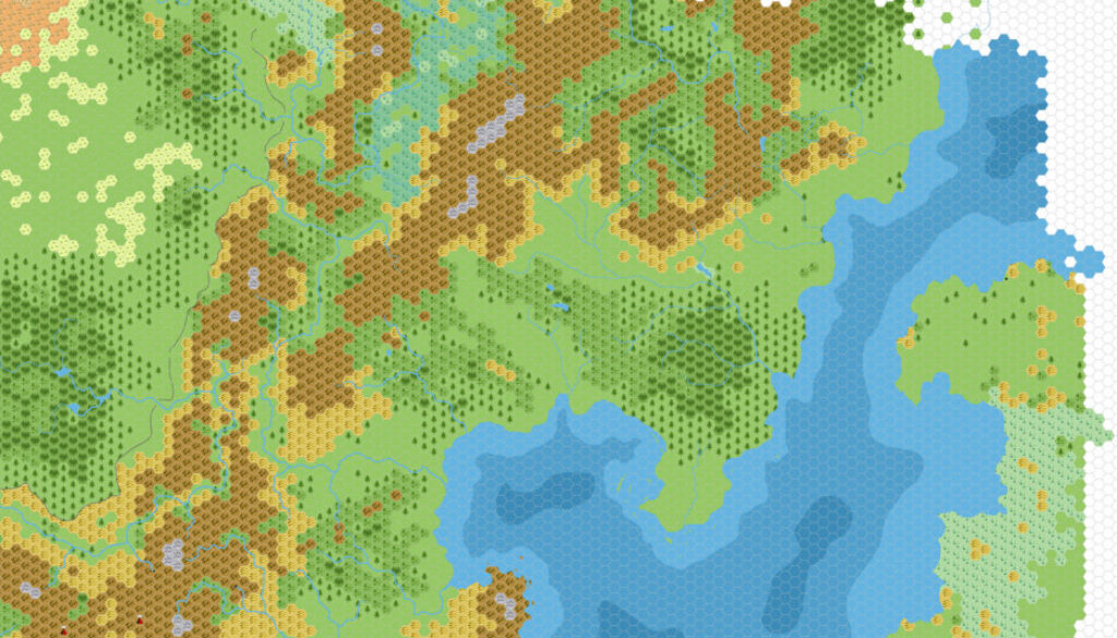
In June 2011, Simone posted in a thread at The Piazza asking about maps of the Northern Wildlands. He replied with this draft map:
I started doing this years ago, planning to write a series of mini-gazetteers on this region – lack of time and real life messed up with this project and definitely stopped it…
He also mentioned that he wasn’t sure that it covered quite the region the original poster, Ville Lahde, was looking for.
Simone provided me with a copy of the original file, which actually dated back as far as November 2007, going by the date stamp on the file itself.
It turned out to be a wonderful work-in-progress 8 mile per hex version of southern Norwold, with beautiful terrain detailing but blank of any settlements, labels, or other signs of civilisation — a blank canvas map.
Given his history as pretty much the undisputed king of Norwold mapping, it’s astounding to see an 8 mile conversion of his 24 mile per hex maps — done by Simone himself, no less! The terrain alone is a great resource. It’s such a shame that this map has not seen wider recognition or development over the years — most likely due to its obscure location, hidden in a random discussion thread and then unavailable for many years.
Fan-made Map by Simone Neri (November 2007)
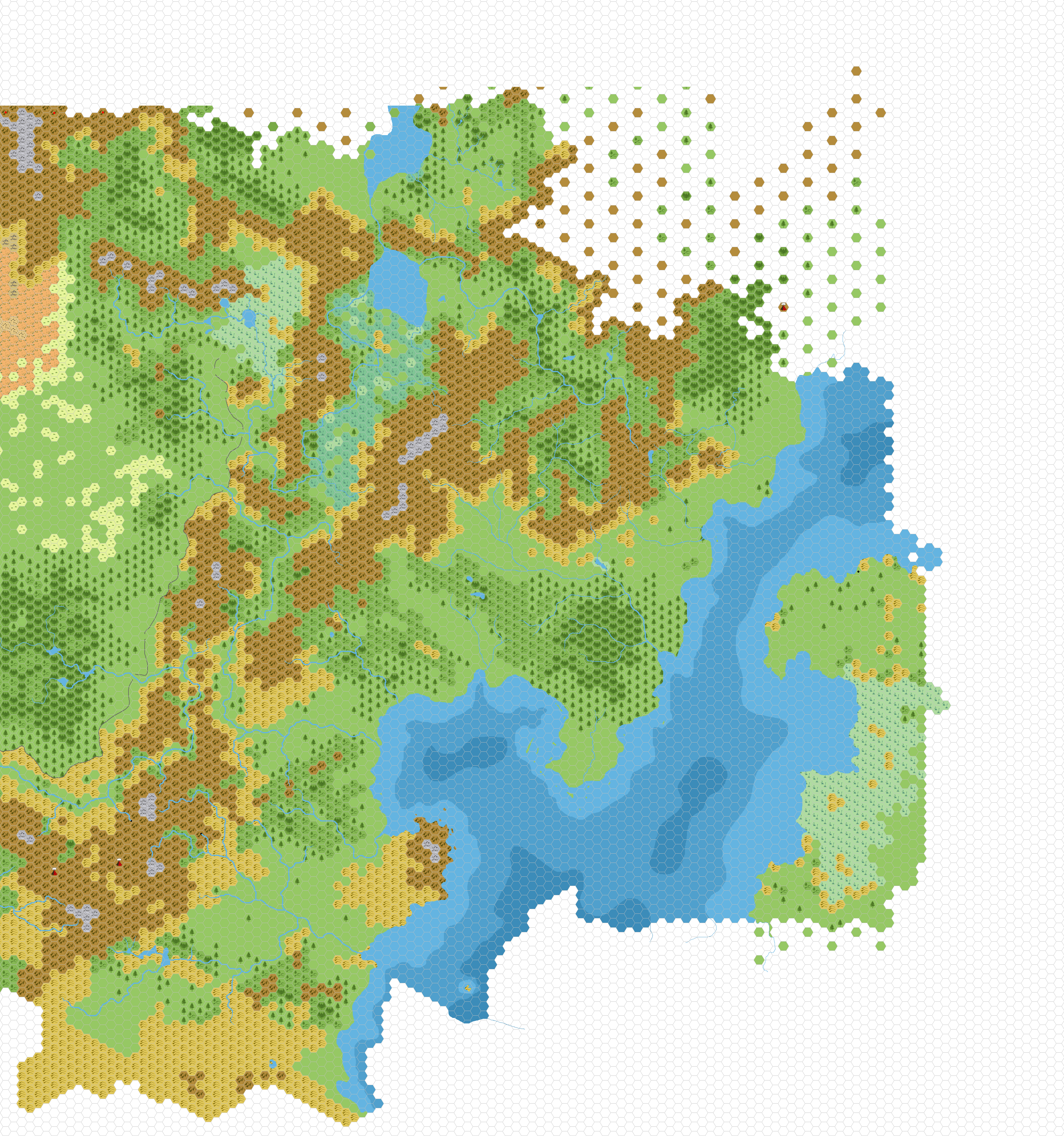
This is an original map created by one of Mystara’s excellent fan cartographers. For more information on the cartographer, including a gallery of all their maps, see also Appendix M: Mappers of Mystara.
Sources
- CM1 Test of the Warlords (1984) (PDF at DriveThruRPG)
Fan Sources
- Zendrolion’s Norwold, 24 miles per hex v1.7 (March 2007)
- Draft map of the Wildlands? discussion thread at The Piazza (June 2011)
References
- All of Simone’s maps at the Atlas of Mystara
- Simone’s entry in Appendix M: Mappers of Mystara (upcoming)
- Simone’s author page at the Vaults of Pandius
Chronological Analysis
This is a fan-made map. It was published in November 2007. The updated Atlas version of this map is not yet available. See also Appendix C for annual chronological snapshots of the area. For the full context of this map in Mystara’s publication history, see the upcoming Let’s Map Mystara 2007.
The following lists are from the Let’s Map Mystara project. Additions are new features, introduced in this map. Revisions are changes to previously-introduced features. Hex Art & Fonts track design elements. Finally, Textual Additions are potential features found in the related text. In most cases, the Atlas adopts these textual additions into updated and chronological maps.
Under Construction! Please check back again soon for updates.
Additions
- XXX —
Revisions
- XXX —
Hex Art & Fonts
- Hex Art —
- Fonts —