Zendrolion’s Vyolstagrad Position, 24 miles per hex
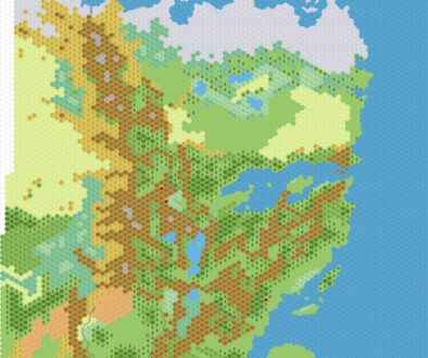
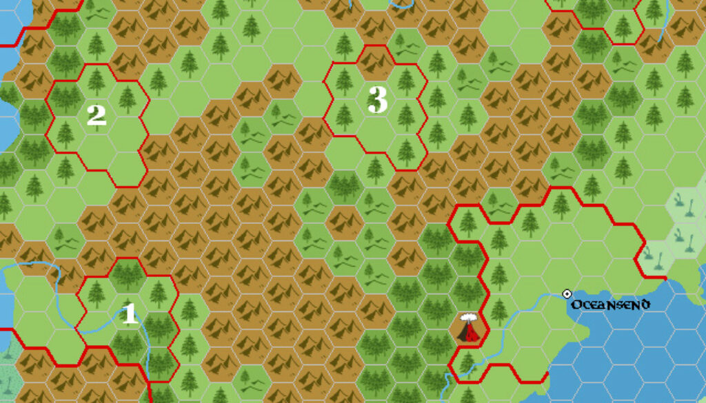
This map comes from Simone’s Demografia Mystarana Norwold thread on the Italian MMB. He posted it right after his 8 mile per hex conversion of Vyolstagrad, proposing four possible placements for the dominion on the larger Norwold map.
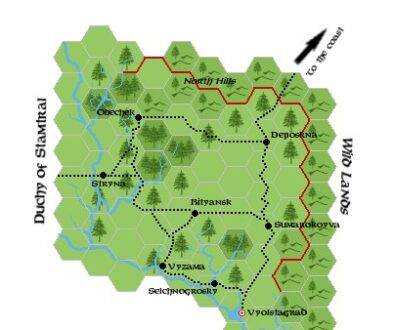
Before looking at the placements, he summarised the known facts about Vyolstagrad from CM4 as follows (translation from Italian via Google Chrome — apologies for any mistakes):
- it is located “somewhere near the Wyrmsteeth Range”;
- the road leading northeast from it reads “Wild Lands to the Coast”;
- the Duchy of Stamtral is located to the west of it, and neighbors;
- the duchy occupies approximately 8 24-mile hexes.
He then outlined each of the four locations shown in his map as follows:
Position 1 : IMO, this would be the best (even better would be to move it one more hex to the southeast—it just occurred to me!
): there’s room for Stamtral to the west, we’re in the middle of the Vantalian zone, and there’s a river that can be connected to the Vyolstagrad river. UNFORTUNATELY, this position has the flaw that there’s no coast to the northeast, but there are the Dragon’s Teeth!
Position 2 : This is the most manageable location, given the corresponding terrain. Unfortunately, there isn’t much room for Stamtral to the west, and the problem remains that the northeast route doesn’t lead to the coast.
Position 3 : Another excellent location, both for its terrain and because it has room for Stamtral. Problems: The coast is much easier to access from the southeast than the northeast, and it’s VERY close to the Dragon’s Teeth.
Position 4 : This location is also good, but once again the coast is closer to the southeast than the northeast. There’s room for Stamtral, and the duchy is close enough to eastern Norwold to be civilized as it appears in CM4. Problems: Dangerously close to the Sabre River (that’s the eastern one, as decided), and slightly outside the area we’ve assigned to the Vantalian culture (but no big deal, we can manage that, and “spots” are always possible).
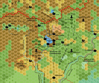
Just a week later, Simone posted the next version (1.4) of his Norwold map; in it, he used Position 2 from this map, at the same time altering the terrain slightly to more closely match Vyolstagrad’s lands.
Fan-made Maps by Simone Neri (April 2006)
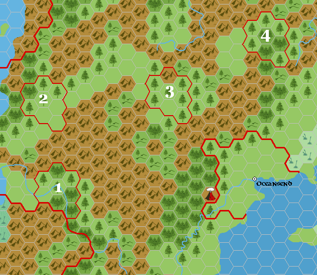
This is an original map created by one of Mystara’s excellent fan cartographers. For more information on the cartographer, including a gallery of all their maps, see also Appendix M: Mappers of Mystara.
Sources
- CM4 Earthshaker! (1985) (PDF at DriveThruRPG)
Fan Sources
References
- All of Simone’s maps at the Atlas of Mystara
- Simone’s entry in Appendix M: Mappers of Mystara (upcoming)
- Simone’s author page at the Vaults of Pandius
Chronological Analysis
This is a fan-made map. It was published in April 2006. The updated Atlas version of this map is not yet available. See also Appendix C for annual chronological snapshots of the area. For the full context of this map in Mystara’s publication history, see the upcoming Let’s Map Mystara 2006.
The following lists are from the Let’s Map Mystara project. Additions are new features, introduced in this map. Revisions are changes to previously-introduced features. Hex Art & Fonts track design elements. Finally, Textual Additions are potential features found in the related text. In most cases, the Atlas adopts these textual additions into updated and chronological maps.
Under Construction! Please check back again soon for updates.
Additions
- XXX —
Revisions
- XXX —
Hex Art & Fonts
- Hex Art —
- Fonts —