Zendrolion’s Ierendi, 8 miles per hex Demographic
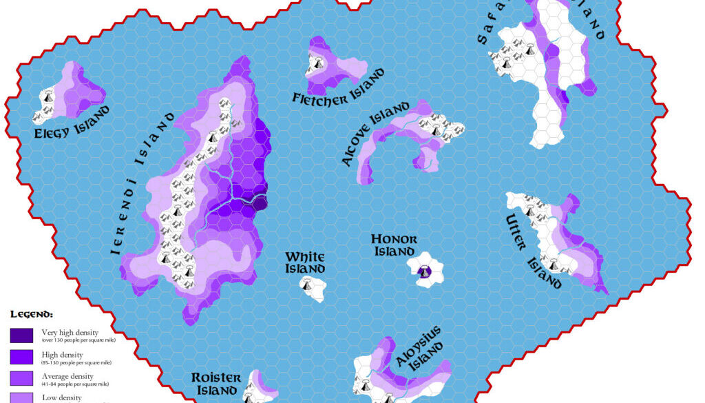
Following on from his Karameikos demographics in Threshold #1, Simone wrote a new article covering Ierendi and Minrothad for Threshold #3. Like the previous instalment, this one also featured beautiful demographic maps. Here’s a sample from the article:
…only a small area of the whole surface of the islands is truly settled; wilderness (37% of total land area) and borderlands (21%) still account for the greater part of the country. In fact, areas with a very high density level (over 130 people per square mile) are only found in the immediate suburban surroundings of Ierendi town, while high density areas (85-130 people per square mile) extend about 15-20 miles around that region, along the final course of the Ierendi River, and on the tract of plain and beachy seacoast north of the capital.
The focus here was very much on population density and “levels of settlement”, and Simone’s map employed a rather attractive set of colour shades to convey this information. It all resulted in a very professional-looking map: highly legible, and immediately useful.
Fan-made Map by Simone Neri (March 2014)
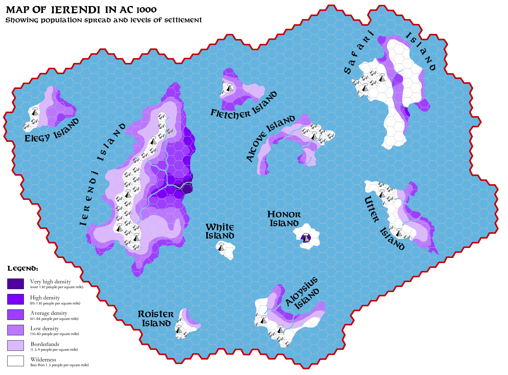
This is an original map created by one of Mystara’s excellent fan cartographers. For more information on the cartographer, including a gallery of all their maps, see also Appendix M: Mappers of Mystara.
Sources
- GAZ4 The Kingdom of Ierendi (1987) (PDF at DriveThruRPG)
Fan Sources
- The Demography of Karameikos from Threshold Magazine at the Vaults of Pandius (September 2013)
- The Demography of Ierendi & Minrothad from Threshold Magazine #3 (March 2014)
References
- All of Simone’s maps at the Atlas of Mystara
- Simone’s entry in Appendix M: Mappers of Mystara (upcoming)
- Simone’s author page at the Vaults of Pandius
Chronological Analysis
This is a fan-made map. It was published in March 2014. The updated Atlas version of this map is not yet available. See also Appendix C for annual chronological snapshots of the area. For the full context of this map in Mystara’s publication history, see the upcoming Let’s Map Mystara 2014.
The following lists are from the Let’s Map Mystara project. Additions are new features, introduced in this map. Revisions are changes to previously-introduced features. Hex Art & Fonts track design elements. Finally, Textual Additions are potential features found in the related text. In most cases, the Atlas adopts these textual additions into updated and chronological maps.
Under Construction! Please check back again soon for updates.
Additions
- XXX —
Revisions
- XXX —
Hex Art & Fonts
- Hex Art —
- Fonts —