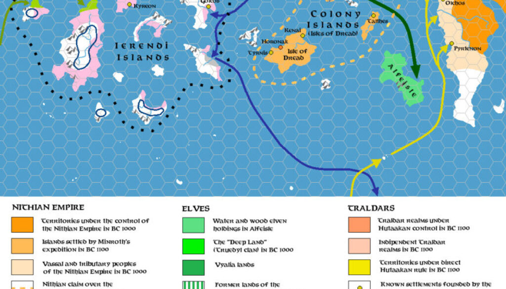
Zendrolion’s Ierendi and Colony Islands 1300 to 600 BC, 24 miles per hex
Just as he followed up his Karameikan demography map and article with an Ierendi and Minrothad entry, Simone also created a History of Ierendi and Minrothad article — both for Threshold #3. He illustrated this new historical article — which was to become the first in a short series — with four maps, of which this was the first. It covered the period of early history following the cataclysmic subsistence of the Sea of Dread coast. The Makai occupied these islands in the west, with elves on Alfeisle in the southeast. These were now joined by a third group: Nithian colonists. Simone explained in his article:
Nithians were attracted to the eastern islands by their natural resources; in BC 1100, under the leadership of the hero-adventurer Minroth, the Nithians quickly took possession of most of the islands of the modern Minrothad archipelago, easily overcoming what little resistance the indigenous (Taymora-descended) population and the Traldar colonies tried to put up. They founded the city of Horonak (on the site of the modern Harbortown) on the largest of these islands, and named the whole archipelago Colony Islands in their tongue.
This is but a tiny peek at Simone’s article — I highly recommend reading the whole thing.
The wonderful thing about this map is the way that Simone tied together the various known histories of the region, dealing not just with the islands themselves, but the migrations moving past and through them, including Traldar (Milenians), Thyatians, Hin, and elves, Not to mention the Nithian colonists, of course.
Fan-made Map by Simone Neri (March 2014)
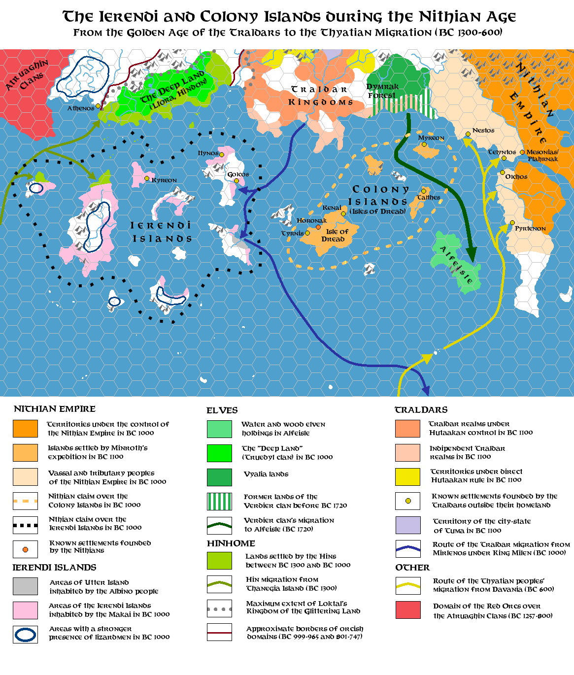
This is an original map created by one of Mystara’s excellent fan cartographers. For more information on the cartographer, including a gallery of all their maps, see also Appendix M: Mappers of Mystara.
Sources
Fan Sources
- The History of Ierendi and Minrothad part I from Threshold Magazine #3 (March 2014)
References
- All of Simone’s maps at the Atlas of Mystara
- Simone’s entry in Appendix M: Mappers of Mystara (upcoming)
- Simone’s author page at the Vaults of Pandius
Chronological Analysis
This is a fan-made map. It was published in March 2014. The updated Atlas version of this map is not yet available. See also Appendix C for annual chronological snapshots of the area. For the full context of this map in Mystara’s publication history, see the upcoming Let’s Map Mystara 2014.
The following lists are from the Let’s Map Mystara project. Additions are new features, introduced in this map. Revisions are changes to previously-introduced features. Hex Art & Fonts track design elements. Finally, Textual Additions are potential features found in the related text. In most cases, the Atlas adopts these textual additions into updated and chronological maps.
Under Construction! Please check back again soon for updates.
Additions
- XXX —
Revisions
- XXX —
Hex Art & Fonts
- Hex Art —
- Fonts —