
Chimpman’s Platea, 8 miles per hex
This was John’s contribution to Michele Carpita’s challenge to the community to detail an empty region of central Davania, Platea. He began by posting a map compiling all the other maps and fragments available. Then he refined it over the next week, with contributions from Geoff Gander. The earlier posted version(s) are lost to us now.
The Vaults of Pandius dates this map to September 2011, which was the date of the last posted message in the thread. The first post of the thread was edited on the same day. However, the map doesn’t include elements we might expect from another update, so I think it’s more likely that this was simply the final version from 2010.
Fan-made Map by John Calvin (December 2010)
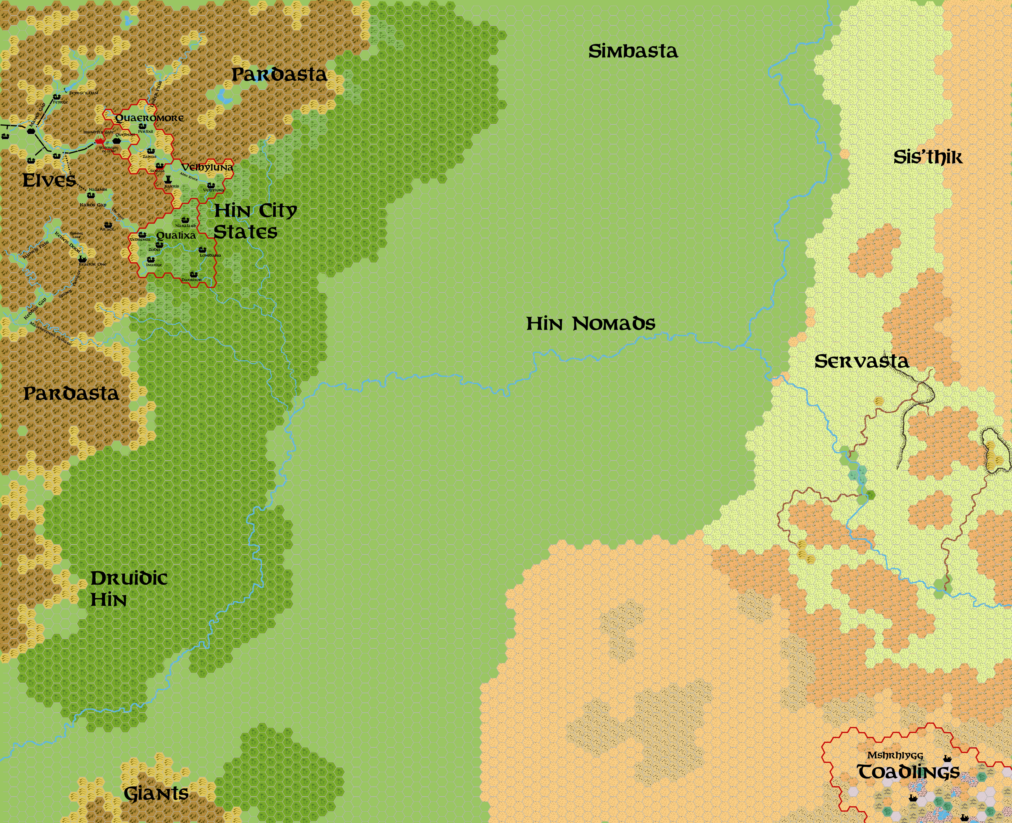
This is an original map created by one of Mystara’s excellent fan cartographers. For more information on the cartographer, including a gallery of all their maps, see also Appendix M: Mappers of Mystara.
Sources
Fan Sources
- LoZompatore’s Platea, 72 miles per hex (October 2010)
- Yellowdingo’s Northwest Platea, 8 miles per hex (November 2010)
- Yellowdingo’s Southwest Platea, 8 miles per hex (November 2010)
- LoZompatore’s Northwestern Platea, 8 miles per hex (November 2010)
- Agathokles’ Platea Regions, 72 miles per hex
- Outer World: Platea, 8 miles per hex discussion thread at The Piazza (December 2010)
References
- All of John’s maps at the Atlas of Mystara
- John’s entry in Appendix M: Mappers of Mystara (upcoming)
- John’s author page at the Vaults of Pandius
Chronological Analysis
This is a fan-made map. It was published in December 2010. The updated Atlas version of this map is not yet available. See also Appendix C for annual chronological snapshots of the area. For the full context of this map in Mystara’s publication history, see the upcoming Let’s Map Mystara 2010.
The following lists are from the Let’s Map Mystara project. Additions are new features, introduced in this map. Revisions are changes to previously-introduced features. Hex Art & Fonts track design elements. Finally, Textual Additions are potential features found in the related text. In most cases, the Atlas adopts these textual additions into updated and chronological maps.
Under Construction! Please check back again soon for updates.

")
