
Chimpman’s Mogreth 2300 BC CC3
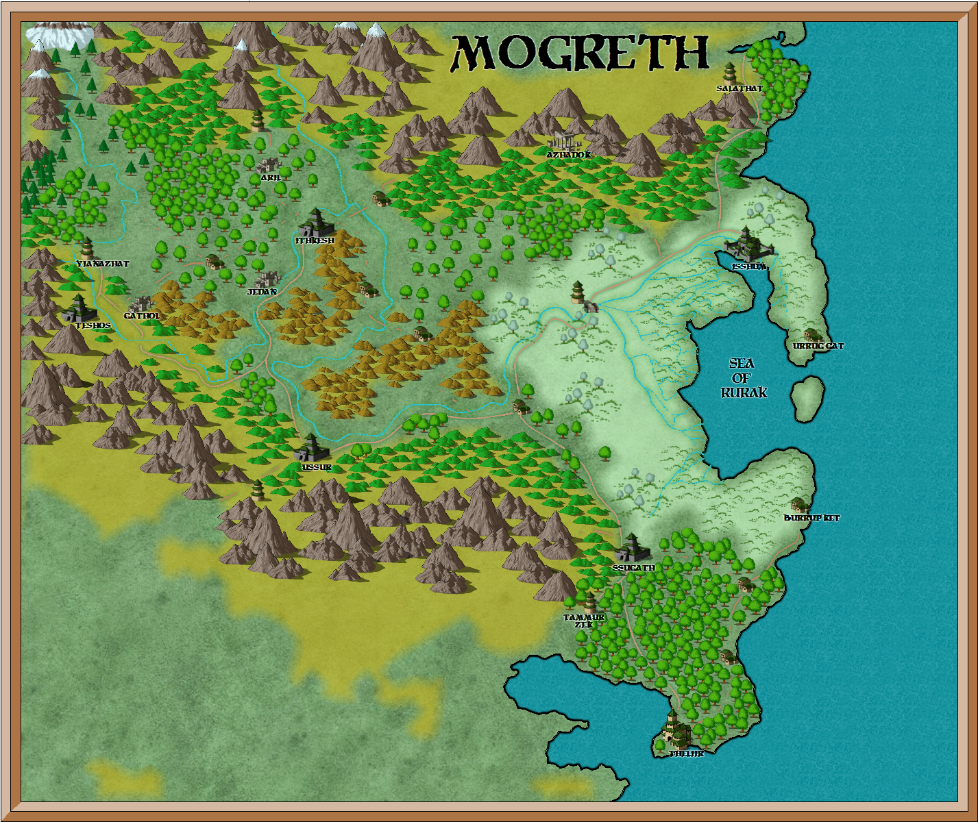
In August 2010, John did an experiment using Campaign Cartographer 3 to create maps of Mogreth. He started with a map using one of CC3’s art styles. Here’s what he posted about the first map over at The Piazza:
What you see above is the result of about 2 full days of work and frustration, just trying to get to know the software. That’s probably the 3rd map of Mogreth that I did. The first one I really messed up, and ended up crashing the program whenever I tried loading it. The second I’m pretty sure I only thought I messed up and scrapped it – thank you Merge Layer (what a pain). At this point I think I’m getting the hang of things.
The new map is pretty much a copy of the hex map – in fact I pulled that in as my baseline and used it for tracing out coastlines, rivers, roads, etc and also for placing symbols. I’m pretty happy about most of it. I like the mountains, and the swamp, but I’m not so sure about the “hill brown” contour layer for hills and mountains. I’m wondering if the roads should be a darker color (black) as well. At some point I may try for a map using Thorf’s colors for land and sea and all the contours, just to see how that turns out.
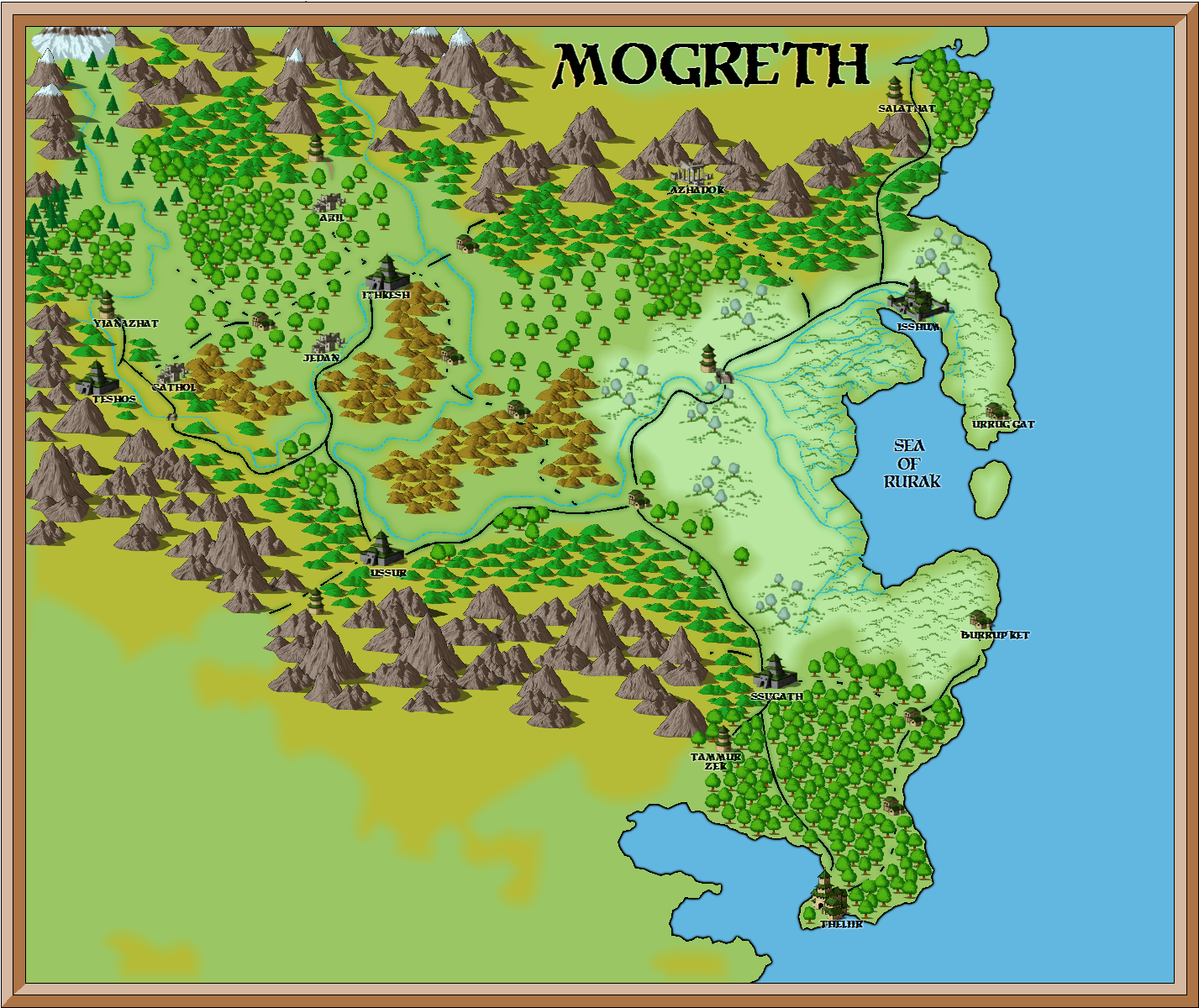
A couple of days later, he posted the second map, adapting my colour palette to CC3’s style.
Although he made a few more CC3 maps, going forward he mostly continued with the traditional Mystara hex style.
Fan-made Maps by John Calvin (August 2010)
This is an original map created by one of Mystara’s excellent fan cartographers. For more information on the cartographer, including a gallery of all their maps, see also Appendix M: Mappers of Mystara.
Sources
Fan Sources
- Chimpman’s Mogreth 2300 BC, 8 miles per hex v1 (August 2009)
- Chimpman’s Mogreth 2300 BC, 8 miles per hex City Comparison (August 2009)
- Outer World: Mogreth 2300 BC, 8 miles per hex discussion thread at The Piazza (August 2009-August 2023)
References
- All of John’s maps at the Atlas of Mystara
- John’s entry in Appendix M: Mappers of Mystara (upcoming)
- John’s author page at the Vaults of Pandius
Chronological Analysis
This is a fan-made map. It was published in August 2010. The updated Atlas version of this map is not yet available. See also Appendix C for annual chronological snapshots of the area. For the full context of this map in Mystara’s publication history, see the upcoming Let’s Map Mystara 2010.
The following lists are from the Let’s Map Mystara project. Additions are new features, introduced in this map. Revisions are changes to previously-introduced features. Hex Art & Fonts track design elements. Finally, Textual Additions are potential features found in the related text. In most cases, the Atlas adopts these textual additions into updated and chronological maps.
Under Construction! Please check back again soon for updates.
")

