LoZompatore’s Alphatian Sea Area
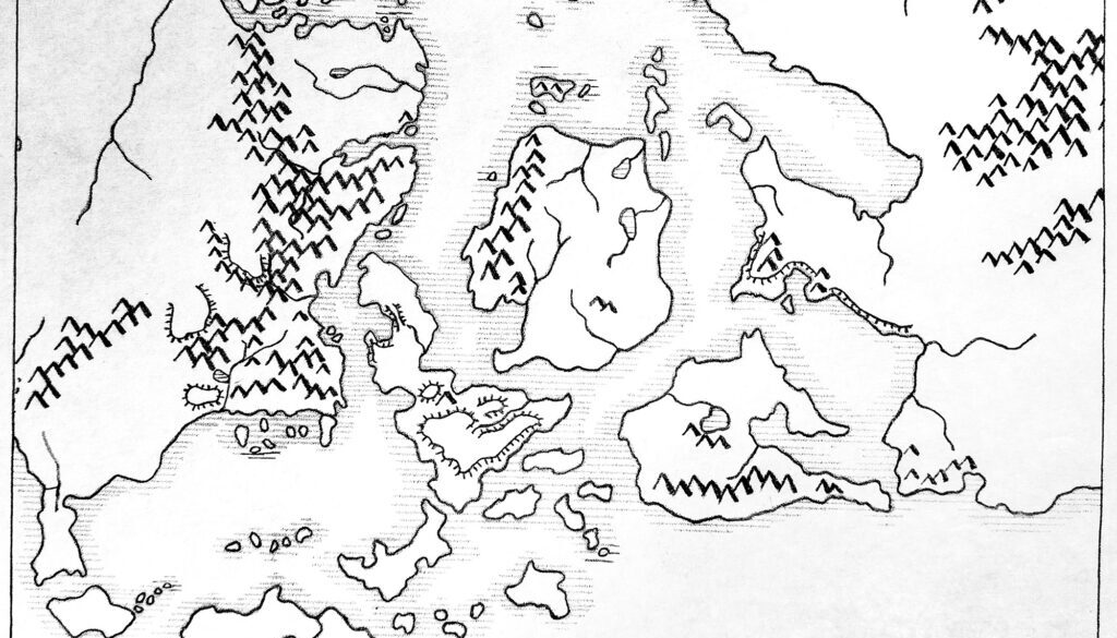
Michele sent me this photograph of one of his earliest Mystara maps, which I have brightened up a little to bring out the details. He explained in a message to me:
About this map, this was my very first attempt at mapmaking something for the web, dated October 10, 2004. The map was created by contouring the Master Set map and then adding details based on other official material. For this drawing I used a black pencil and a graphite pencil.
I guess that the only part of the map that was ever published is actually the one in “Isle of Dawn Nonhuman Populations” because I almost immediately moved to Paint and digital drawing. Anyway, looking at the map now, I must say that I am quite satisfied by the result.
I have a few older maps than this, but they were heavily-personalized, “for personal use only” maps to be used with my players only and they were never published anywhere on the web.
The style is unmistakably Michele’s, displaying the same careful drawing he used in his Brun and Alphatia maps in the succeeding years. What made this one different was its hand-drawn style, using pencils and paper rather than digital painting. It’s interesting how similar his latest maps ended up — a testament to what a good job he made of his base maps.
Fan-made Map by Michele Carpita (October 2004)
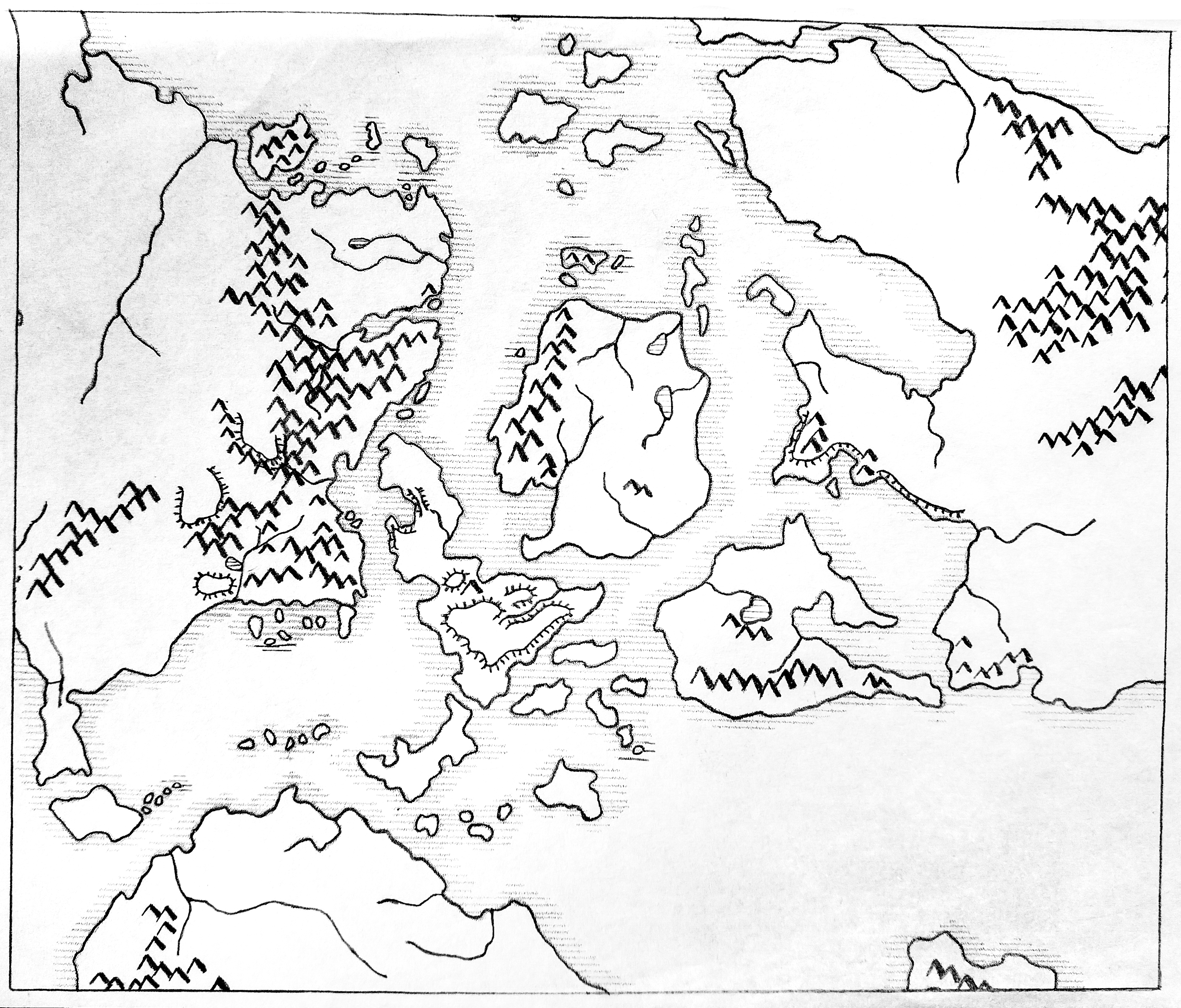
This is an original map created by one of Mystara’s excellent fan cartographers. For more information on the cartographer, including a gallery of all their maps, see also Appendix M: Mappers of Mystara.
Sources
- Companion Rules Set (1984) (PDF at DriveThruRPG)
- Master Rules Set (1985) (PDF at DriveThruRPG)
Fan Sources
References
- Reimplemented in LoZompatore’s Isle of Dawn Nonhuman Populations (September 2005)
- All of Michele’s maps at the Atlas of Mystara
- Michele’s entry in Appendix M: Mappers of Mystara (upcoming)
- Michele’s author page at the Vaults of Pandius
Chronological Analysis
This is a fan-made map. It was published in October 2004. The updated Atlas version of this map is not yet available. See also Appendix C for annual chronological snapshots of the area. For the full context of this map in Mystara’s publication history, see the upcoming Let’s Map Mystara 2004.
The following lists are from the Let’s Map Mystara project. Additions are new features, introduced in this map. Revisions are changes to previously-introduced features. Hex Art & Fonts track design elements. Finally, Textual Additions are potential features found in the related text. In most cases, the Atlas adopts these textual additions into updated and chronological maps.
Under Construction! Please check back again soon for updates.
Additions
- XXX —
Revisions
- XXX —
Hex Art & Fonts
- Hex Art —
- Fonts —