Zendrolion’s Norwold, 24 miles per hex Regions
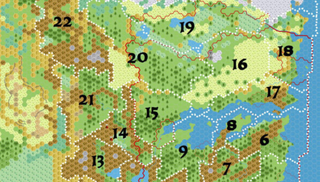
The last of Simone’s maps in his Threshold #7 A Traveller’s Guide to Norwold article was this one splitting Norwold into 24 separate regions. This was quite an interesting thing to do, because up until that point it had really been mostly one vast region, with little in the way of internal divisions.
He provided write-ups for each region in the article. For convenience, I will provide just the key below:
- Heldland and the Skaufskogr
- The Hettafjall, and the Ransarn and Vinisk Valleys
- The Lower Strange and the Mørkskog
- The Isles of the Strand
- The Tranquil Coast and the Kilmik Vale
- The Wotandal and the Dragon Spur Hills
- The Giants’ Cradle and the Hidden Valley
- The Peninsula of Alpha
- The Skogenvår, the Scarlet Forest, and the Peninsula of Err
- Severnaya Polovina and the Wyrmsteeth Core
- The Azure Lake and the Vatskiy Rodina
- Engherland and the Lower Icereach
- The Ice Wall and Quesa’s Massif
- The White Bear Valley and the Arch of Fire
- Leehashire, the Lothbarth, and the Western Viaskaland
- The Noskumis Plain and the Eastern Viaskaland
- The Ljallenvals and the Landrise
- Littonia and Itämaa
- The Autuasmaa Plain
- Koleamaa and Länsimaa
- The Great Circle, the Ostma and Natoka Valleys
- The Borean Range
- The Everwinter Valleys
- Frosthaven and the Norzee Islands
Fan-made Map by Simone Neri (April 2015)
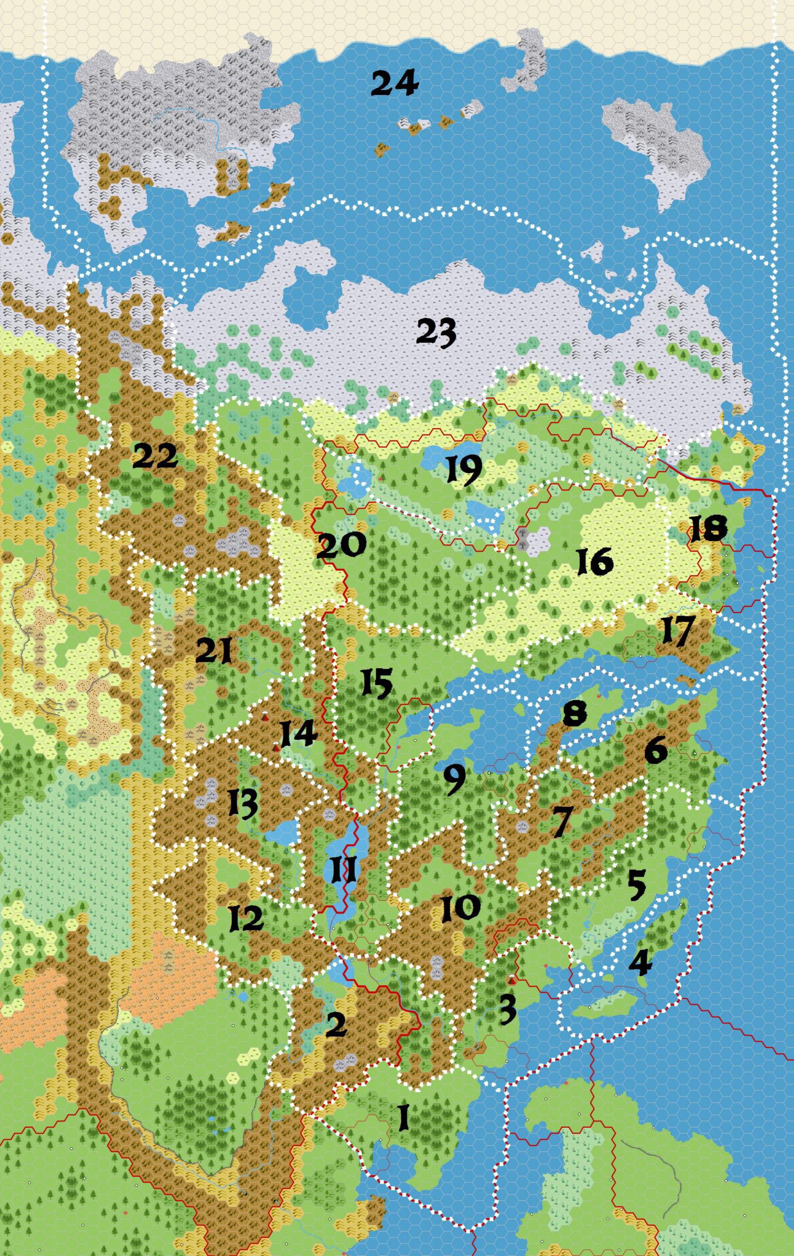
This is an original map created by one of Mystara’s excellent fan cartographers. For more information on the cartographer, including a gallery of all their maps, see also Appendix M: Mappers of Mystara.
Sources
Fan Sources
- A Traveller’s Guide to Norwold from Threshold Magazine #7 (April 2015)
References
- All of Simone’s maps at the Atlas of Mystara
- Simone’s entry in Appendix M: Mappers of Mystara (upcoming)
- Simone’s author page at the Vaults of Pandius
Chronological Analysis
This is a fan-made map. It was published in April 2015. The updated Atlas version of this map is not yet available. See also Appendix C for annual chronological snapshots of the area. For the full context of this map in Mystara’s publication history, see the upcoming Let’s Map Mystara 2015.
The following lists are from the Let’s Map Mystara project. Additions are new features, introduced in this map. Revisions are changes to previously-introduced features. Hex Art & Fonts track design elements. Finally, Textual Additions are potential features found in the related text. In most cases, the Atlas adopts these textual additions into updated and chronological maps.
Under Construction! Please check back again soon for updates.
Additions
- XXX —
Revisions
- XXX —
Hex Art & Fonts
- Hex Art —
- Fonts —