")
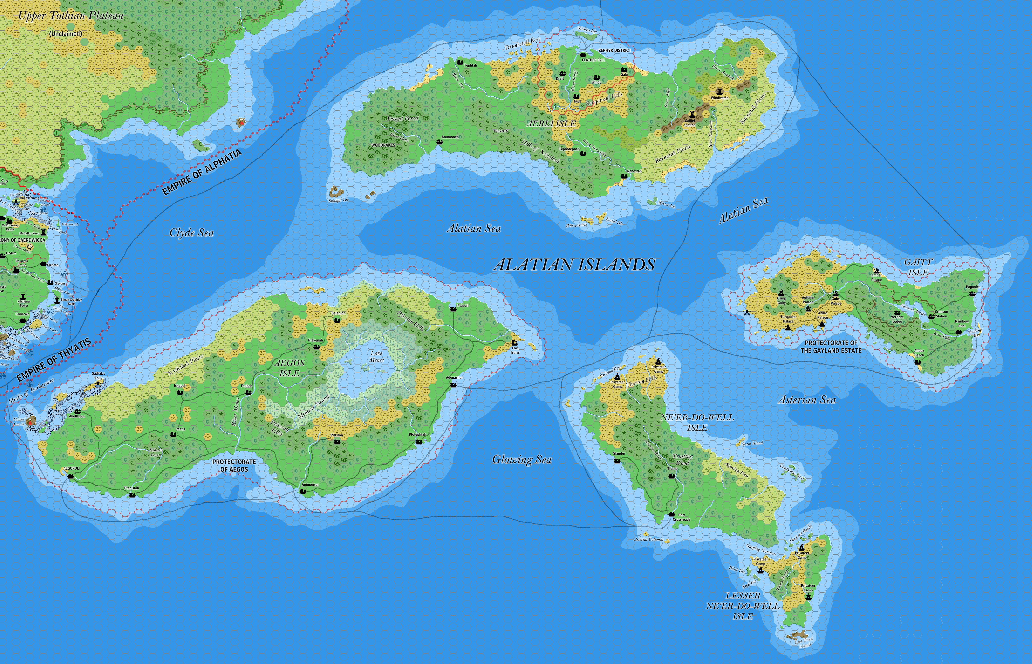
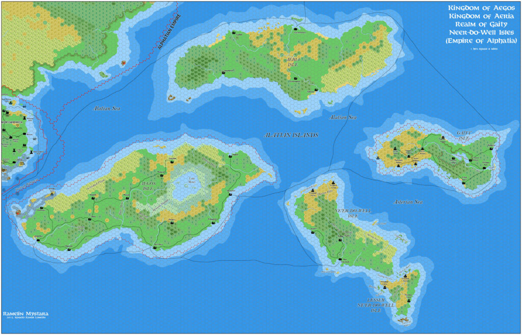
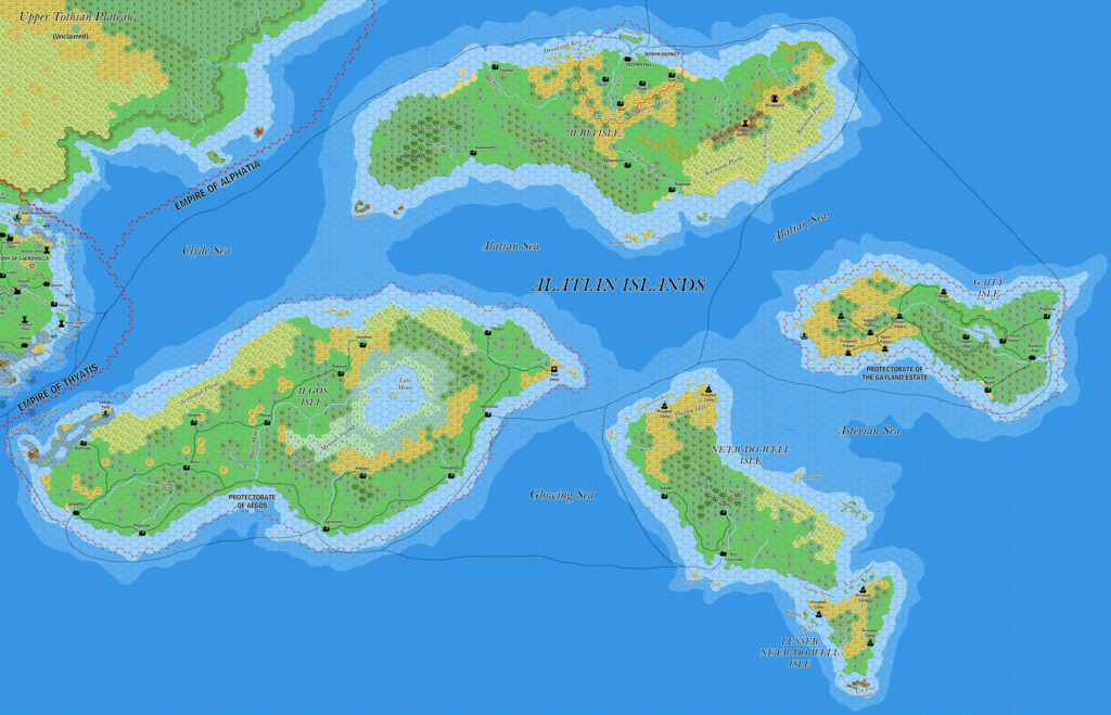
Ramelin’s Alatian Islands, 8 miles per hex v3
In his third version of the Alatian Islands, Jose made just a few small changes to the already well developed previous version. First, he continued the trend of connecting the shallow coastal waters between the isles, begun in the Isle of Dawn map. In that map, he had connected Aeria, Aegos, and Ne’er-do-well’s coastal waters; now, he connected Ne’er-do-well with Gaity, too, reducing the depth of a large portion of the Asterian Sea. Second, he made some minor tweaks to shipping lanes, mostly on the northwestern side of the map. Finally, he adjusted the border in the Clyde Sea, ceding most of the waters to the Alatians and the Alphatian Empire.
The resulting map is surely the definitive Ramelin Mystara map of the Alatian Islands — though as with other standalone maps, it does leave out recent developments in surrounding lands — in this case, on the coast of the Isle of Dawn beneath the Upper Thothian Plateau.
Fan-made Map by Jose Ignacio Ramos Lomelin (August 2018)
This is an original map created by one of Mystara’s excellent fan cartographers. For more information on the cartographer, including a gallery of all their maps, see also Appendix M: Mappers of Mystara.
Sources
- Dawn of the Emperors (1989) (PDF at DriveThruRPG)
Fan Sources
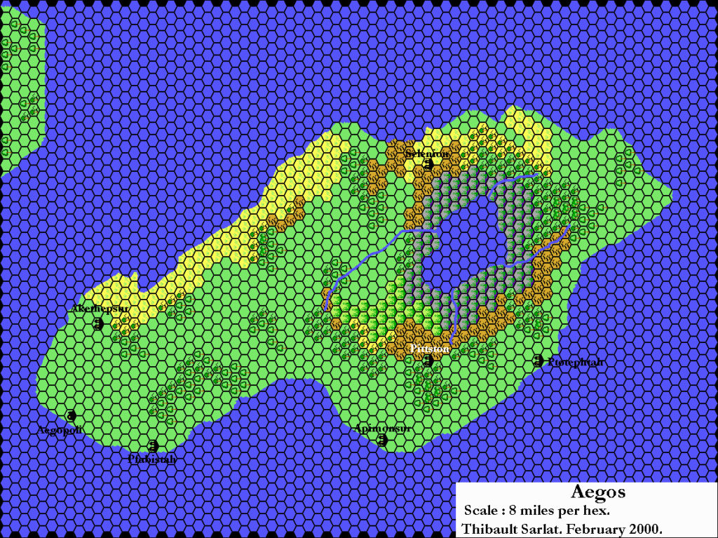
- Thibault’s Aegos, 8 miles per hex (February 2002)
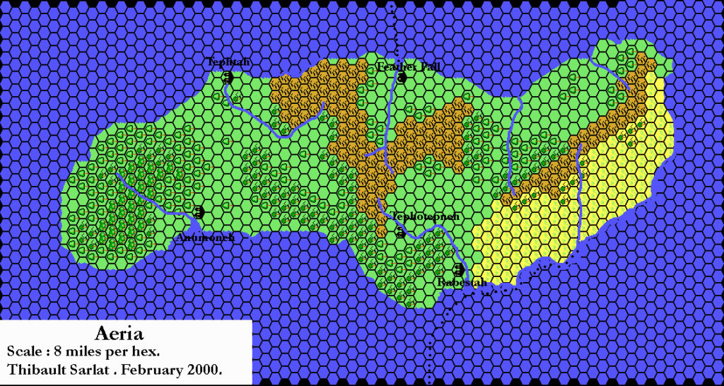
- Thibault’s Aeria, 8 miles per hex (February 2002)
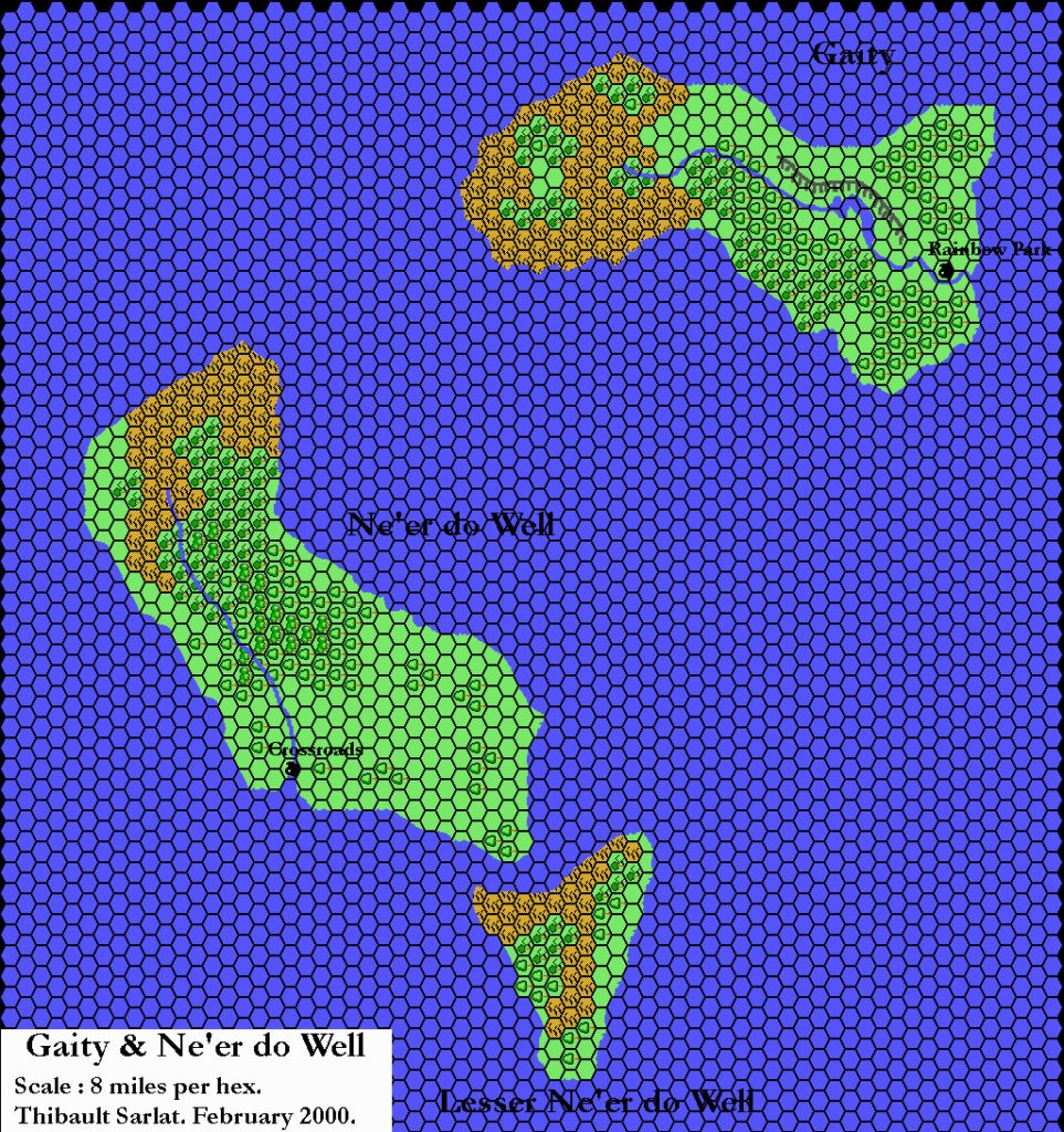
- Thibault’s Gaity and Ne’er-do-well, 8 miles per hex (February 2002)
- Ramelin’s Alatian Islands, 8 miles per hex v1 (November 2015)
- Ramelin’s Alatian Islands, 8 miles per hex v2 (July 2017)
- Ramelin’s Isle of Dawn, 8 miles per hex (November 2017)
References
- All of Jose’s maps at the Atlas of Mystara
- Jose’s entry in Appendix M: Mappers of Mystara (upcoming)
- Jose’s author page at the Vaults of Pandius
Chronological Analysis
This is a fan-made map. It was published in August 2018. The updated Atlas version of this map is not yet available. See also Appendix C for annual chronological snapshots of the area. For the full context of this map in Mystara’s publication history, see the upcoming Let’s Map Mystara 2018.
The following lists are from the Let’s Map Mystara project. Additions are new features, introduced in this map. Revisions are changes to previously-introduced features. Hex Art & Fonts track design elements. Finally, Textual Additions are potential features found in the related text. In most cases, the Atlas adopts these textual additions into updated and chronological maps.
Under Construction! Please check back again soon for updates.
Additions
- Settlements —
Revisions
- Settlements —
Hex Art & Fonts
- Hex Art — Ramelin Mystara standard.
- Fonts — Bell MT (major geographic and all water labels), Bell Centennial (all other labels), Feinen (titling).

")

")