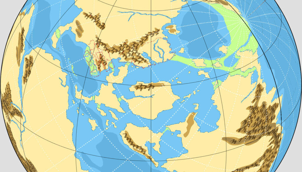
Ashtagon’s Precataclysmic Mystara Map C
This was the third in a series of maps Emma made exploring different placements for the North Pole in Precataclysmic Mystara. She explained the reasoning for this particular position in a post at The Piazza:
Map C, which has the north pole off the coast, moves the Borea Valley to below the Arctic Circle. It’s still going to be cold. With the continental effects and latitude, imagine Lake Baikal and northern Mongolia. It’s definitely frozen in winter, but flowing in summer.
Map B had placed the Sylvan Realm at the North Pole, so this was a slight nudge from that position, to make Borea’s climate a little less drastic — a problem for the history, which places humanoid cultures there at that time.
Like its predecessor, Emma based this map on my Outer World (1985) map. However, she also began to add adjustments to the shapes of the continents to more closely match the pre-Great Rain of Fire configuration. You can see these areas in green.
Fan-made Map by Emma Rome (January 2022)
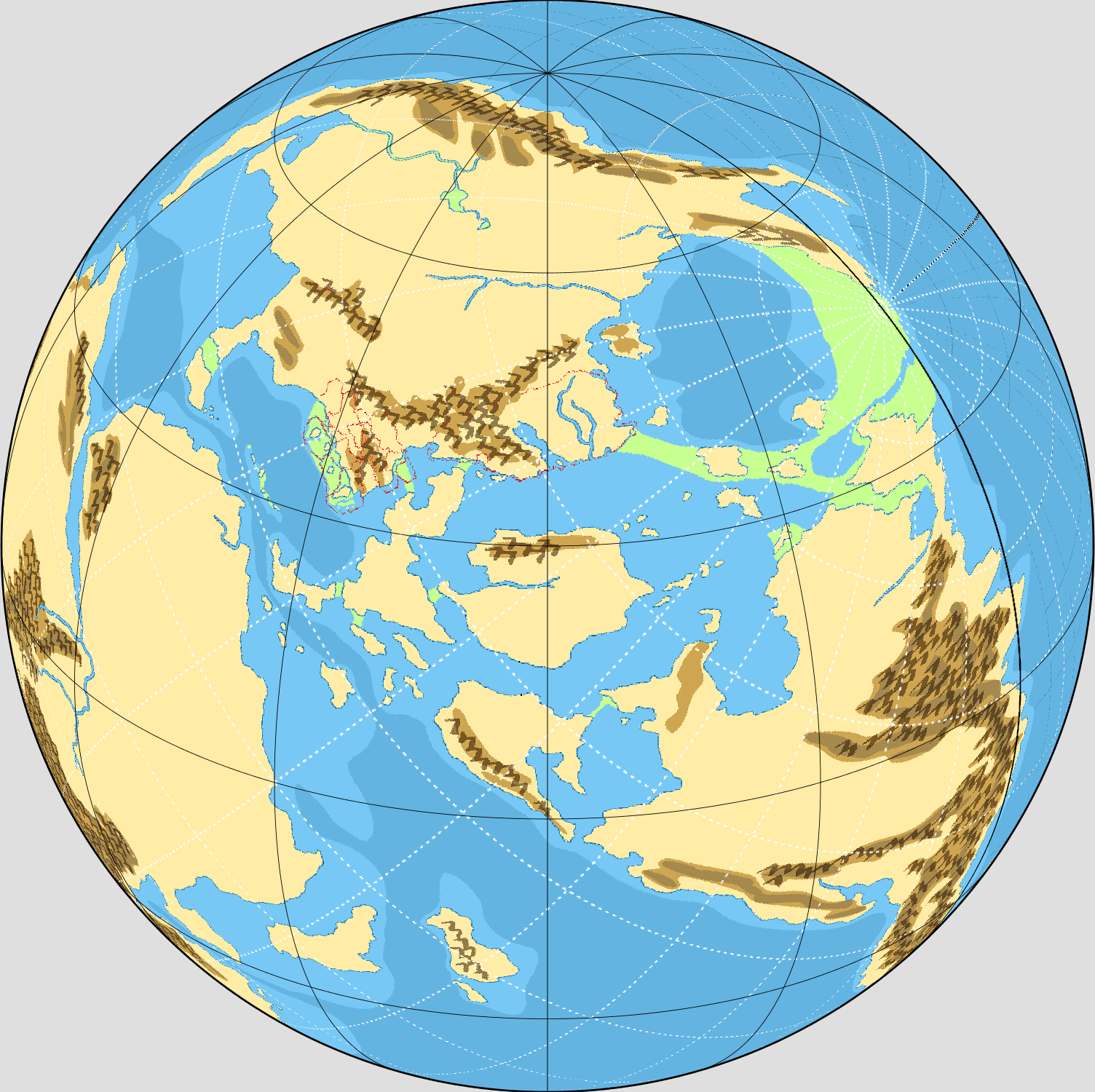
This is an original map created by one of Mystara’s excellent fan cartographers. For more information on the cartographer, including a gallery of all their maps, see also Appendix M: Mappers of Mystara.
Sources
- Hollow World Campaign Set (1990) (PDF at DriveThruRPG)
Fan Sources
- Altas of Mystara (2005-present)
- Pre-cataclysm Mystara discussion thread at The Piazza (January 2022)
References
- All of Emma’s maps at the Atlas of Mystara
- Emma’s entry in Appendix M: Mappers of Mystara (upcoming)
- Emma’s author page at the Vaults of Pandius
Chronological Analysis
This is a fan-made map. It was published in January 2022. The updated Atlas version of this map is not yet available. See also Appendix C for annual chronological snapshots of the area. For the full context of this map in Mystara’s publication history, see the upcoming Let’s Map Mystara 2022.
The following lists are from the Let’s Map Mystara project. Additions are new features, introduced in this map. Revisions are changes to previously-introduced features. Hex Art & Fonts track design elements. Finally, Textual Additions are potential features found in the related text. In most cases, the Atlas adopts these textual additions into updated and chronological maps.
Under Construction! Please check back again soon for updates.