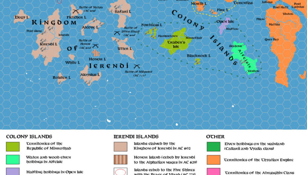
Zendrolion’s Ierendi and Colony Islands 602 to 790 AC, 24 miles per hex
Following on from the previous map directly, Simone published this third entry in his The History of Ierendi and Minrothad series in Threshold #5, featuring this map, the fourth and perhaps final one. He started his article with the following overview of the period:
The 7th and 8th centuries were a time ofconsolidation and internal transformation for the Colony Islands’ trading combine, and for the newly-created Kingdom of Ierendi. Both areas experimented with a change of political structure or a reshuffling of social classes to power; in the Ierendian case amidst serious internal turmoil and in both cases with results which produced increased internal stability.
With the Ierendian rebellion and internal upheaval in the Five Shires, Thyatian political and trading power – despite various failed efforts to reestablish it – waned from this part of the Known World, this allowed the rise of the two new trading and maritime-oriented powers of Minrothad and Ierendi, which imposed themselves over competitors both old and new – and each other. Their rivalry, from this age onward, will dominate trade and international relations in the Sea of Dread for the time to come.
I have always felt that historical maps become easier to read as they get closer to the “present day”, and this one is surely no exception. At this point in the history of the region, both Ierendi and Minrothad were beginning to resemble their 1000 AC versions, though of course the devil is in the details.
As far as I know, although Simone wrote one more article to complete this series, this was the last historical map he made for Ierendi and Minrothad.
I’ve said it in previous posts, but it’s worth saying again: I thoroughly enjoyed this journey through the history of the island nations of the northern Sea of Dread — and especially the maps. The level of professionalism evident in Simone’s approach to both the articles and the maps is astounding. I would dearly love to see more of this kind of thing for other nations in the Known World, and indeed elsewhere in Mystara.
Thank you, Simone, for this wonderful series.
Fan-made Map by Simone Neri (October 2014)
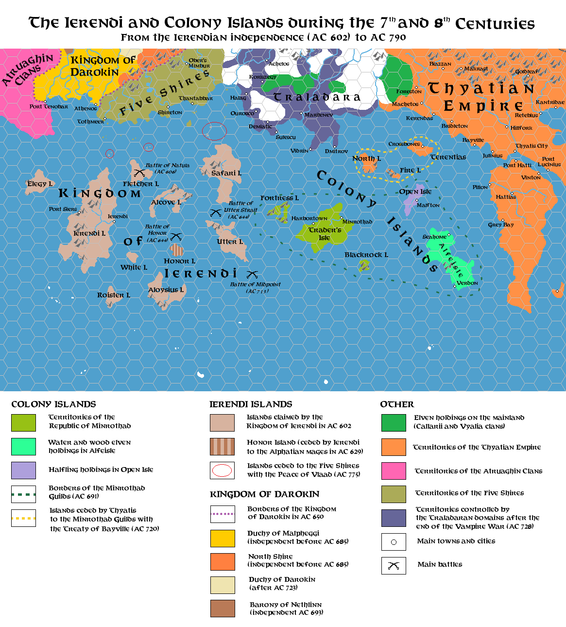
This is an original map created by one of Mystara’s excellent fan cartographers. For more information on the cartographer, including a gallery of all their maps, see also Appendix M: Mappers of Mystara.
Sources
Fan Sources
- The History of Ierendi and Minrothad part I from Threshold Magazine #3 (March 2014)
- The History of Ierendi and Minrothad part 2 from Threshold Magazine #4 (June 2014)
- The History of Ierendi and Minrothad part 3 from Threshold Magazine #5 (October 2014)
References
- All of Simone’s maps at the Atlas of Mystara
- Simone’s entry in Appendix M: Mappers of Mystara (upcoming)
- Simone’s author page at the Vaults of Pandius
Chronological Analysis
This is a fan-made map. It was published in October 2014. The updated Atlas version of this map is not yet available. See also Appendix C for annual chronological snapshots of the area. For the full context of this map in Mystara’s publication history, see the upcoming Let’s Map Mystara 2014.
The following lists are from the Let’s Map Mystara project. Additions are new features, introduced in this map. Revisions are changes to previously-introduced features. Hex Art & Fonts track design elements. Finally, Textual Additions are potential features found in the related text. In most cases, the Atlas adopts these textual additions into updated and chronological maps.
Under Construction! Please check back again soon for updates.
Additions
- XXX —
Revisions
- XXX —
Hex Art & Fonts
- Hex Art —
- Fonts —