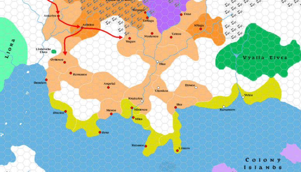
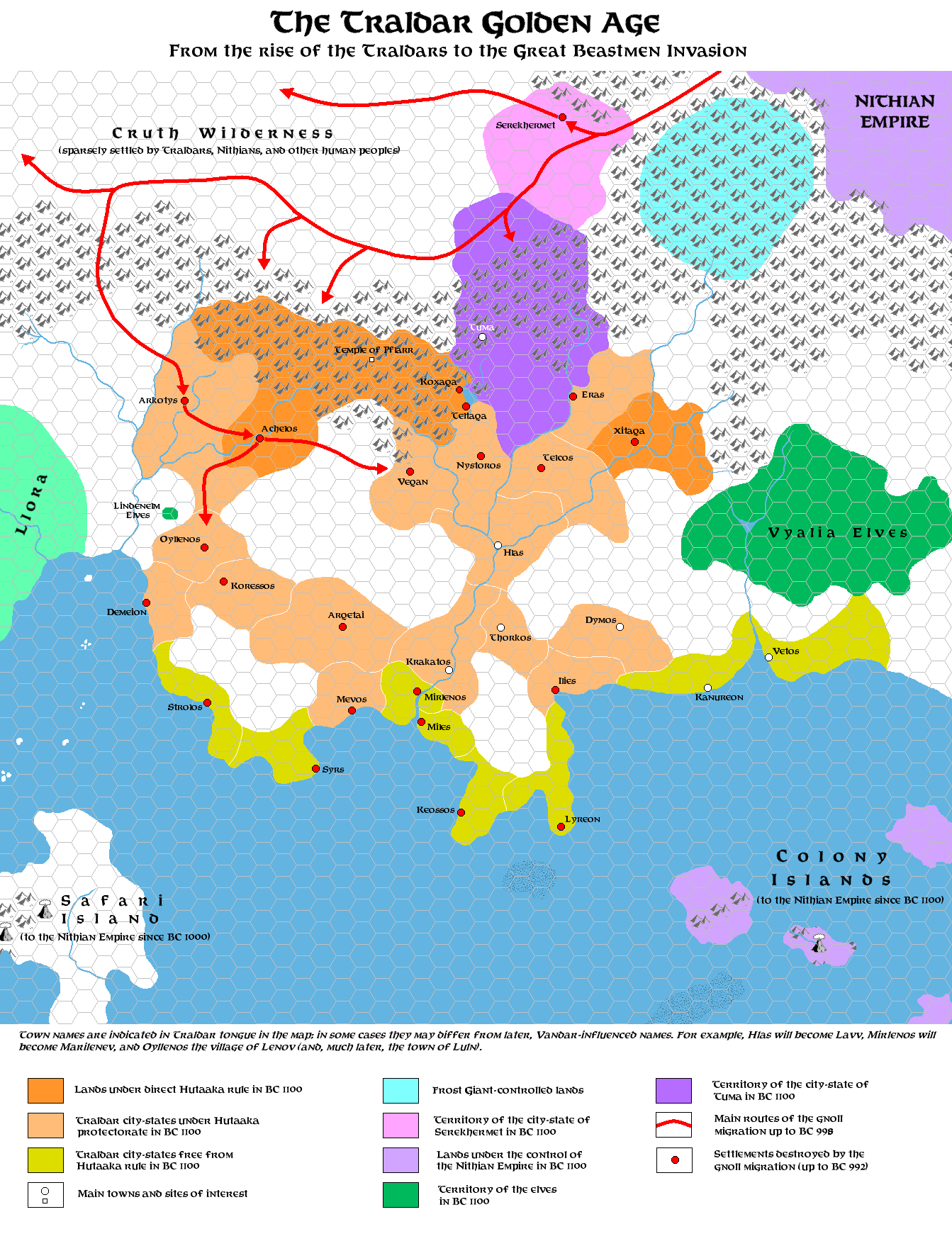
Zendrolion’s Traladara 1100-992 BC, 8 miles per hex
This was the second of seven maps in Simone’s History of Karameikos article, featured in Threshold Magazine #1. The first had shown the arrival of the pre-Traldar peoples; this one showed them from their Golden Age around 1100 BC, right up to the Great Beastmen Invasion of 1000. By 992 BC the invasion had largely run its course, with all of the settlements marked red on the map destroyed. Quoting Simone from his article:
The Traldars’ prosperity came to a sudden end when a huge horde of gnolls – the greater part of those tjat had fled from the Nithian Empire in BC 1050 – poured beyond Traldar borders from the north-west (BC 1000). The Hutaakans, aware they could not resist the gnolls’ savagery, decided to retreat to their most secure mountain shelter, the Valley of Hutaaka (seat of the Temple of Pflarr), even abandoning some of their greatest cities like Achelos… The terrible Great Beastmen Invasion which followed (BC 1000-992) saw the nearly total extermination of the Traldars.
This map also showed a split between areas of Traldar control (along the coasts) and those with Hutaakan influence or direct control.
There’s a lot going on in this map, as it deals with a crucial and well-known period in Karameikan history — one which most Mystara fans are intimately familiar with. It’s great to have it in visual form.
Fan-made Map by Simone Neri (September 2013)
This is an original map created by one of Mystara’s excellent fan cartographers. For more information on the cartographer, including a gallery of all their maps, see also Appendix M: Mappers of Mystara.
Sources
- GAZ1 The Grand Duchy of Karameikos (1987) (PDF at DriveThruRPG)
Fan Sources
- The History of Karameikos from Threshold Magazine #1 at the Vaults of Pandius (September 2013)
- Zendrolion’s Traladara 1500 BC, 8 miles per hex (September 2013)
References
- All of Simone’s maps at the Atlas of Mystara
- Simone’s entry in Appendix M: Mappers of Mystara (upcoming)
- Simone’s author page at the Vaults of Pandius
Chronological Analysis
This is a fan-made map. It was published in September 2013. The updated Atlas version of this map is not yet available. See also Appendix C for annual chronological snapshots of the area. For the full context of this map in Mystara’s publication history, see the upcoming Let’s Map Mystara 2013.
The following lists are from the Let’s Map Mystara project. Additions are new features, introduced in this map. Revisions are changes to previously-introduced features. Hex Art & Fonts track design elements. Finally, Textual Additions are potential features found in the related text. In most cases, the Atlas adopts these textual additions into updated and chronological maps.
Under Construction! Please check back again soon for updates.
Additions
- XXX —
Revisions
- XXX —
Hex Art & Fonts
- Hex Art —
- Fonts —