")
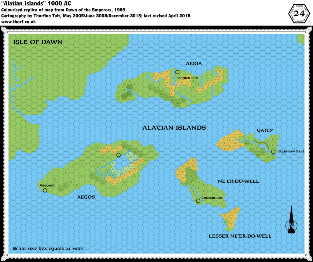
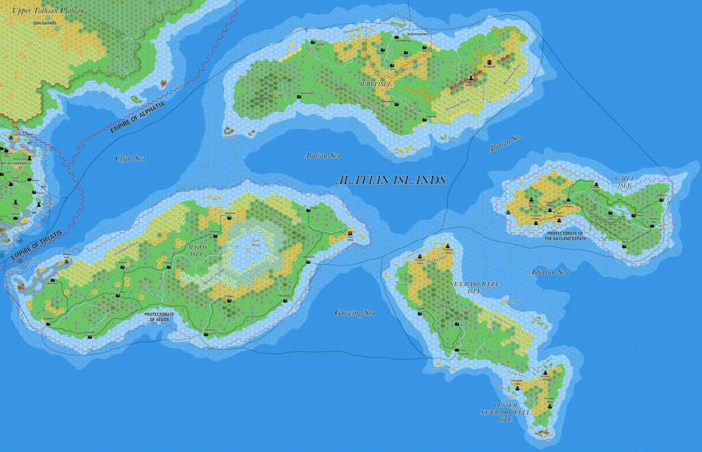
Ramelin’s Alatian Islands, 8 miles per hex v2
Although it would appear that Jose didn’t share this at the time, it belongs with a large group of maps he posted in July 2017. The first batch covered northwestern Brun, while this one came with the second batch dealing with Bellissaria and the Alphatian Sea region.
It was his second pass at the Alatian Islands, and the main changes were to Aeria, which had previously been left pretty blank. Now he gave it a detailed district around its capital, Feather Fall, complete with new settlements with wind-themed names. Also new was the small mountain ridge in the east, with two new towers. Aegos got a new fort on its eastern tip, and Jose added two new sea names, the Glowing Sea between Aegos and Ne’er-do-well, and the Clyde Sea between Aeria, Aegos and Caerdwicca on the Isle of Dawn. The latter also received an update, bringing it into line with the newer version of Caerdwicca on the Sea of Dawn Islands map.
The splits between the seas around this area were always rather ambiguous. It would appear that Jose was making an attempt to split them up a little more logically and clearly.
He would return to the map for one more version in 2018.
Fan-made Map by Jose Ignacio Ramos Lomelin (July 2017)
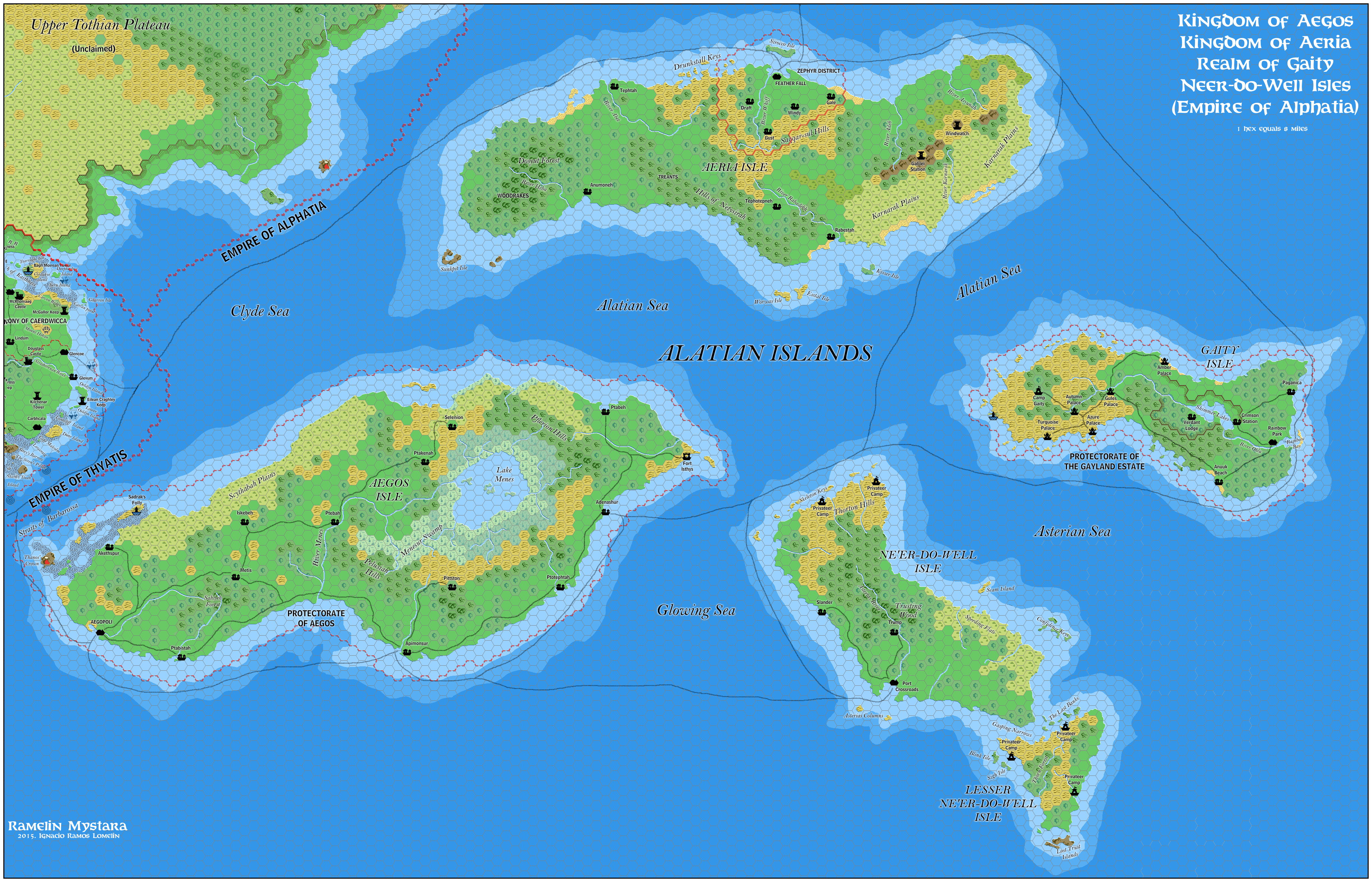
This is an original map created by one of Mystara’s excellent fan cartographers. For more information on the cartographer, including a gallery of all their maps, see also Appendix M: Mappers of Mystara.
Sources
- Dawn of the Emperors (1989) (PDF at DriveThruRPG)
Fan Sources
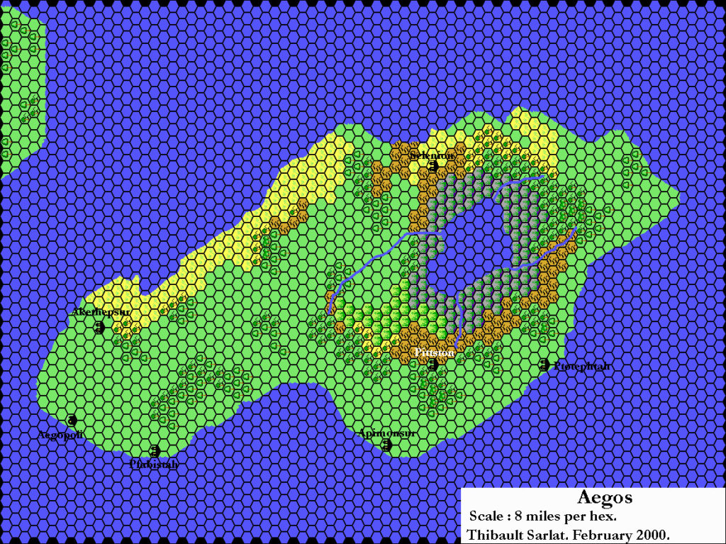
- Thibault’s Aegos, 8 miles per hex (February 2002)
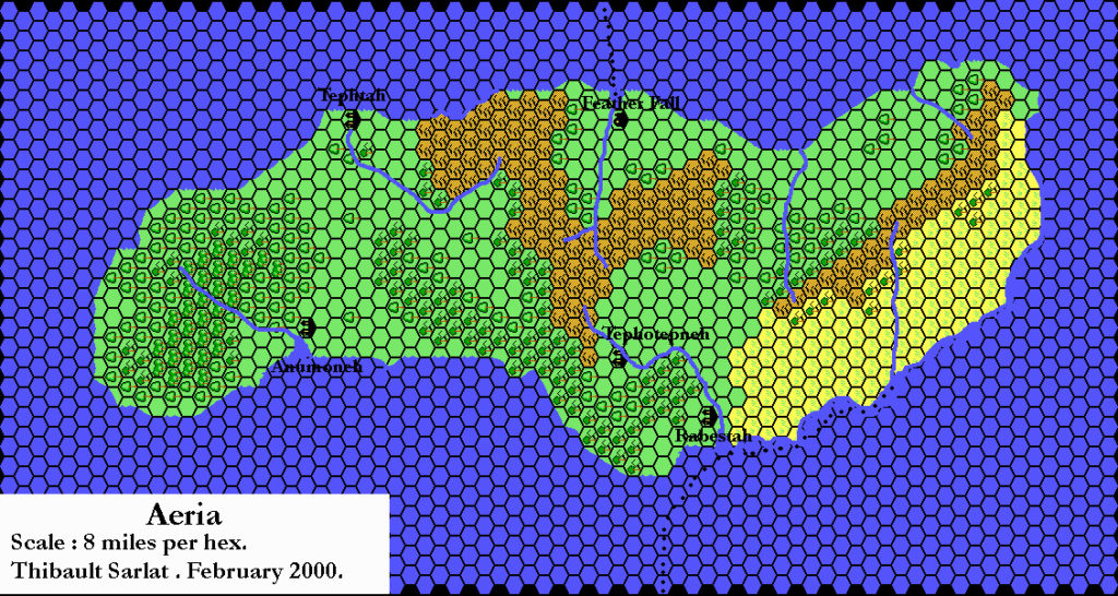
- Thibault’s Aeria, 8 miles per hex (February 2002)
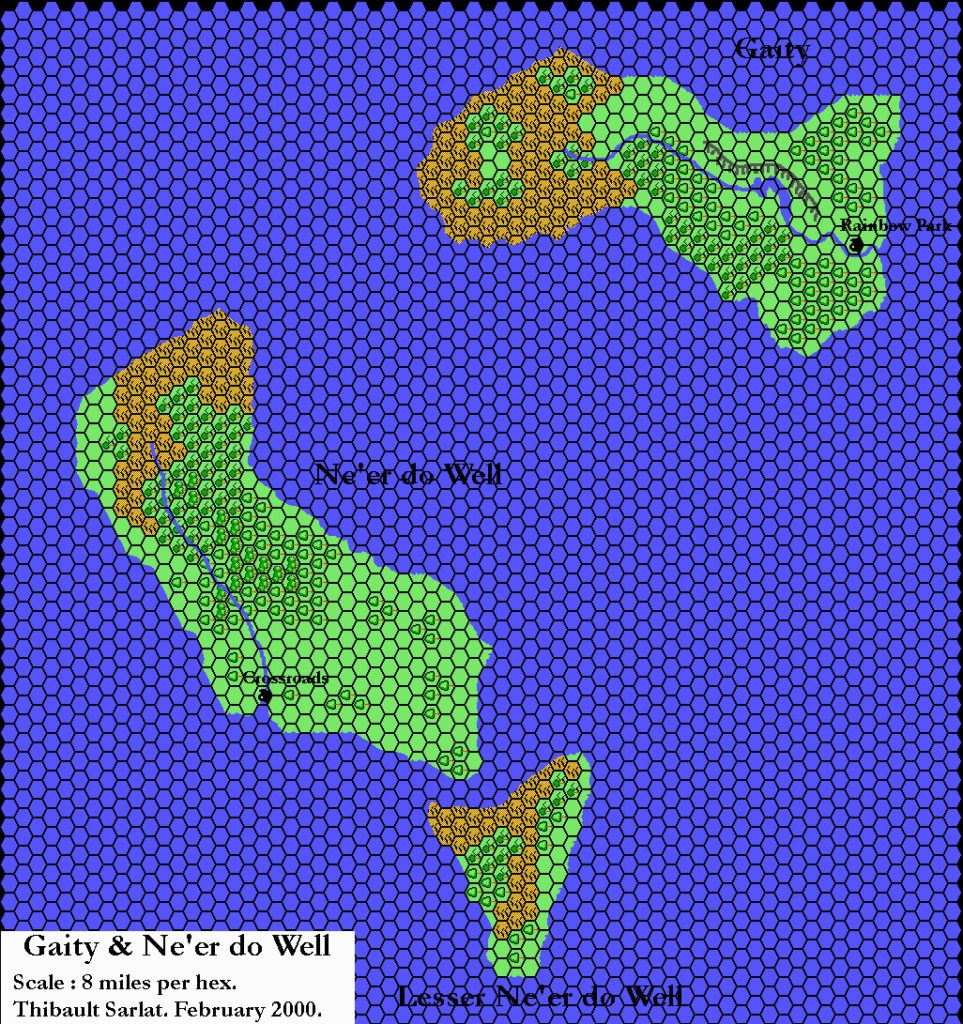
- Thibault’s Gaity and Ne’er-do-well, 8 miles per hex (February 2002)
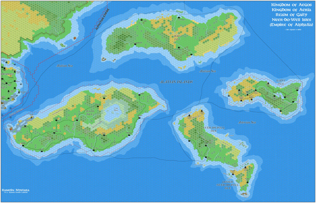
- Ramelin’s Alatian Islands, 8 miles per hex v1 (November 2015)
References
- All of Jose’s maps at the Atlas of Mystara
- Jose’s entry in Appendix M: Mappers of Mystara (upcoming)
- Jose’s author page at the Vaults of Pandius
Chronological Analysis
This is a fan-made map. It was published in July 2017. The updated Atlas version of this map is not yet available. See also Appendix C for annual chronological snapshots of the area. For the full context of this map in Mystara’s publication history, see the upcoming Let’s Map Mystara 2017.
The following lists are from the Let’s Map Mystara project. Additions are new features, introduced in this map. Revisions are changes to previously-introduced features. Hex Art & Fonts track design elements. Finally, Textual Additions are potential features found in the related text. In most cases, the Atlas adopts these textual additions into updated and chronological maps.
Under Construction! Please check back again soon for updates.
Additions
- Settlements —
Revisions
- Settlements —
Hex Art & Fonts
- Hex Art — Ramelin Mystara standard.
- Fonts — Bell MT (major geographic and all water labels), Bell Centennial (all other labels), Feinen (titling).