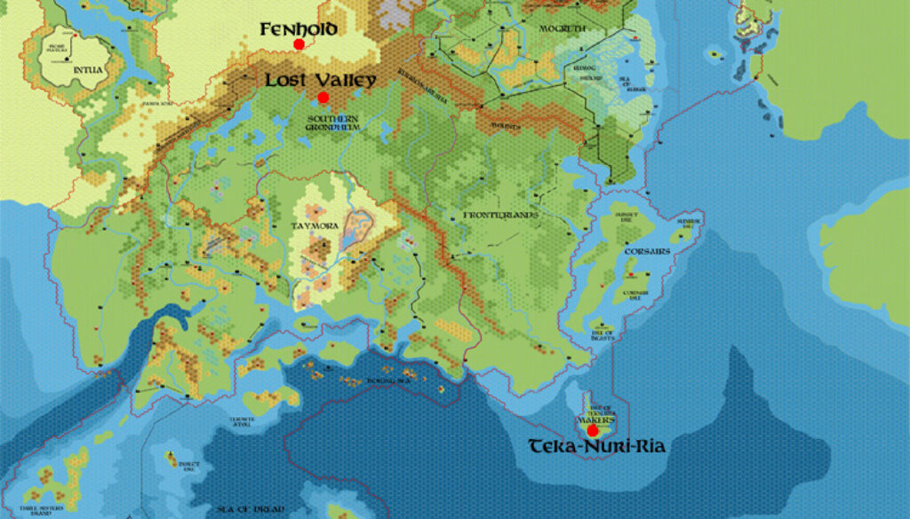
Chimpman’s Blackmoorian Locations in 2300 BC, 8 miles per hex
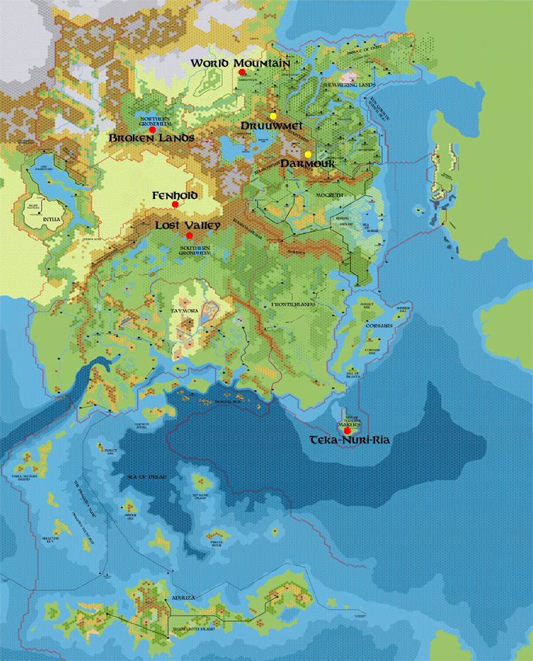
John made this map in mid-2012 to show Blackmoor-related sites in the Known World region in 2300 BC. He explained the background to the map in his post at The Piazza:
I know we’ve talked about this a little bit in other threads, but I wanted to get these ideas in an image format I could look over.
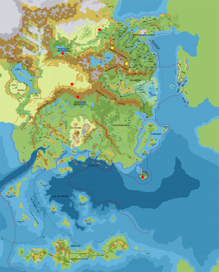
The red dots mark possible locations that the Blackmoorians could have occupied before the GRoF. Those locations fall on 1) The Lost Valley in Grondheim/Karameikos, 2) Site of the BC 1700 catastrophe in Grondheim/Broken Lands, 3) Fenhold in Toralai lands?/Alfheim, 4) The World Mountain in the Shimmering Lands/Ethengar, and 5) Teka Nuri Ria in the Sea of Dread/Refuge of the Makers. The only site I can think of that is not listed on this map would be Urzud (which is much farther north and to the west in Hyboria).
One thing I’m noticing so far is that Hidden Mogreth would have been completely surrounded in the Blackmoor era (at least at the end of it). It also might be a possibility that these sites were built along some kind of ley lines. If that is the case then perhaps we can extrapolate new locations on a larger map.
That described the first version, which is lost to us. But it seems that the second version (presented second below) was just a small update:
I updated the Map of Blackmoorian Locations in BC 2300, adding the two sites (Darmouk and Druumet) in yellow.
Finally, he updated his own version (first below) to include labels for the sites. I have been unable to find this one online — my file came from John himself — so it would appear that he never shared this final version until now.
The map is a great resource for tracing Blackmoor through time, potentially providing adventure ideas for modern 1000 AC campaigns as well as John’s 2300 BC setting.
Fan-made Map by John Calvin (August 2012)
This is an original map created by one of Mystara’s excellent fan cartographers. For more information on the cartographer, including a gallery of all their maps, see also Appendix M: Mappers of Mystara.
Sources
Fan Sources
- Blackmoorian locations in BC 2300 discussion thread at The Piazza (July 2012)
References
- All of John’s maps at the Atlas of Mystara
- John’s entry in Appendix M: Mappers of Mystara (upcoming)
- John’s author page at the Vaults of Pandius
Chronological Analysis
This is a fan-made map. It was published in August 2012. The updated Atlas version of this map is not yet available. See also Appendix C for annual chronological snapshots of the area. For the full context of this map in Mystara’s publication history, see the upcoming Let’s Map Mystara 2012.
The following lists are from the Let’s Map Mystara project. Additions are new features, introduced in this map. Revisions are changes to previously-introduced features. Hex Art & Fonts track design elements. Finally, Textual Additions are potential features found in the related text. In most cases, the Atlas adopts these textual additions into updated and chronological maps.
Under Construction! Please check back again soon for updates.