")
Chimpman’s Shimmering Lands 2300 BC, 8 miles per hex v1
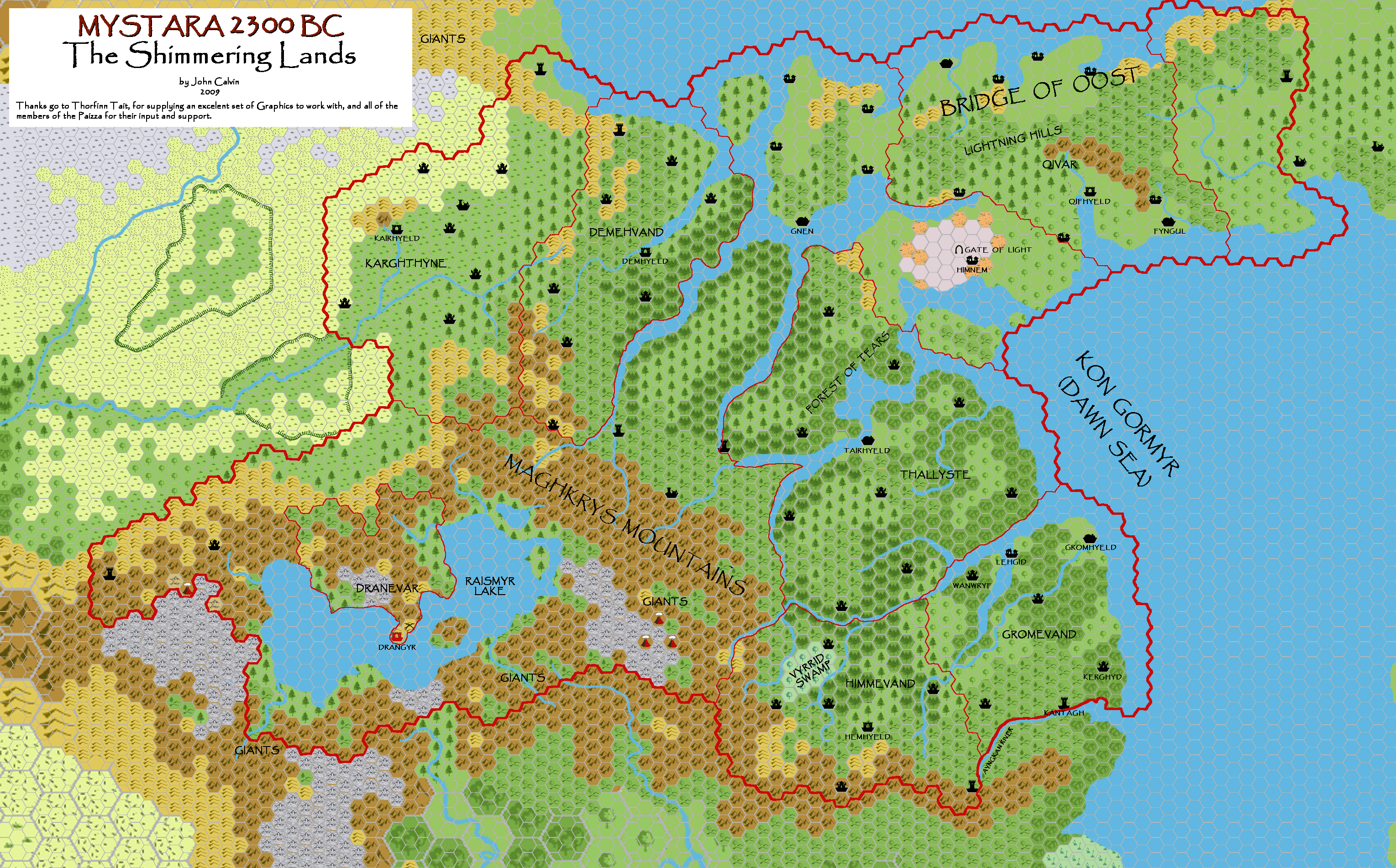
A couple of weeks after sharing his preview Southeastern Shimmering Lands map, John posted his first pass at the whole region at 8 miles per hex. As with the preview, the terrain on this map was already developed to a high degree of detail. John had also added more settlements, including a lot of palaces throughout. He explained these in his thread at The Piazza at the time:
The Palace symbols are to represent the Moadreg estates, although at the 8mi/hex scale only the largest estates are shown. Estates are run by the servants of a single dwarven elder and exist for the sole purpose of catering to said individual’s every want or need. The smallest estates probably cover around 10 square miles, while larger estates can cover up to several hundred.
The preview map’s names had been a bit spotty, with many settlements still unnamed. This map had more names, but there were still many left nameless at this early stage of development. Once again, the font choice — Papyrus — also marks this as one of John’s early Mystara 2300 BC maps.
He would return to this map many times over the succeeding months and years.
Fan-made Map by John Calvin (April 2009)
This is an original map created by one of Mystara’s excellent fan cartographers. For more information on the cartographer, including a gallery of all their maps, see also Appendix M: Mappers of Mystara.
Sources
Fan Sources
- Chimpman’s Shimmering Lands 2300 BC, 24 miles per hex (March 2009)
- Chimpman’s Southeastern Shimmering Lands, 8 miles per hex (March 2009)
- Outer World: Shimmering Lands 2300 BC, 8 miles per hex discussion thread at The Piazza (April 2009)
References
- All of John’s maps at the Atlas of Mystara
- John’s entry in Appendix M: Mappers of Mystara (upcoming)
- John’s author page at the Vaults of Pandius
Chronological Analysis
This is a fan-made map. It was published in April 2009. The updated Atlas version of this map is not yet available. See also Appendix C for annual chronological snapshots of the area. For the full context of this map in Mystara’s publication history, see the upcoming Let’s Map Mystara 2009.
The following lists are from the Let’s Map Mystara project. Additions are new features, introduced in this map. Revisions are changes to previously-introduced features. Hex Art & Fonts track design elements. Finally, Textual Additions are potential features found in the related text. In most cases, the Atlas adopts these textual additions into updated and chronological maps.
Under Construction! Please check back again soon for updates.
")
")
")