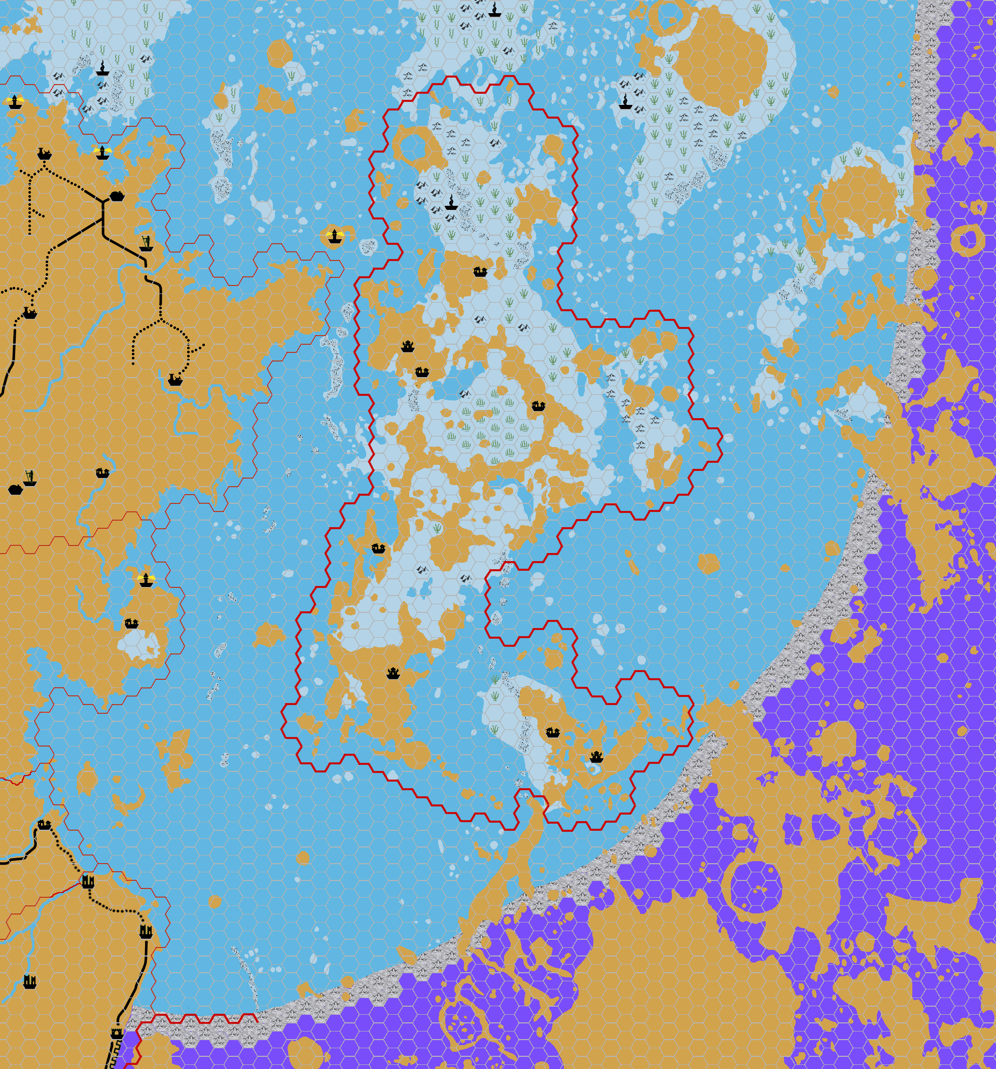
Chimpman’s Spindrift Undersea, 8 miles per hex
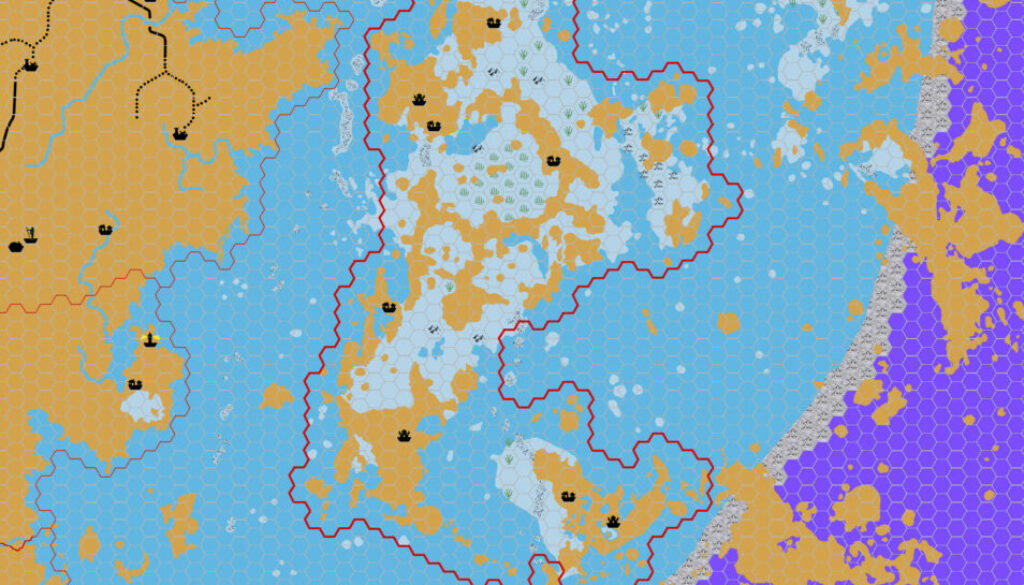
While updating his Hollow Moon Adhuza map, John also came up with a new map, an undersea map of the Spindrift Sea. He posted it in the Adhuza thread in the Geographical Mapping forum at The Piazza:
Added another map for Adhuza – my first attempt at an undersea map. This one depicts one quarter of the Spindrift Sea. Brown is land, the light blue color is undersea land, and the normal blue represents ocean that sits directly on top of the crystal firmament. Because of the properties of the crystal firmament (it freezes whatever it touches), undersea cultures can only build their communities on the light blue portions of the map. This limits the amount of space those cultures have to colonize, but it also provides for a more varied undersea world.
Once again I am using the Google Moon maps to determine coastlines and undersea land masses. This is still a work in progress. I think there are several small islands that I still want to “sink” making them undersea terrain instead.
The original work-in-progress version is lost to us; the map in this thread is the updated version from about a week later. He remarked:
Ok, updated the Undersea map. Added undersea terrain and cities. Still working on this one, but it’s getting close to being finished.
The cities cleverly used a Yavdlom-style spiral shell tower as their icon.
John made great use of my undersea symbols from PC3 for this map. Undersea maps are generally few and far between, so this was a very welcome development, both for the Hollow Moon as well as Mystara as a whole.
Fan-made Map by John Calvin (March 2012)
This is an original map created by one of Mystara’s excellent fan cartographers. For more information on the cartographer, including a gallery of all their maps, see also Appendix M: Mappers of Mystara.
Sources
Fan Sources
- Inside Matera: The Hollow Moon by Sharon Dornhoff at the Vaults of Pandius (1998-1999)
- Re: Hollow Moon: Adhuza, 8 miles per hex discussion thread at The Piazza (August 2009)
References
- All of John’s maps at the Atlas of Mystara
- John’s entry in Appendix M: Mappers of Mystara (upcoming)
- John’s author page at the Vaults of Pandius
Chronological Analysis
This is a fan-made map. It was published in March 2012. The updated Atlas version of this map is not yet available. See also Appendix C for annual chronological snapshots of the area. For the full context of this map in Mystara’s publication history, see the upcoming Let’s Map Mystara 2012.
The following lists are from the Let’s Map Mystara project. Additions are new features, introduced in this map. Revisions are changes to previously-introduced features. Hex Art & Fonts track design elements. Finally, Textual Additions are potential features found in the related text. In most cases, the Atlas adopts these textual additions into updated and chronological maps.
Under Construction! Please check back again soon for updates.