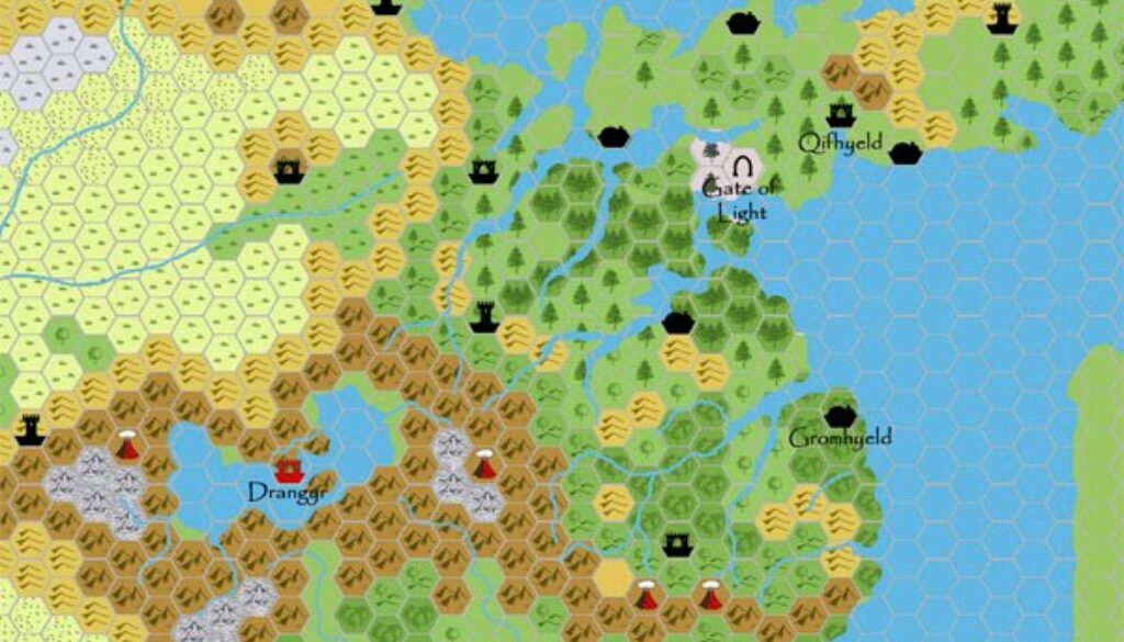
Chimpman’s Shimmering Lands 2300 BC, 24 miles per hex
The same day he posted his Mogreth 2300 BC, 24 miles per hex map at The Piazza, John posted his first map of the Shimmering Lands at the same scale. It was a development of his Moadreg map from the week before, but now with settlements as well as a lot more forests. A few of the settlements were named already; the Papyrus font is a hallmark of John’s early 2300 BC maps.
Strangely enough, as far as I have been able to see, he never released a finished 24 mile per hex map of his 2300 BC setting. Though a little out of date with later developments, this map remains a valid source for the area.
Fan-made Map by John Calvin (March 2009)
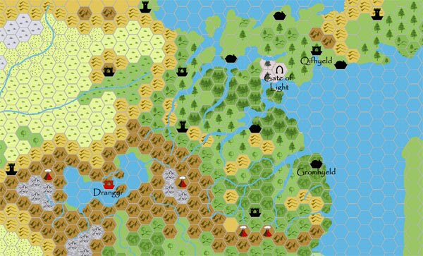
This is an original map created by one of Mystara’s excellent fan cartographers. For more information on the cartographer, including a gallery of all their maps, see also Appendix M: Mappers of Mystara.
Sources
- GAZ5 The Elves of Alfheim (1988) (PDF at DriveThruRPG)
- GAZ6 The Dwarves of Rockhome (1988) (PDF at DriveThruRPG)
- GAZ10 The Orcs of Thar (1989) (PDF at DriveThruRPG)
- Hollow World Campaign Set (1990) (PDF at DriveThruRPG)
- HWR2 Kingdom of Nithia (1991) (PDF at DriveThruRPG)
Fan Sources
- Chimpman’s Moadreg 2300 BC, 24 miles per hex (February 2009)
- Mystara 2300 BC – The Shimmering Lands discussion thread at The Piazza (March 2009)
References
- All of John’s maps at the Atlas of Mystara
- John’s entry in Appendix M: Mappers of Mystara (upcoming)
- John’s author page at the Vaults of Pandius
Chronological Analysis
This is a fan-made map. It was published in March 2009. The updated Atlas version of this map is not yet available. See also Appendix C for annual chronological snapshots of the area. For the full context of this map in Mystara’s publication history, see the upcoming Let’s Map Mystara 2009.
The following lists are from the Let’s Map Mystara project. Additions are new features, introduced in this map. Revisions are changes to previously-introduced features. Hex Art & Fonts track design elements. Finally, Textual Additions are potential features found in the related text. In most cases, the Atlas adopts these textual additions into updated and chronological maps.
Under Construction! Please check back again soon for updates.