Chimpman’s Hollow Moon Adhuza, 8 miles per hex v2
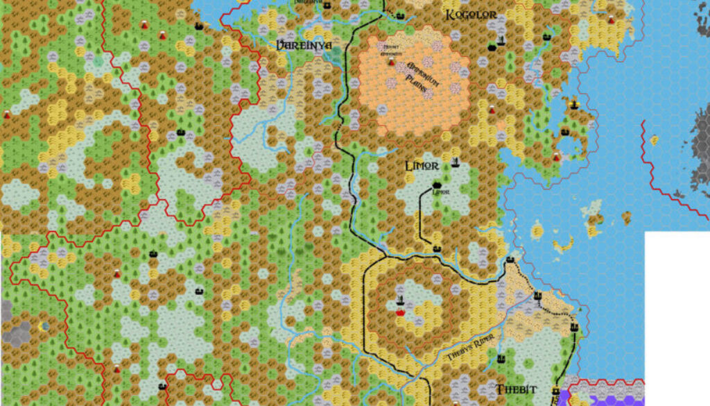
At the same time as he updated his Apennines and Albheldri maps for the Hollow Moon in late 2011, John also made a map of Adhuza. Not to be confused with the Mystara 2300 BC nation of the same name, this one was located in the Hollow Moon. The first version of this map was noted to be rather bare, awaiting further development. That version is now lost to us, not least because it was quickly superseded by updated versions — the remaining version being the map below. In John’s words from The Piazza at the time:
I’ve made some major changes to the Adhuza map. Once again I’ve incorporated the Google Moon charts into the map, using them to refine my terrains. There are probably still some minor (and perhaps some major) tweaks to make before I’m completely happy with this map (input is welcomed!), but it’s at the state where I feel I can share it.
Adhuza is broken down into several satrapies – each a “city state” with nominal control over some portion of the territory around them.
He continued a few days later:
I’ve switched Limor and Vareinya, and redrawn much of their borders. Vareinya now has access to the Hypparq Sea as well as to the Spindrift Sea (perfectly situated for piratical activities). Limor is fortified within one of the central craters, and has a bit of coastal territory along the Spindrift. I’m still in the process of placing all of the cities – any suggestions are welcomed.
Another modification is the placement of several statue icons. I’m thinking that these huge statues are actually used by the Adhuzans (the kopru) to exert their control over the general populace. Lighthouses have also been placed in key areas along the coast since the human populations in Adhuza would need them to navigate by.
The roads are also almost fully formed. I think I’ll need at least some paths in Vareinya, and possibly some more roads in Limor and Kogolor.
All of this gives a very firm picture of his development of the area, and clearly this map was the final version. He did actually create an expanded third version, but it added an area of the Spindrift Sea to the map rather than changing what was already there.
Fan-made Map by John Calvin (March 2012)
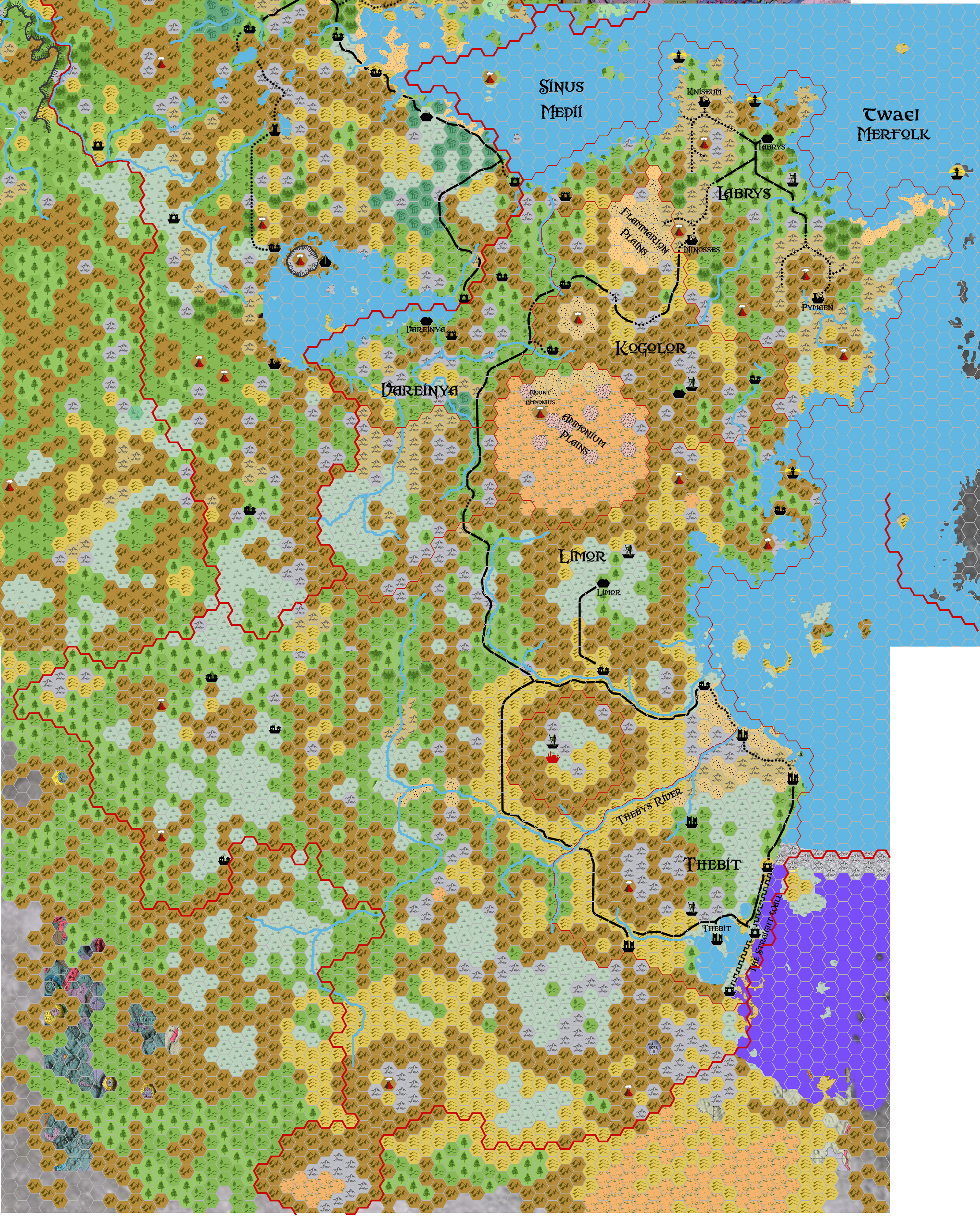
This is an original map created by one of Mystara’s excellent fan cartographers. For more information on the cartographer, including a gallery of all their maps, see also Appendix M: Mappers of Mystara.
Sources
Fan Sources
- Inside Matera: The Hollow Moon by Sharon Dornhoff at the Vaults of Pandius (1998-1999)
- Hollow Moon: Adhuza, 8 miles per hex discussion thread at The Piazza (August 2009)
References
- All of John’s maps at the Atlas of Mystara
- John’s entry in Appendix M: Mappers of Mystara (upcoming)
- John’s author page at the Vaults of Pandius
Chronological Analysis
This is a fan-made map. It was published in March 2012. The updated Atlas version of this map is not yet available. See also Appendix C for annual chronological snapshots of the area. For the full context of this map in Mystara’s publication history, see the upcoming Let’s Map Mystara 2012.
The following lists are from the Let’s Map Mystara project. Additions are new features, introduced in this map. Revisions are changes to previously-introduced features. Hex Art & Fonts track design elements. Finally, Textual Additions are potential features found in the related text. In most cases, the Atlas adopts these textual additions into updated and chronological maps.
Under Construction! Please check back again soon for updates.