
Chimpman’s Known World, 8 miles per hex Coastlines
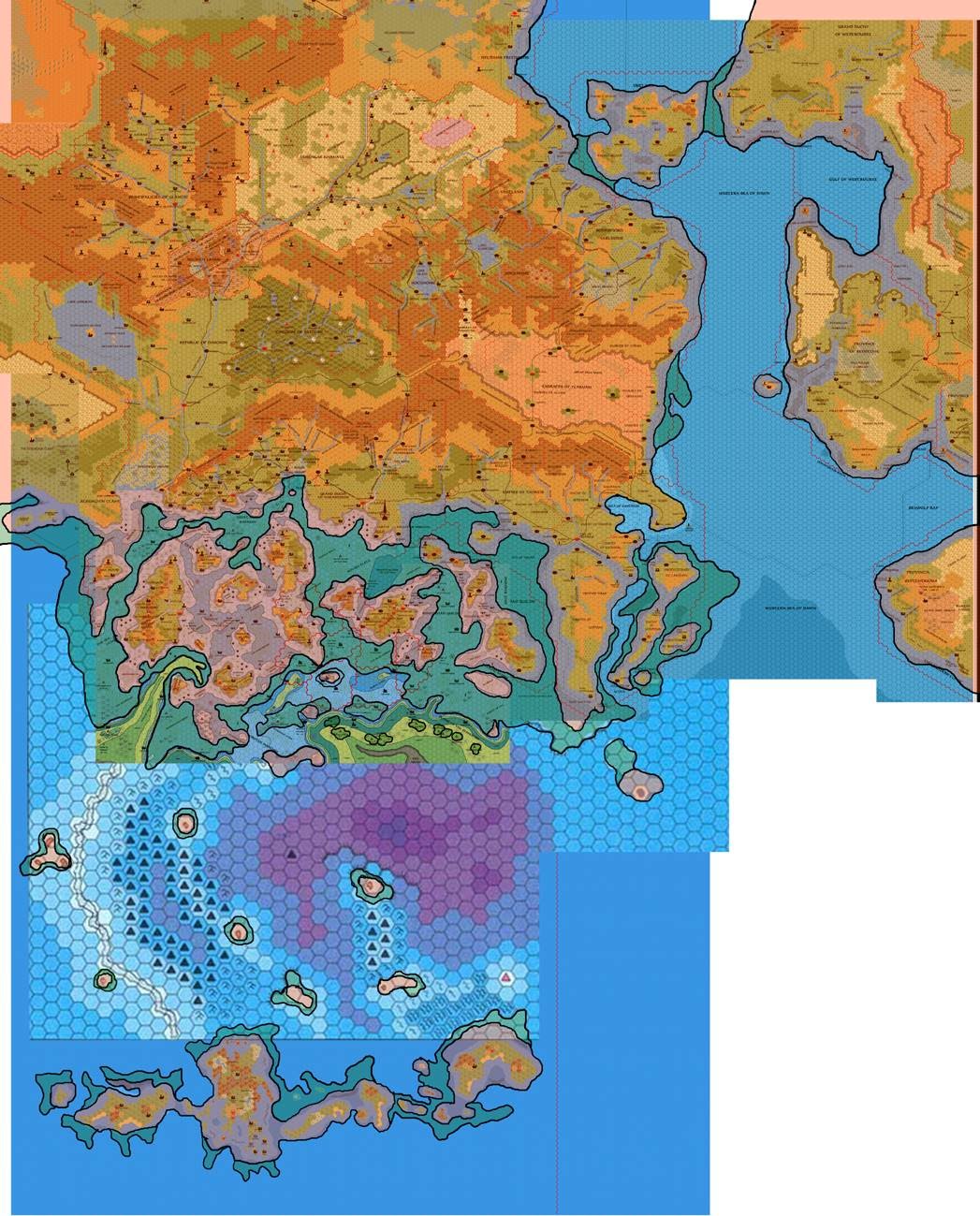
The next day after beginning his new foray into 8 mile per hex maps for his 2300 BC project, John shared his first pass at the coastlines. He drew them on top of the composite Master Template from the previous day. Fans of Mystara 2300 BC will likely begin to recognise familiar shapes immediately upon looking at this map, as much of its content stuck, and persisted into the final stages of the project. John explained at The Piazza:
Ok, here is my first pass at mapping the overall coastal changes in the KW-Sea of Dread area. The underlying map of course represents the BC 1700 changes. The red, inner outlines represent the BC 1750 changes, and the green outer outlines represent the coasts before our geological turmoil of the time changed them.
Since there were multiple stages of cataclysms between 2300 BC and 1000 AC, John used the modern-day maps to extrapolate back through these to the ancient landforms. Naturally, this resulted not only in maps for 2300 BC, but also for various stages in between.
Of course, this map was a stepping stone between John’s early ideas and his final designs, so it wasn’t an exact match to either of these.
Fan-made Map by John Calvin (September 2009)
This is an original map created by one of Mystara’s excellent fan cartographers. For more information on the cartographer, including a gallery of all their maps, see also Appendix M: Mappers of Mystara.
Sources
Fan Sources
- Chimpman’s Known World, 8 miles per hex Master Template (September 2009)
- Historical Mapping in the KW and Sea of Dread discussion thread at The Piazza (September 2009-October 2010)
References
- All of John’s maps at the Atlas of Mystara
- John’s entry in Appendix M: Mappers of Mystara (upcoming)
- John’s author page at the Vaults of Pandius
Chronological Analysis
This is a fan-made map. It was published in September 2009. The updated Atlas version of this map is not yet available. See also Appendix C for annual chronological snapshots of the area. For the full context of this map in Mystara’s publication history, see the upcoming Let’s Map Mystara 2009.
The following lists are from the Let’s Map Mystara project. Additions are new features, introduced in this map. Revisions are changes to previously-introduced features. Hex Art & Fonts track design elements. Finally, Textual Additions are potential features found in the related text. In most cases, the Atlas adopts these textual additions into updated and chronological maps.
Under Construction! Please check back again soon for updates.
")
")
")