Chimpman’s Pelatan, 24 miles per hex v2
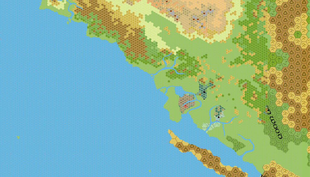
Just a few days after posting his first research compilation map of Pelatan, John was back with a new version. He described the updates in his post at The Piazza:
I’ve updated the map – the terrains in the northern regions are mostly done. They match up pretty well with 72mph map, so I don’t think any changes are needed there. I do have one question about the terrain near the string of volcanoes. The terrain icons look like black sands. Are they supposed to be “black sands” like in Ethengar, or should they be volcanic terrain?
Once we get to terrain near the three pronged river in the center of the map, then some terrain needs to be shifted. The mountain range to the south should shift to the west. The shift should also open up the Korva Plains, making it much wider (which also is more in line with the 72 mph map).
There also appears to be a swamp on the 72 mph map (along that same river) that is missing on the more detailed map.
These comments provide a peek into John’s process with the map, methodically working through the source maps, adding details of his own while adapting the terrain to a larger scale.
Unfortunately, this was as far as he got with this map. Even incomplete, it provides a very welcome expansion of the terrain in this region of Davania, and other mappers have referred to John’s work over the years since.
Fan-made Map by John Calvin (April 2011)
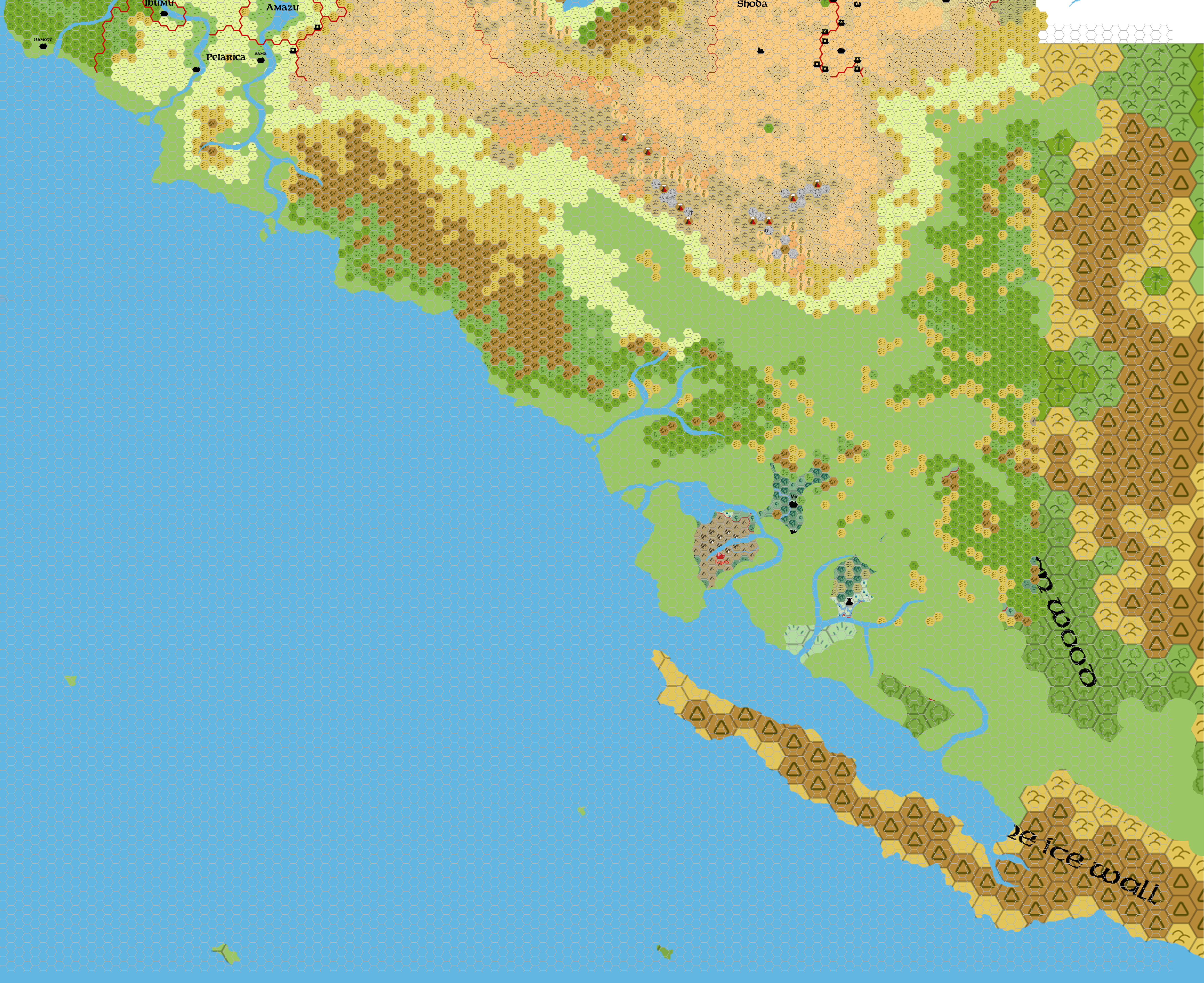
This is an original map created by one of Mystara’s excellent fan cartographers. For more information on the cartographer, including a gallery of all their maps, see also Appendix M: Mappers of Mystara.
Sources
Fan Sources
- Outer World: Pelatan, 24 miles per hex discussion thread at The Piazza (April 2011)
- Geoff’s Pelatan, 72 miles per hex (January 1998)
- Sturm’s Izonda & Pelatan, 24 miles per hex (March 2011)
- Izondian Deep, 24 miles per hex (March 2011)
References
- All of John’s maps at the Atlas of Mystara
- John’s entry in Appendix M: Mappers of Mystara (upcoming)
- John’s author page at the Vaults of Pandius
Chronological Analysis
This is a fan-made map. It was published in April 2011. The updated Atlas version of this map is not yet available. See also Appendix C for annual chronological snapshots of the area. For the full context of this map in Mystara’s publication history, see the upcoming Let’s Map Mystara 2011.
The following lists are from the Let’s Map Mystara project. Additions are new features, introduced in this map. Revisions are changes to previously-introduced features. Hex Art & Fonts track design elements. Finally, Textual Additions are potential features found in the related text. In most cases, the Atlas adopts these textual additions into updated and chronological maps.
Under Construction! Please check back again soon for updates.