
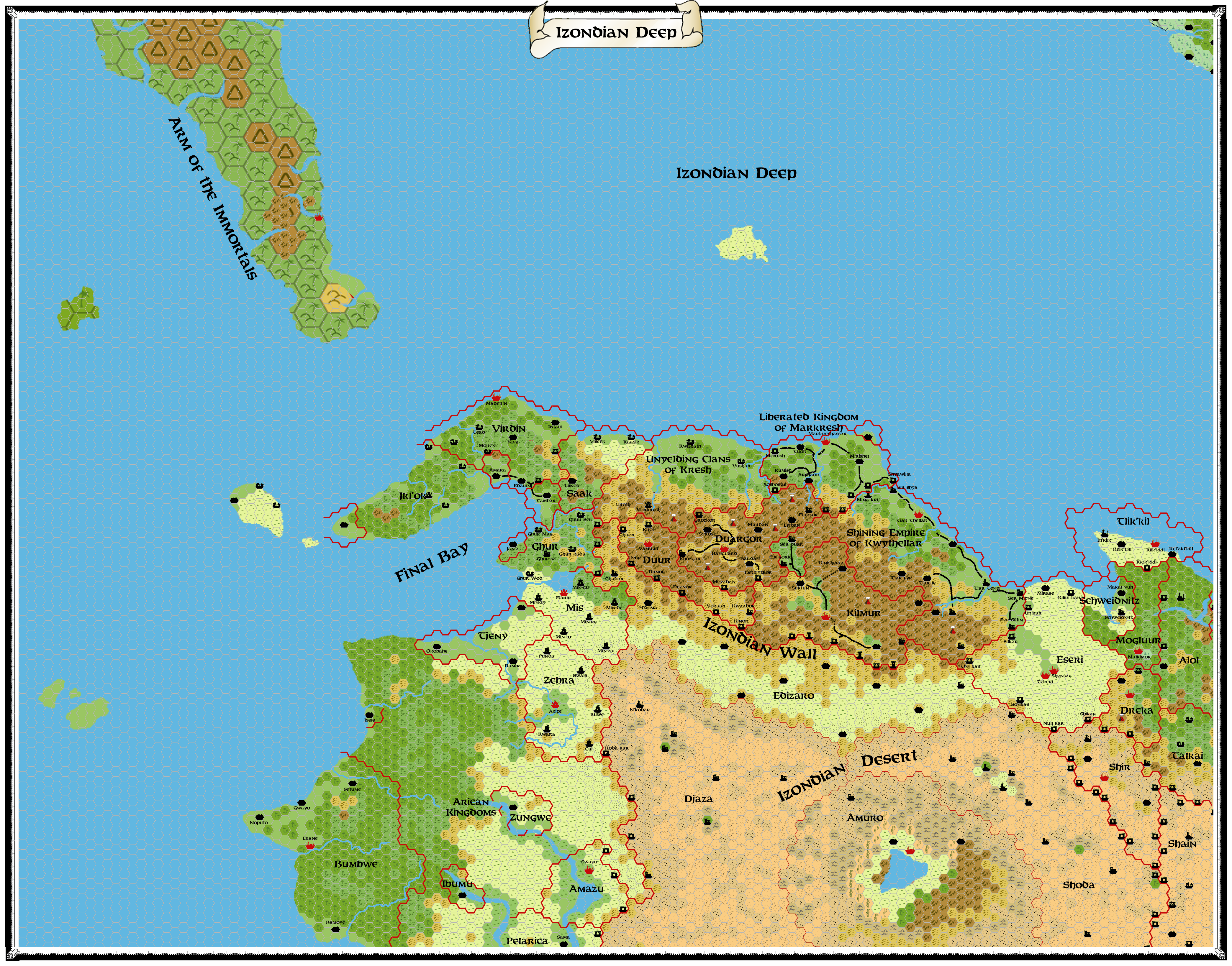
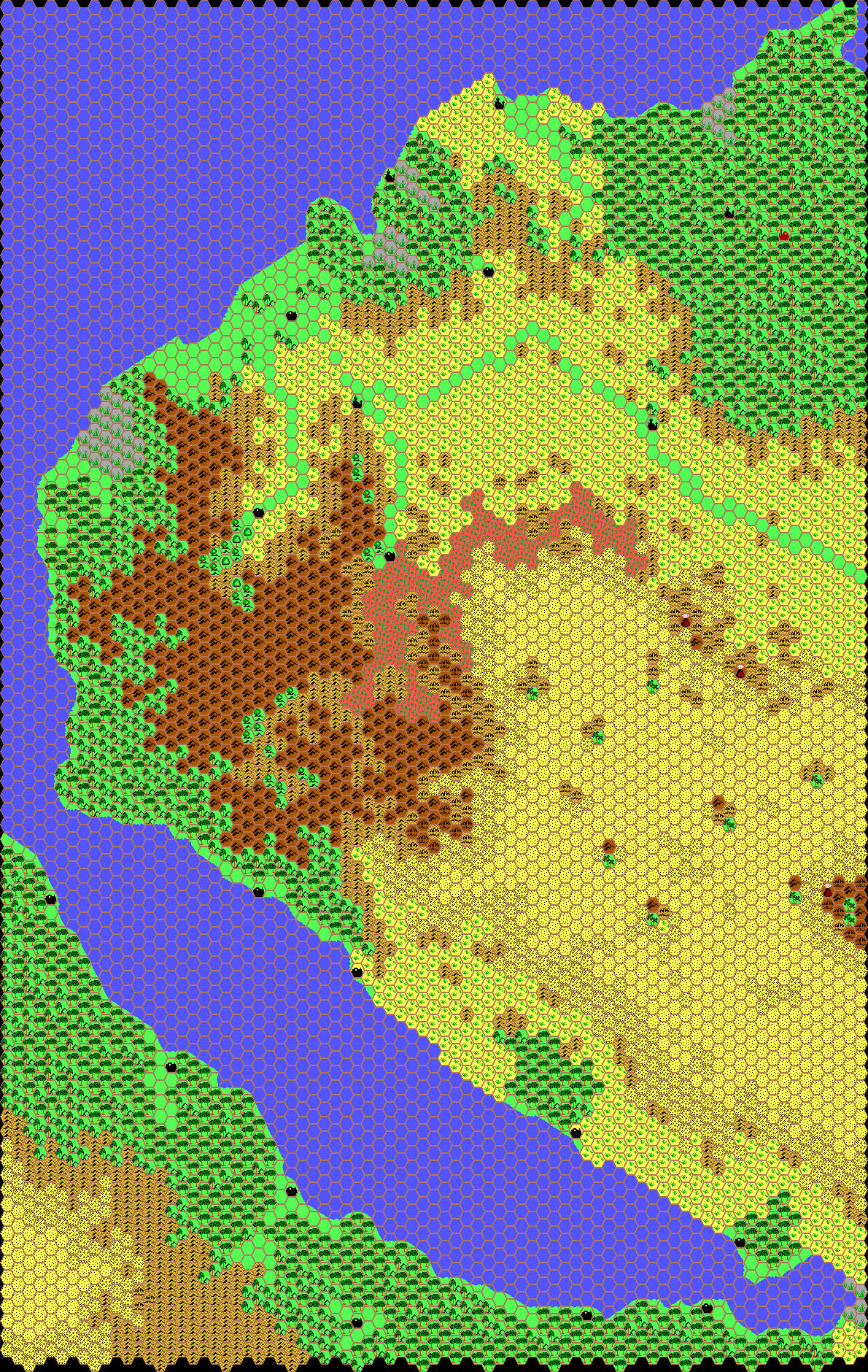
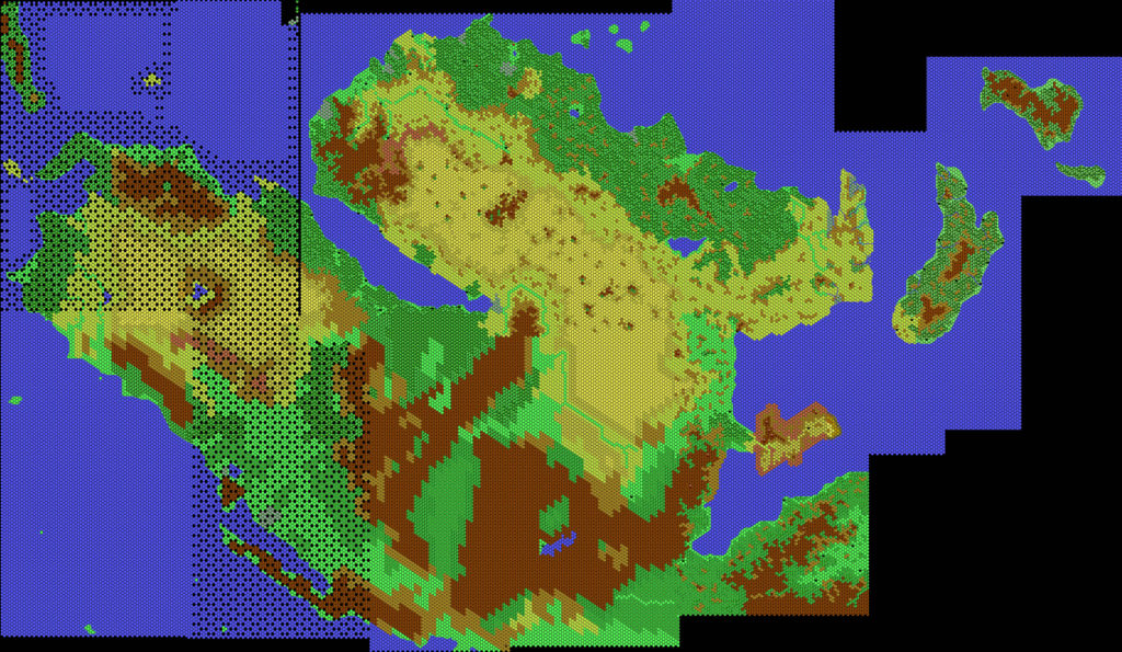
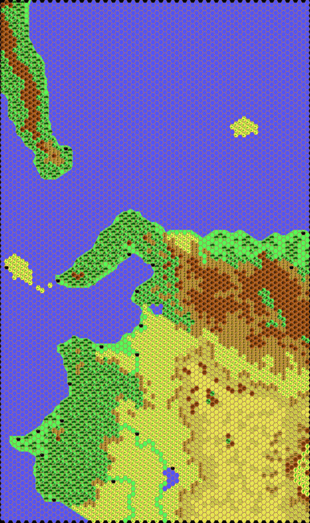
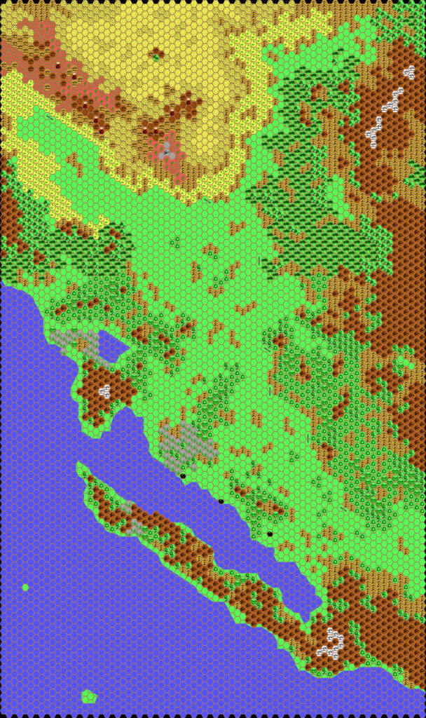
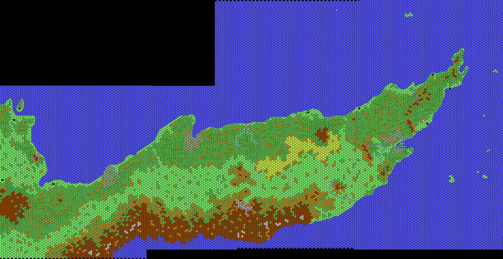
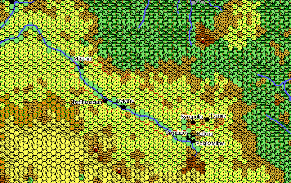
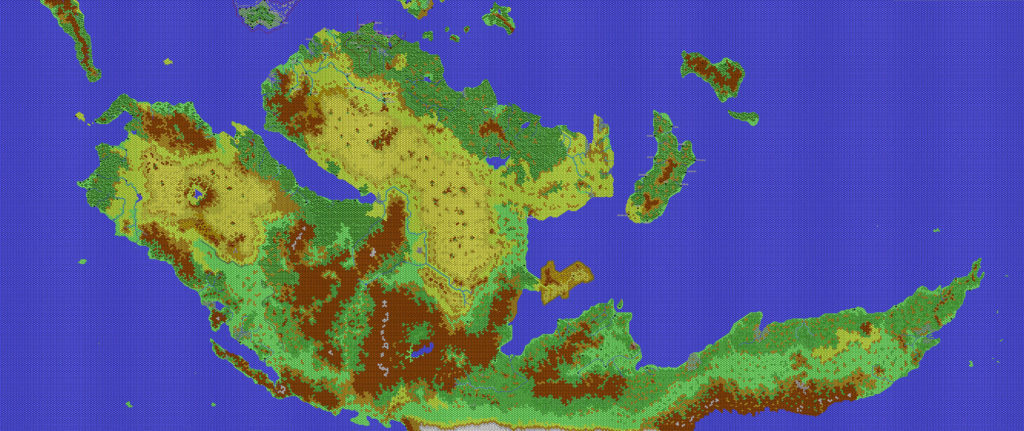
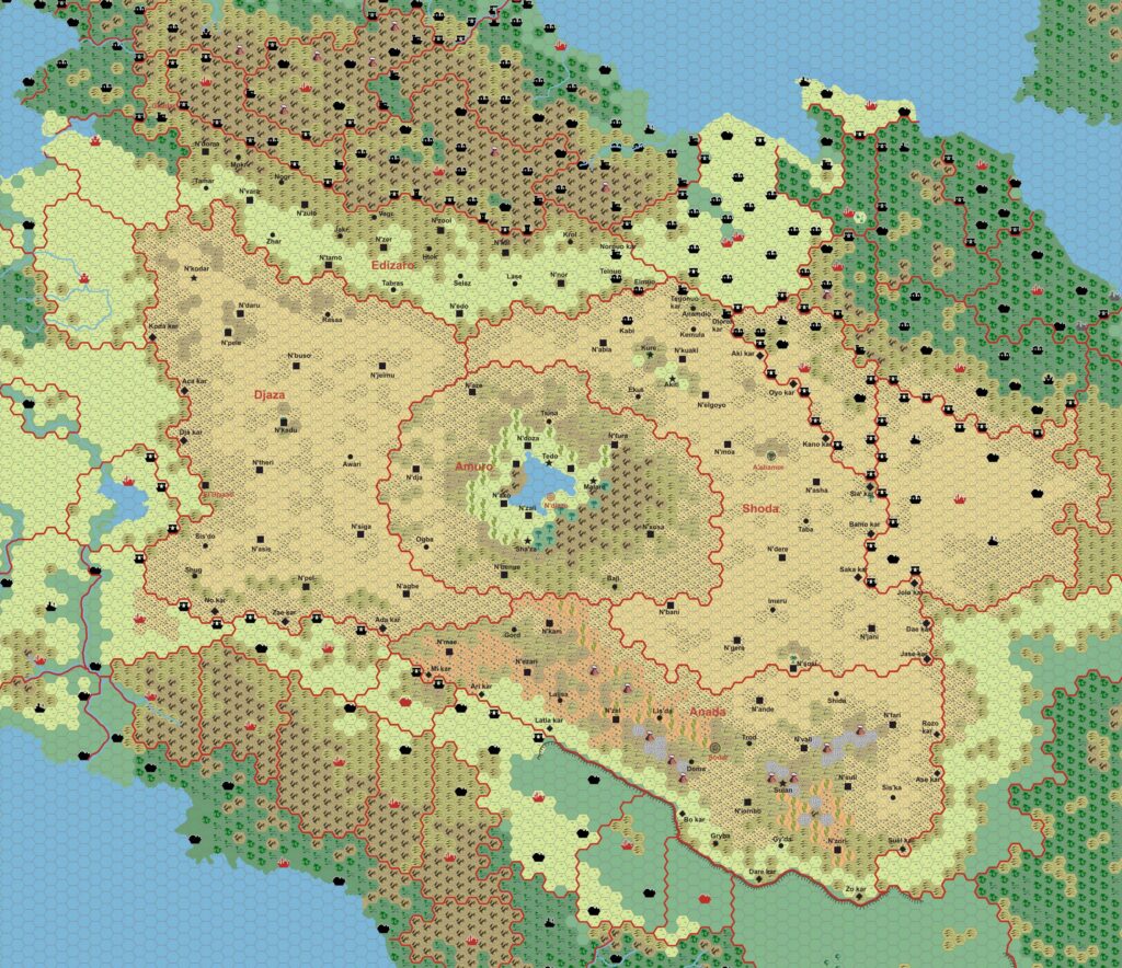
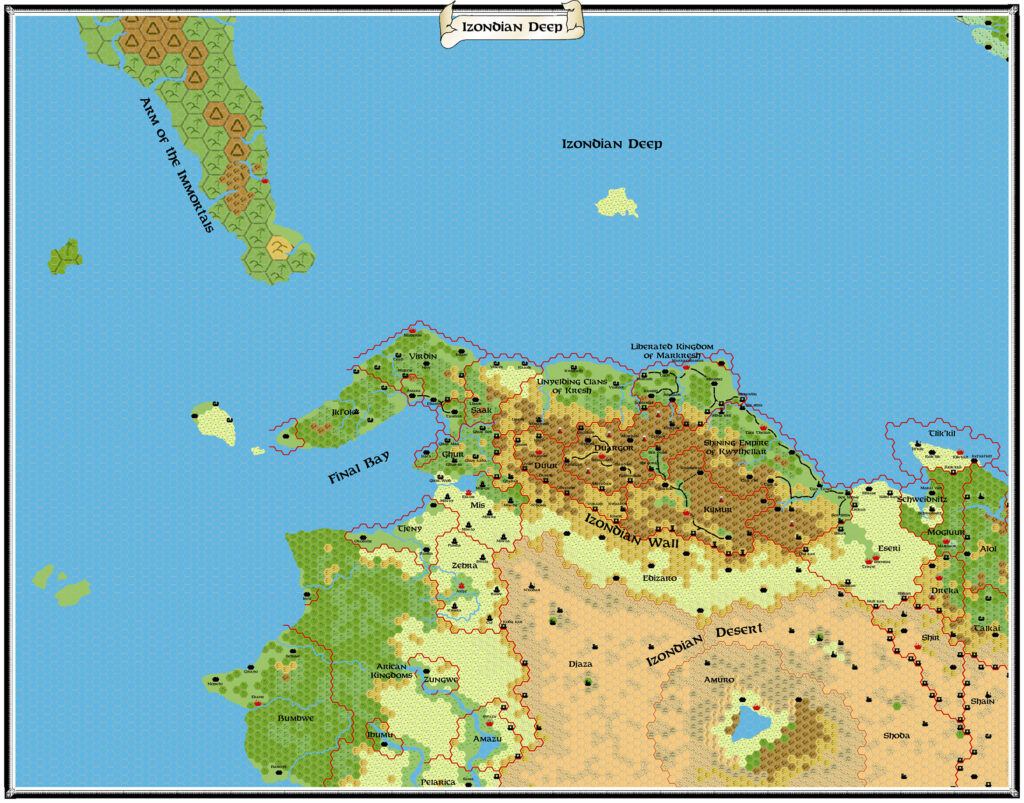
Chimpman’s Izondian Deep, 24 miles per hex
Continuing on from his explorations of Davania’s Hinterlands and his North Davania Compilation, John moved his focus to the far west, and the Izondian Deep region between Izonda and the Arm of the Immortals.
He created a rough base map, then went through a few iterations, incorporating waves of feedback from Geoff, Francesco, and others. The earlier versions are lost to us, but we have the latest one. John posted about it in the Geographical Mapping forum at The Piazza:
I’m trying a little experiment with this latest update. I added in some new terrain types (poor and good grazing). I also added in some rivers and river borders. These aren’t exactly the same as Sturm’s original however. The differences are attempts at reconciling that map with Thorf’s 72mph river placements. I’ve also had to move around a handful of coastal settlements, but I don’t think it impacts the map too much.
The real experiment was removing most of the villages. I tried adding in some roads and trails, but the map started to look really crowded. I still have the villages on another layer, but for now they’re hidden. I was checking out some of Thorf’s other 24 mph maps, and while most of them don’t have villages, those that do aren’t quite as crowded as this one.
By this point, John had included Francesco’s Izonda map with various additions, as well as marking the location for Geoff’s Nastoreth.
This was as far as he went with this map. It remains a useful source for those working on the region.
Fan-made Map by John Calvin (March 2011)
This is an original map created by one of Mystara’s excellent fan cartographers. For more information on the cartographer, including a gallery of all their maps, see also Appendix M: Mappers of Mystara.
Sources
- The Known World Grimoire: Lords of the skies, Dragon #200 (December 1993)
Fan Sources
- Geoff’s Nastoreth, 8 miles per hex (May 2010)
- Sturm’s Izonda & Pelatan, 24 miles per hex (March 2011)
References
- All of John’s maps at the Atlas of Mystara
- John’s entry in Appendix M: Mappers of Mystara (upcoming)
- John’s author page at the Vaults of Pandius
Chronological Analysis
This is a fan-made map. It was published in March 2011. The updated Atlas version of this map is not yet available. See also Appendix C for annual chronological snapshots of the area. For the full context of this map in Mystara’s publication history, see the upcoming Let’s Map Mystara 2011.
The following lists are from the Let’s Map Mystara project. Additions are new features, introduced in this map. Revisions are changes to previously-introduced features. Hex Art & Fonts track design elements. Finally, Textual Additions are potential features found in the related text. In most cases, the Atlas adopts these textual additions into updated and chronological maps.
Under Construction! Please check back again soon for updates.

")
")
