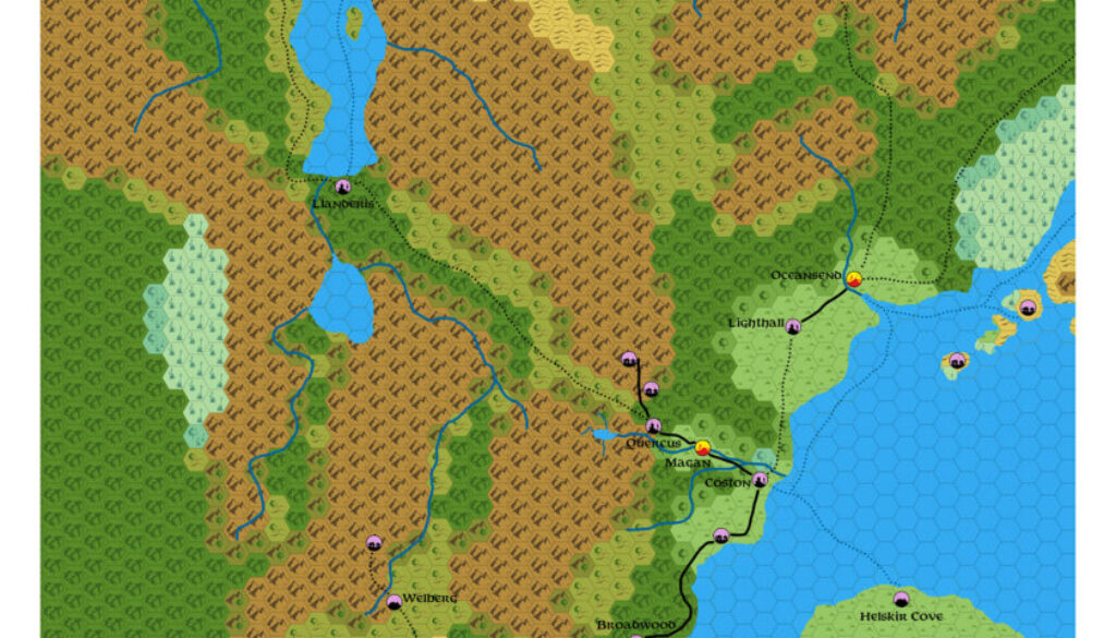
Ashtagon’s Norwold Maganshire, 24 miles per hex
In October 2025, Emma took a break from working on her Patera, 8 mile per hex map to post this map of Cab Davidson’s Maganshire in Norwold. Cab’s campaign has been running for many years, with extensive development of his version of Norwold, centred around Maganshire southwest of Oceansend. He has produced a lot of material for it, much of which he has shared and can be found at the Vaults of Pandius. On the other hand, he hasn’t produced a lot of maps for it, so Emma’s map was a very welcome development.
This was very much a map based on Cab’s campaign, which Emma made clear in her comments at The Piazza when sharing it:
It may be worth noting that this map uses a hand-drawn map by cab as its sole source, and it does not make reference to any pre-existing official or fanon maps of Norwold.
It would be wonderful to see more maps of Maganshire in the future.
On Facebook, Emma pointed out something that I had missed:
This map is the first time I started doing white borders on the edge of the maps instead of black borders. This was partly because it makes it visually easier to crop, but also in recognition of the fact that some people print these maps, and large swathes of black are not fun to print.
Fan-made Map by Emma Rome (October 2025)
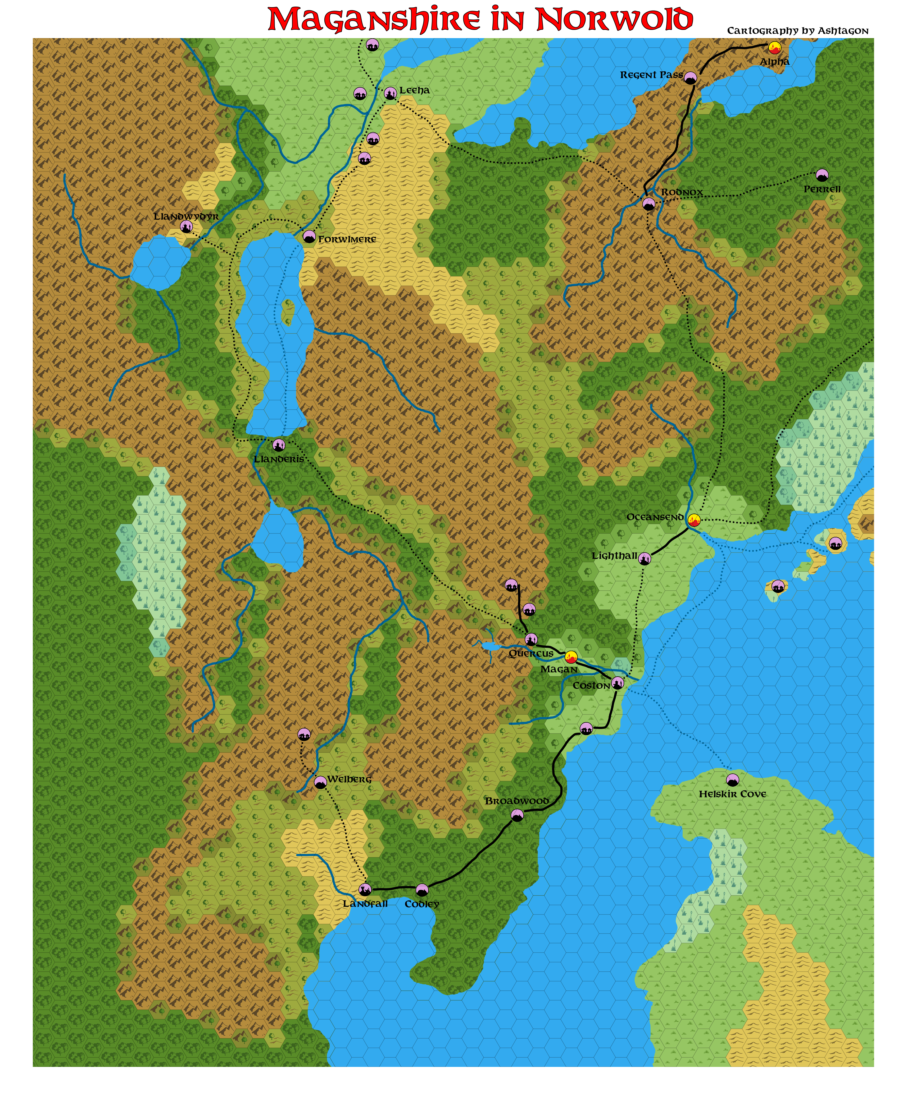
This is an original map created by one of Mystara’s excellent fan cartographers. For more information on the cartographer, including a gallery of all their maps, see also Appendix M: Mappers of Mystara.
Sources
- CM1 Test of the Warlords (1984) (PDF at DriveThruRPG)
Fan Sources
- Map of Maganshire and the City of Magan AC 1057, 5 miles per hex at the Vaults of Pandius (January 2022)
- Maganshire discussion thread at The Piazza (October 2025)
References
- All of Emma’s maps at the Atlas of Mystara
- Emma’s entry in Appendix M: Mappers of Mystara (upcoming)
- Emma’s author page at the Vaults of Pandius
Chronological Analysis
This is a fan-made map. It was published in October 2025. The updated Atlas version of this map is not yet available. See also Appendix C for annual chronological snapshots of the area. For the full context of this map in Mystara’s publication history, see the upcoming Let’s Map Mystara 2025.
The following lists are from the Let’s Map Mystara project. Additions are new features, introduced in this map. Revisions are changes to previously-introduced features. Hex Art & Fonts track design elements. Finally, Textual Additions are potential features found in the related text. In most cases, the Atlas adopts these textual additions into updated and chronological maps.
Under Construction! Please check back again soon for updates.