
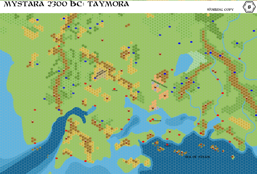
Chimpman’s Taymora 2300 BC, 8 miles per hex Cities
In March 2010, after a six month break from mapping, John returned to his 2300 BC project with some maps of Taymora. This was the second in the set; the others concentrated on borders, while this one looked at settlements. John explained the meaning of the colours at The Piazza:
The ruins from PC3 are in red, while most of the other (relevant) cities from the Gaz line are in blue. This gives us quite a bit more to play with, but I don’t think all of those cities should have Taymoran origins. Some might.
Ierendi City and some of the nearby villages could all lie along the path of a river running from the Shires along the western mountains and to the sea.
Harbortown, Minrothad, and Stronghold might also make sense.
This was another step on the way to a full map, and the effort to tie in modern 1000 AC settlements (and ruins) was especially clear here. John would later create an overlay for the finished map to make the relationship clear from a post-design perspective; this one shows the establishment of these connections during development.
Fan-made Map by John Calvin (March 2010)
This is an original map created by one of Mystara’s excellent fan cartographers. For more information on the cartographer, including a gallery of all their maps, see also Appendix M: Mappers of Mystara.
Sources
- PC3 The Sea People (1990) (PDF at DriveThruRPG)
Fan Sources
- Chimpman’s Taymora 2300 BC, 24 miles per hex Cities (August 2009)
- Chimpman’s Taymora 2300 BC, 8 miles per hex v2 (September 2009)
- World of Mystara 2300 BC discussion thread at The Piazza (March 2009-August 2010)
References
- All of John’s maps at the Atlas of Mystara
- John’s entry in Appendix M: Mappers of Mystara (upcoming)
- John’s author page at the Vaults of Pandius
Chronological Analysis
This is a fan-made map. It was published in March 2010. The updated Atlas version of this map is not yet available. See also Appendix C for annual chronological snapshots of the area. For the full context of this map in Mystara’s publication history, see the upcoming Let’s Map Mystara 2010.
The following lists are from the Let’s Map Mystara project. Additions are new features, introduced in this map. Revisions are changes to previously-introduced features. Hex Art & Fonts track design elements. Finally, Textual Additions are potential features found in the related text. In most cases, the Atlas adopts these textual additions into updated and chronological maps.
Under Construction! Please check back again soon for updates.
")

")