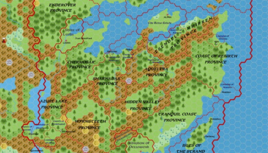
Zendrolion’s Norwold, 24 miles per hex Provinces
Of the four maps Simone created for Threshold #7, three appeared in his A Traveller’s Guide to Norwold. This one, the fourth, illustrated his other article, The Great Land Rush of Norwold. A couple of paragraphs described the background of the map as follows:
King Ericall has ruled for ten years, a large stretch of this vast and wilderness subcontinent. In those ten years, Ericall has gathered a number of advisors and bureaucrats to help him manage the burden of ruling this huge and diverse land, divided by massive geographical barriers – the powerful rivers, the deep forests, the highest mountains, and the cold tundras. Despite the king’s efforts, however, his success in this process has been partial at best – also due to the young Ericall’s naivety, idealism, and lack of experience.
The official borders of the Kingdom of Norwold are shown in the accompanying map, above, alongside independent realms found within or at the borders of the kingdom, the borders of the kingdom’s provinces, and those of existing fiefs before the Great Land Rush.
While the other maps focused on climate, toponyms, and regions, this one showed only the political divisions of Norwold. It was the logical successor to Simone’s previous political and dominion maps.
Fan-made Map by Simone Neri (April 2015)
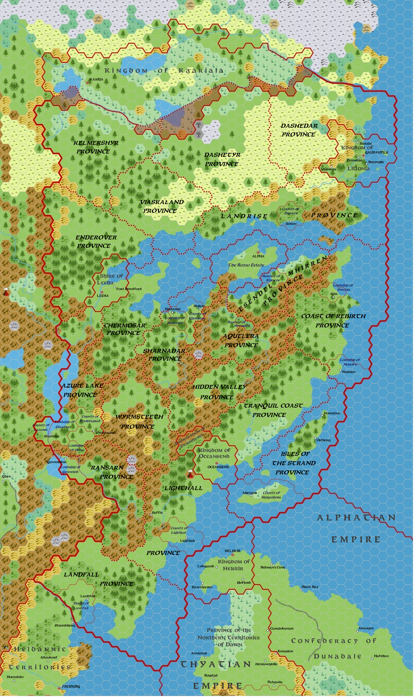
This is an original map created by one of Mystara’s excellent fan cartographers. For more information on the cartographer, including a gallery of all their maps, see also Appendix M: Mappers of Mystara.
Sources
Fan Sources
- Zendrolion’s Norwold Domains, 24 miles per hex v3
- Zendrolion’s Norwold, 24 miles per hex v1.5 Political
- A Traveller’s Guide to Norwold from Threshold Magazine #7 (April 2015)
References
- All of Simone’s maps at the Atlas of Mystara
- Simone’s entry in Appendix M: Mappers of Mystara (upcoming)
- Simone’s author page at the Vaults of Pandius
Chronological Analysis
This is a fan-made map. It was published in April 2015. The updated Atlas version of this map is not yet available. See also Appendix C for annual chronological snapshots of the area. For the full context of this map in Mystara’s publication history, see the upcoming Let’s Map Mystara 2015.
The following lists are from the Let’s Map Mystara project. Additions are new features, introduced in this map. Revisions are changes to previously-introduced features. Hex Art & Fonts track design elements. Finally, Textual Additions are potential features found in the related text. In most cases, the Atlas adopts these textual additions into updated and chronological maps.
Under Construction! Please check back again soon for updates.
Additions
- XXX —
Revisions
- XXX —
Hex Art & Fonts
- Hex Art —
- Fonts —