
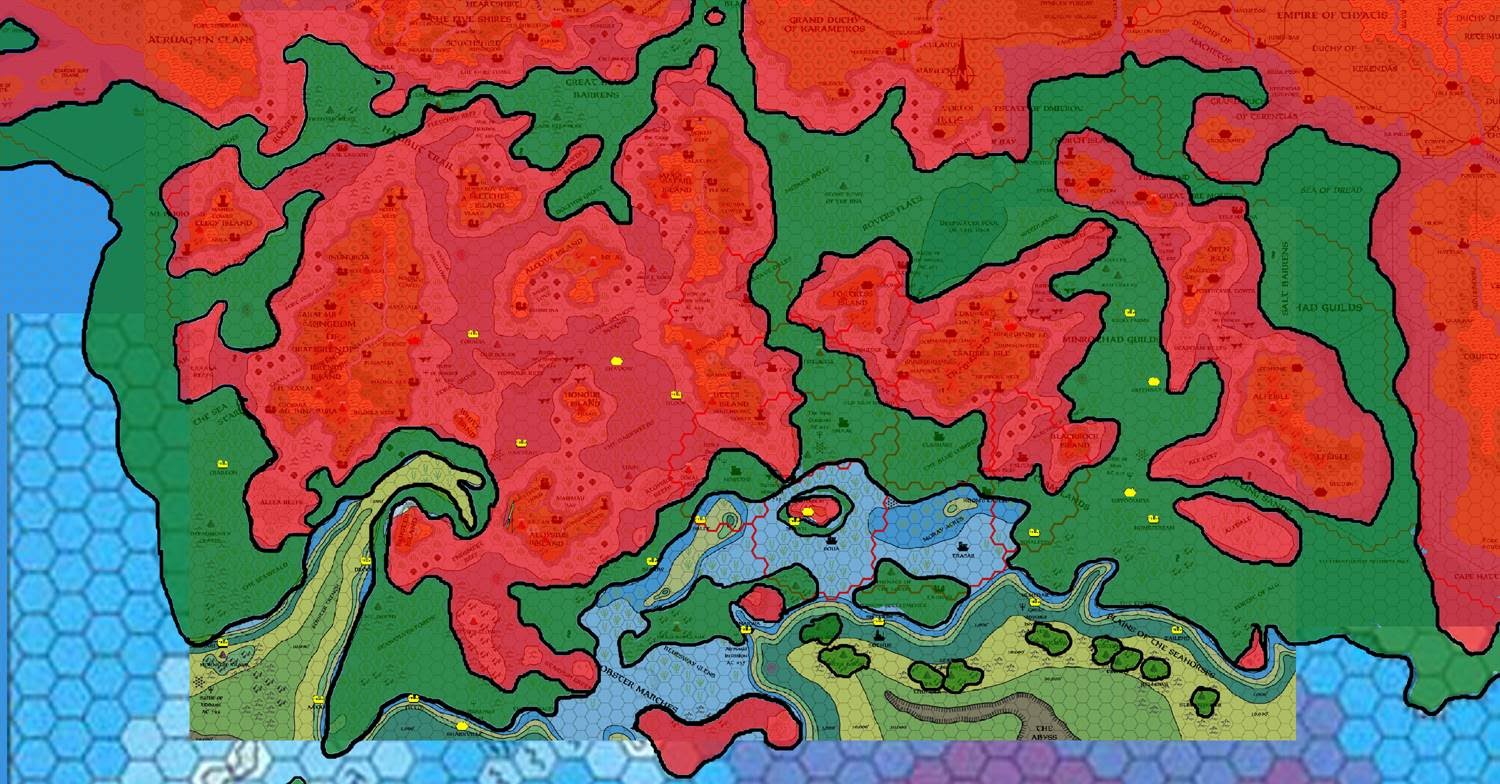
Chimpman’s Known World, 8 miles per hex Coastlines with Cities
In this map, John took his Coastlines design and gave it some bolder colours, and then marked in Taymoran cities on top of that. The project was really beginning to take shape at this point, moving ever-closer to a full map of ancient Taymora. He explained in his post at The Piazza:
I’ve got one more map for everyone’s consideration. Here I’ve labeled the sunken Taymoran cities in yellow. Hopefully they are easy enough to see. Is there any information we can get from their placement that might help us to better draw the historical shorelines? I’m assuming that many of these were coastal settlements, but it’s probable that not all of them were.
It would be a couple of years still before John produced a finished map of the area, but this was another major stepping stone along the way.
Fan-made Map by John Calvin (September 2009)
This is an original map created by one of Mystara’s excellent fan cartographers. For more information on the cartographer, including a gallery of all their maps, see also Appendix M: Mappers of Mystara.
Sources
- PC3 The Sea People (1990) (PDF at DriveThruRPG)
Fan Sources
- Chimpman’s Known World, 8 miles per hex Master Template (September 2009)
- Historical Mapping in the KW and Sea of Dread discussion thread at The Piazza (September 2009-October 2010)
- Chimpman’s Known World, 8 miles per hex Coastlines (September 2009)
References
- All of John’s maps at the Atlas of Mystara
- John’s entry in Appendix M: Mappers of Mystara (upcoming)
- John’s author page at the Vaults of Pandius
Chronological Analysis
This is a fan-made map. It was published in September 2009. The updated Atlas version of this map is not yet available. See also Appendix C for annual chronological snapshots of the area. For the full context of this map in Mystara’s publication history, see the upcoming Let’s Map Mystara 2009.
The following lists are from the Let’s Map Mystara project. Additions are new features, introduced in this map. Revisions are changes to previously-introduced features. Hex Art & Fonts track design elements. Finally, Textual Additions are potential features found in the related text. In most cases, the Atlas adopts these textual additions into updated and chronological maps.
Under Construction! Please check back again soon for updates.
")
")
")