")
Chimpman’s Known World 2300 BC, 8 miles per hex Working Coastlines v1
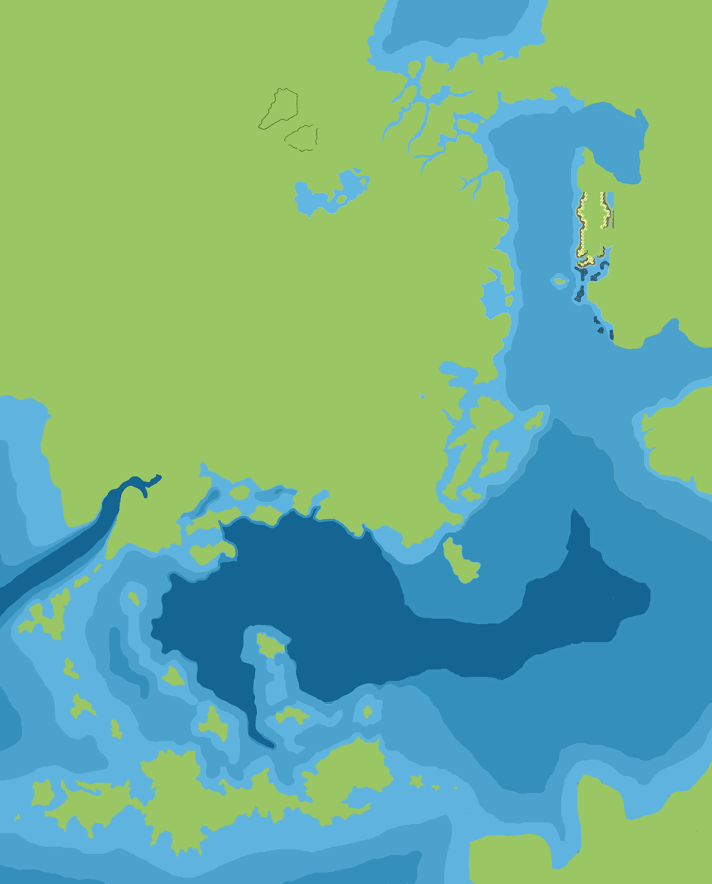
With apologies for the exceedingly long title… This was another major step forward for John’s 2300 BC Known World map. Through a series of exploratory and experimental maps, he had now built up a very detailed picture of the coasts and bathymetry of the area. With these now largely in place, it was time to begin developing the terrain. John explained in his post at The Piazza at the time:
Alright, I’ve got one more map. This one just shows the coastlines and ocean topography. I really only focused on the Brun coast, and the Thanegioth Archipelago/Island – The IOD is very rough at this point.
There’s a lot of nice detail in these coasts, and it’s clear that John put a lot of work into drawing this map. It comes as no surprise, then, that he used this as the basis of all of his future 2300 BC maps — the first of which he would release just a week after posting this one. Before that, he would revisit this map to begin adding some terrain.
Fan-made Map by John Calvin (September 2009)
This is an original map created by one of Mystara’s excellent fan cartographers. For more information on the cartographer, including a gallery of all their maps, see also Appendix M: Mappers of Mystara.
Sources
- PC3 The Sea People (1990) (PDF at DriveThruRPG)
Fan Sources
- Chimpman’s Known World, 8 miles per hex Master Template (September 2009)
- Chimpman’s Known World, 8 miles per hex Coastlines (September 2009)
- Chimpman’s Known World, 8 miles per hex Coastlines with Cities (September 2009)
- Historical Mapping in the KW and Sea of Dread discussion thread at The Piazza (September 2009-October 2010)
References
- All of John’s maps at the Atlas of Mystara
- John’s entry in Appendix M: Mappers of Mystara (upcoming)
- John’s author page at the Vaults of Pandius
Chronological Analysis
This is a fan-made map. It was published in September 2009. The updated Atlas version of this map is not yet available. See also Appendix C for annual chronological snapshots of the area. For the full context of this map in Mystara’s publication history, see the upcoming Let’s Map Mystara 2009.
The following lists are from the Let’s Map Mystara project. Additions are new features, introduced in this map. Revisions are changes to previously-introduced features. Hex Art & Fonts track design elements. Finally, Textual Additions are potential features found in the related text. In most cases, the Atlas adopts these textual additions into updated and chronological maps.
Under Construction! Please check back again soon for updates.
")
")
")