")
Chimpman’s Mogreth 2300 BC, 8 miles per hex v1
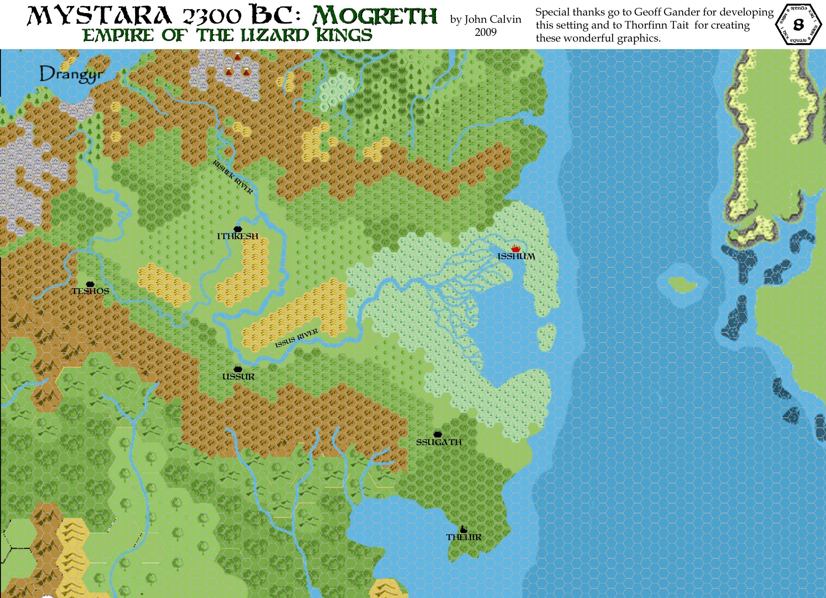
Following his first forays into 8 mile per hex mapping with the Shimmering Lands a few months earlier, by the end of August 2009 John had created a second map bordering the first: Mogreth. John explained in his post at The Piazza:
This map of Mogreth in 2300 BC covers areas of current day (1000 AC) Ylaruam, portions of the Northern Reaches, Thyatis, and the Isle of Dawn, as well as lands that sunk beneath the sea in 1700 BC.
The map was clearly very much still under construction, with a 24 mile per hex guide still visible at the bottom of the map. This map predated his switch from a 24 mile per hex base map to a new 8 mile per hex base map; indeed, it was likely the cause of the switch, given the timing — he produced his 8 mile per hex Master Template just a couple of days later.
It’s also notable as being the apparent first use of Moria Citadel, the font John went on to use throughout his 2300 BC maps.
He would return to this map for updates and a final version in the succeeding years.
Fan-made Map by John Calvin (August 2009)
This is an original map created by one of Mystara’s excellent fan cartographers. For more information on the cartographer, including a gallery of all their maps, see also Appendix M: Mappers of Mystara.
Sources
Fan Sources
- Chimpman’s Taymora 2300 BC, 24 miles per hex Cities (August 2009)
- Outer World: Mogreth 2300 BC, 8 miles per hex discussion thread at The Piazza (August 2009-August 2023)
References
- All of John’s maps at the Atlas of Mystara
- John’s entry in Appendix M: Mappers of Mystara (upcoming)
- John’s author page at the Vaults of Pandius
Chronological Analysis
This is a fan-made map. It was published in August 2009. The updated Atlas version of this map is not yet available. See also Appendix C for annual chronological snapshots of the area. For the full context of this map in Mystara’s publication history, see the upcoming Let’s Map Mystara 2009.
The following lists are from the Let’s Map Mystara project. Additions are new features, introduced in this map. Revisions are changes to previously-introduced features. Hex Art & Fonts track design elements. Finally, Textual Additions are potential features found in the related text. In most cases, the Atlas adopts these textual additions into updated and chronological maps.
Under Construction! Please check back again soon for updates.
")
")
")