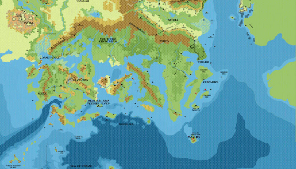
Chimpman’s Known World 1750 BC, 8 miles per hex v2
In early September 2011, John created a thread in the Geographical Mapping forum at The Piazza presenting a map of the Known World in 1750 BC. He had previously mapped the area in 1000 BC, and extensively in 2300 BC, so this map was a bridge between those eras. And it wasn’t the only one: later in the month, he created a 1700 BC version, too.
The original version of this map is now lost to us. This is the second version, from a few months later in January 2012. John explained the changes in a post at The Piazza:
I’ve just updated the 1750 map and added 2 ancient Blackmoorian locations (both marked with an obelisk symbol). One is in the Hidden Valley in Karameikos, and the second is on the site of Fenhold in Darokin.
Other changes include the redirection of several rivers through the center of what will be Darokin, and the formation of a small lake around Fenhold (which could either be attributed to natural causes, the opening of a gate to the plane of water – as in CM9, or a combination of both events).
We can deduce from this that the original map wasn’t so very different from this one.
The map itself was a wonderful piece of work, bridging the gap between John’s 2300 BC landforms and the modern coastlines and terrain of the Known World in 1000 AC. It’s especially interesting as you can see the beginnings of the familiar shapes: Karameikos, the Five Shires, Thyatis, and parts of the island nations. In 2300 BC, most of these areas were inland, making them stand out far less; in 1750 BC, they are now sitting in plain sight.
10 years later John returned to this map for some updates. He also made at least two other maps showing the area in slightly later periods.
Fan-made Map by John Calvin (January 2012)
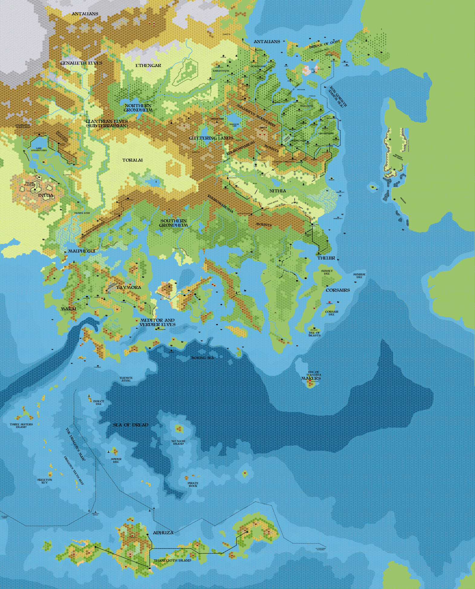
This is an original map created by one of Mystara’s excellent fan cartographers. For more information on the cartographer, including a gallery of all their maps, see also Appendix M: Mappers of Mystara.
Sources
Fan Sources
- Historical: Known World BC 1750, 8mph discussion thread at The Piazza (September 2011)
- Chimpman’s Known World 2300 BC, 8 miles per hex v2 (July 2010)
References
- All of John’s maps at the Atlas of Mystara
- John’s entry in Appendix M: Mappers of Mystara (upcoming)
- John’s author page at the Vaults of Pandius
Chronological Analysis
This is a fan-made map. It was published in January 2012. The updated Atlas version of this map is not yet available. See also Appendix C for annual chronological snapshots of the area. For the full context of this map in Mystara’s publication history, see the upcoming Let’s Map Mystara 2012.
The following lists are from the Let’s Map Mystara project. Additions are new features, introduced in this map. Revisions are changes to previously-introduced features. Hex Art & Fonts track design elements. Finally, Textual Additions are potential features found in the related text. In most cases, the Atlas adopts these textual additions into updated and chronological maps.
Under Construction! Please check back again soon for updates.