")
Chimpman’s Hollow Moon Nearside, 40 miles per hex v1
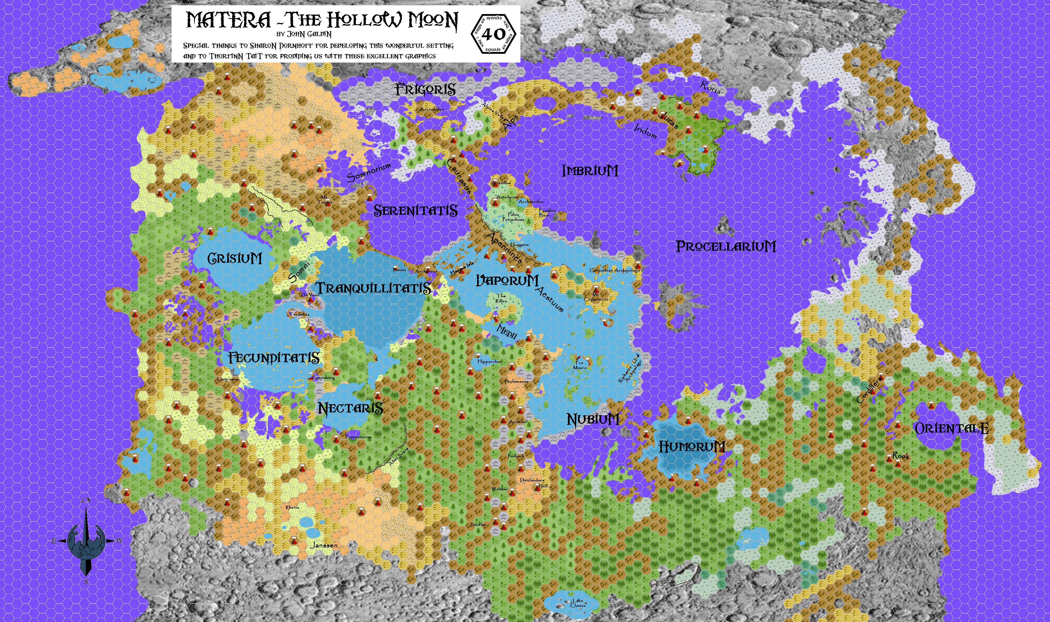
Not content with just one super-project (Mystara 2300 BC), in April 2009 John Calvin began a second: mapping out Sharon Dornhoff’s Hollow Moon. This was to be a labour of love, born of his liking for the setting, and his desire to see it properly mapped. John described the map in his post at The Piazza:
This map of the Hollow Moon covers the Nearside – the inside section of Matera that is always facing Mystara. The base map is a mirror image of our own moon, Luna. The darker blue/violet color represents the crystal firmament of Matera. These are the dark patches on the face of the moon (and on the inside of it as well). It is through the crystal firmament that light from the sun will shine through to illuminate the interior of the Hollow Moon in a dim blue light. Gray hexes represent areas on land that have not been mapped yet. All other hexes should be standard.
He started mapping in April, continuing on and off for the rest of the year and beyond. It appears that there were many intermediate versions, but this is the earliest that remains to us — and indeed the only one from this early period. At this stage, the map was still in its infancy, although it had already had a number of major updates.
John would continue to add to the map for quite a few years after his first flurry of activity in 2009.
Fan-made Map by John Calvin (c. June 2009)
This is an original map created by one of Mystara’s excellent fan cartographers. For more information on the cartographer, including a gallery of all their maps, see also Appendix M: Mappers of Mystara.
Sources
Fan Sources
- Inside Matera: The Hollow Moon by Sharon Dornhoff at the Vaults of Pandius (1998-1999)
- Hollow Moon: Nearside, 40 miles per hex discussion thread at The Piazza (April 2009-March 2012)
References
- All of John’s maps at the Atlas of Mystara
- John’s entry in Appendix M: Mappers of Mystara (upcoming)
- John’s author page at the Vaults of Pandius
Chronological Analysis
This is a fan-made map. It was published around June 2009. The updated Atlas version of this map is not yet available. See also Appendix C for annual chronological snapshots of the area. For the full context of this map in Mystara’s publication history, see the upcoming Let’s Map Mystara 2009.
The following lists are from the Let’s Map Mystara project. Additions are new features, introduced in this map. Revisions are changes to previously-introduced features. Hex Art & Fonts track design elements. Finally, Textual Additions are potential features found in the related text. In most cases, the Atlas adopts these textual additions into updated and chronological maps.
Under Construction! Please check back again soon for updates.
")
")
")
4 June 2026 @ 4:55 am
M-O-O-N spells Moon! Awesome map.