
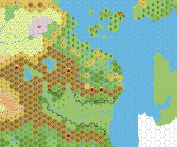
Chimpman’s Moadreg 1000 BC, 24 miles per hex
In January 2009, John returned to a project he had first conceived as early as 2003. He explained in his Shimmering Lands thread at The Piazza that this was the kingdom of the Moadreg — the forerunners of the Modrigswerg dwarves.
This map was a stepping stone bridging the time gap between 1000 AC and 2300 BC, the chosen date for John’s setting. Its coastlines and features were more similar to modern day features due to it being closer in time — though there are still major differences, of course.
There were actually two versions of this map. This is the second; the first is lost to us, though it’s likely that it was very similar to his Known World v2 map from the previous year. John explained the changes since the (lost) first version:
I’ve updated the map images above to account for changing climate and the aforementioned mega-flood.
From the thread, we can see that the main changes were the addition of the canyon walls and a straightening of the River Nithia.
In the same post, John presented his first 2300 BC map. It used similar framing for easy comparison.
Fan-made Map by John Calvin (February 2009)
This is an original map created by one of Mystara’s excellent fan cartographers. For more information on the cartographer, including a gallery of all their maps, see also Appendix M: Mappers of Mystara.
Sources
- B10 Night’s Dark Terror (1986) (PDF at DriveThruRPG)
- GAZ5 The Elves of Alfheim (1988) (PDF at DriveThruRPG)
- GAZ6 The Dwarves of Rockhome (1988) (PDF at DriveThruRPG)
- GAZ10 The Orcs of Thar (1989) (PDF at DriveThruRPG)
- Hollow World Campaign Set (1990) (PDF at DriveThruRPG)
- HWR2 Kingdom of Nithia (1991) (PDF at DriveThruRPG)
Fan Sources
- Chimpman’s Known World 1000 BC, 24 miles per hex v2 (September 2008)
- Mystara 2300 BC – The Shimmering Lands discussion thread at The Piazza (February 2009)
- Mystara 2300 BC – The Shimmering Lands discussion thread at The Piazza (February 2009)
References
- All of John’s maps at the Atlas of Mystara
- John’s entry in Appendix M: Mappers of Mystara (upcoming)
- John’s author page at the Vaults of Pandius
Chronological Analysis
This is a fan-made map. It was published in February 2009. The updated Atlas version of this map is not yet available. See also Appendix C for annual chronological snapshots of the area. For the full context of this map in Mystara’s publication history, see the upcoming Let’s Map Mystara 2009.
The following lists are from the Let’s Map Mystara project. Additions are new features, introduced in this map. Revisions are changes to previously-introduced features. Hex Art & Fonts track design elements. Finally, Textual Additions are potential features found in the related text. In most cases, the Atlas adopts these textual additions into updated and chronological maps.
Under Construction! Please check back again soon for updates.
")
")
")