
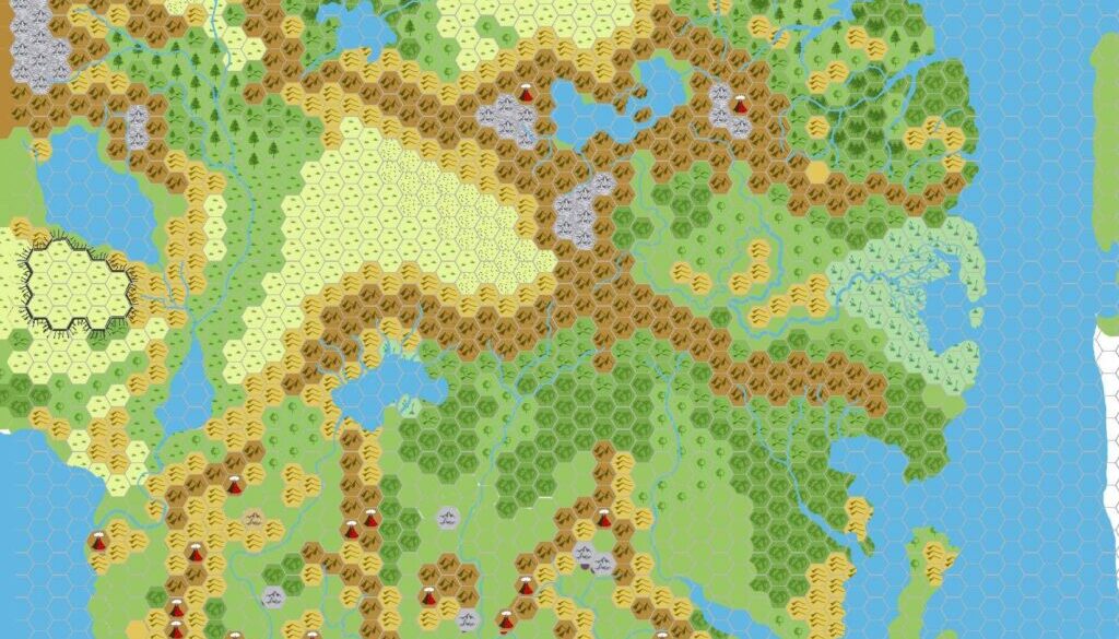
Chimpman’s Taymora 2300 BC, 24 miles per hex
John’s third 2300 BC map was his version of Taymora — the ancient version of what is the Sea of Dread coast in modern 1000 AC times. He posted the first version in late February 2009, but that version is now lost to us. However, we do have an updated version from just a few weeks later, in March 2009. This is the version presented here.
For the first version, John explained in his post at The Piazza:
I tried to use the contours given in the PC3 map along with most of the sunken ruins to determine a good shoreline.
John’s coastline was rather different from previous takes on this time period by James Mishler, Geoff Gander and Giampaolo Agosta. For his second version (below), he gave some details on the upgrades:
I’ve updated my KW_2300BC and KW_Cities_2300BC maps. I’ve made several changes, including replacing the Taymoran cities with their appropriate icons (most were villages). The only actual city is Colhador, but based on the descriptions from PC3 I’m not convinced that was the actual capital. …
Geographically I’ve rebuilt the Great Plateau, and drawn out many of the rivers (focusing mostly on the Taymora area) as well as cleaned up the southern islands. The islands may need to be smaller still than they are. I’ve also made some changes to the forests up north, but am still not done with those.
As you can see, John had by this time brought this map to quite a high degree of completion in terms of his concept for the area in 2300 BC. Aside from Taymora itself, all of the major terrain for the Shimmering Lands, Mogreth, Intua, and other areas was already in place.
Fan-made Map by John Calvin (March 2009)
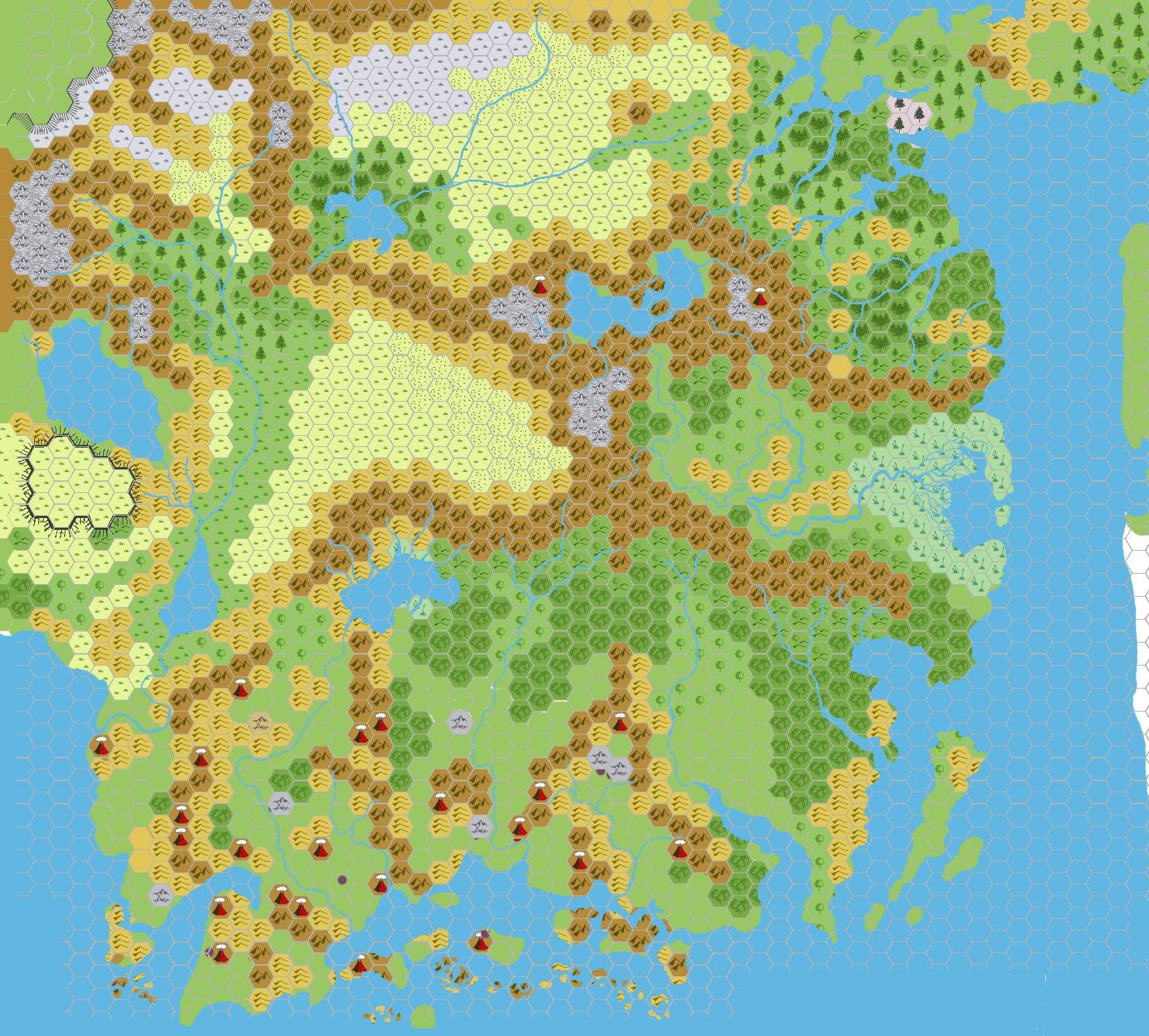
This is an original map created by one of Mystara’s excellent fan cartographers. For more information on the cartographer, including a gallery of all their maps, see also Appendix M: Mappers of Mystara.
Sources
- GAZ5 The Elves of Alfheim (1988) (PDF at DriveThruRPG)
- GAZ6 The Dwarves of Rockhome (1988) (PDF at DriveThruRPG)
- GAZ10 The Orcs of Thar (1989) (PDF at DriveThruRPG)
- Hollow World Campaign Set (1990) (PDF at DriveThruRPG)
- PC3 The Sea People (1990) (PDF at DriveThruRPG)
- HWR2 Kingdom of Nithia (1991) (PDF at DriveThruRPG)
Fan Sources
- Chimpman’s Moadreg 2300 BC, 24 miles per hex (February 2009)
- Chimpman’s Mogreth 2300 BC, 24 miles per hex (March 2009)
- Outer World: Taymora 2300 BC, 24 miles per hex discussion thread at The Piazza (March 2009)
References
- All of John’s maps at the Atlas of Mystara
- John’s entry in Appendix M: Mappers of Mystara (upcoming)
- John’s author page at the Vaults of Pandius
Chronological Analysis
This is a fan-made map. It was published in March 2009. The updated Atlas version of this map is not yet available. See also Appendix C for annual chronological snapshots of the area. For the full context of this map in Mystara’s publication history, see the upcoming Let’s Map Mystara 2009.
The following lists are from the Let’s Map Mystara project. Additions are new features, introduced in this map. Revisions are changes to previously-introduced features. Hex Art & Fonts track design elements. Finally, Textual Additions are potential features found in the related text. In most cases, the Atlas adopts these textual additions into updated and chronological maps.
Under Construction! Please check back again soon for updates.
28 May 2026 @ 3:26 am
That’s a lot of volcanos!