Zendrolion’s Norwold, 24 miles per hex v1.4
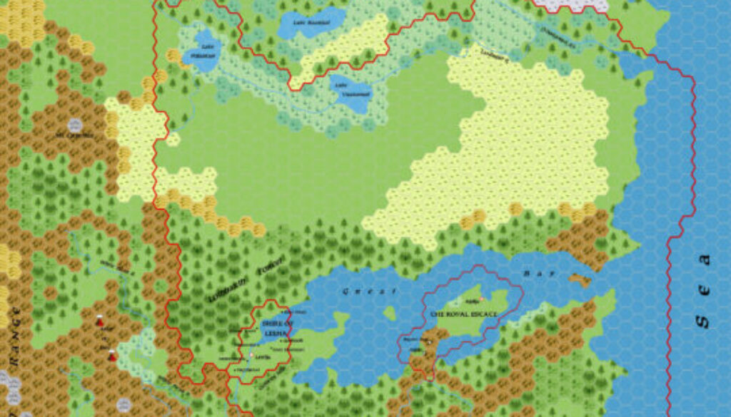
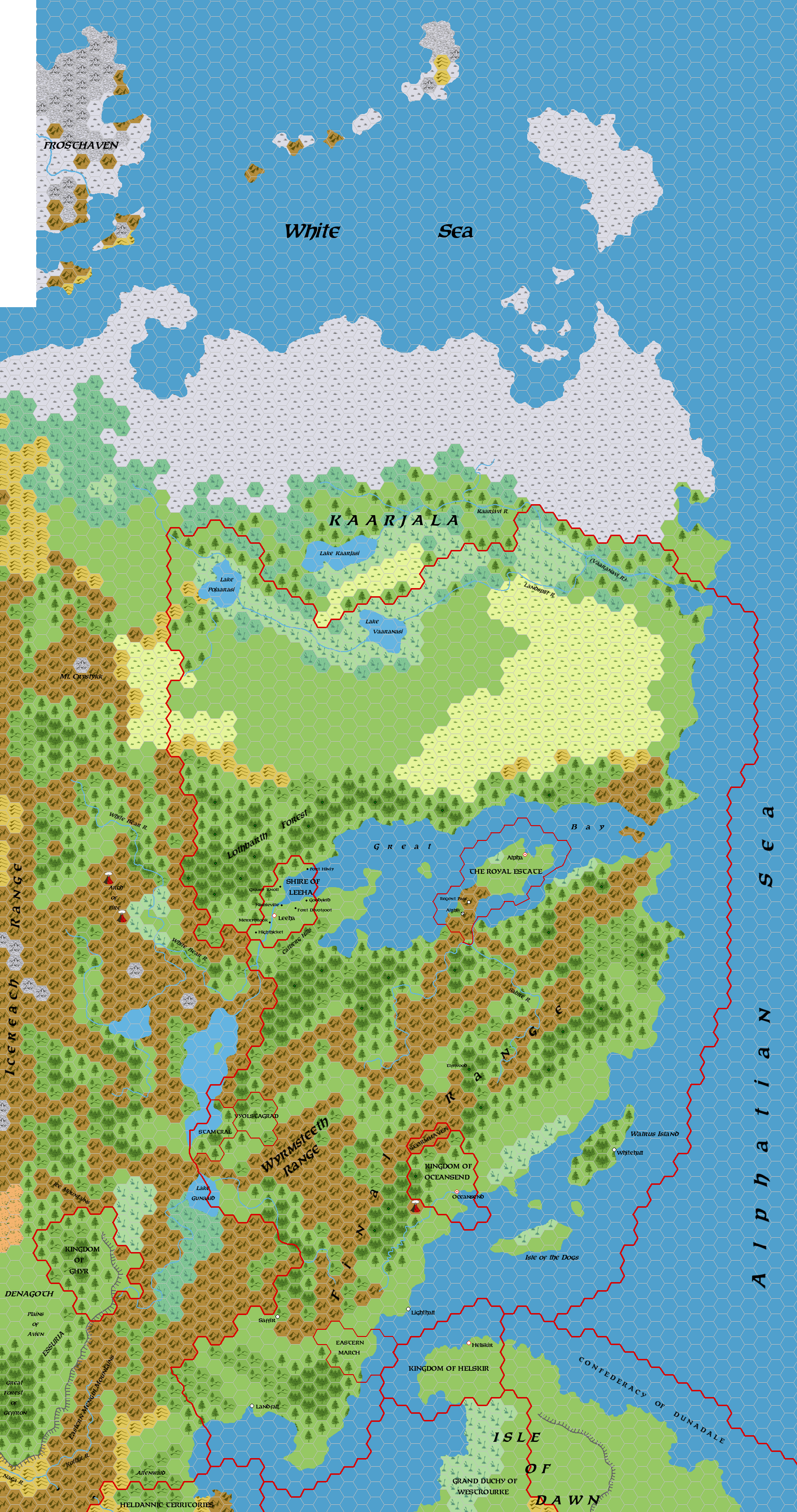
This map followed directly on from Simone’s 1.3 map and his first ethnographic map of Norwold, in late April 2006. It was his first pass at a properly labelled map, and he added a lot of geographic and political names. Although these remained a fraction of what the final map would eventually get, nonetheless it had taken a long discussion to get this far, and it was a major achievement for Simone and his collaborators on the Italian MMB. He named this map “1.4-eng”, indicating that the labels were in English rather than Italian.
Simone posted a long explanation of his choices, and I think it’s well worth quoting him at length here (translation is Google Translate, with apologies for inaccuracies as always):
I’ve finally updated the map, which I hope is clearer now. I’d say we should be covering Alpha and Oceansend (including the demihumans), but feel free to post any further criticisms or ideas. Naturally, once this (easy) part is over, the hard part will come: the distribution of some toponyms, the positioning of the Norwold fiefdoms … , and the calculation of the barbarian or indigenous population. …
… I’ve added a few features to the map, which I’ll list (with source):
- Alpha: I’ve changed the borders, removing the island and adding a mountain hex, as you previously suggested. I’ve also placed the Regent’s Pass fort, as well as the ruins of the capital of the principality of Alinor, which I’ve labeled “Alphia” for convenience.
- Altenwald: the wooded hills on the northern edge of the Heldannic Territories, the name comes from Geoff Gander’s Territories map, in the Vaults.
- Crystykk: I’ve placed the abode of the famous witches from CM1 southwest of Kaarjala.
- Eastern March (PC1), Stamtral, and Vyolstagrad (CM4): placed here as per the previous discussion; Naturally, I had to modify the existing terrain types in the Vyolstagrad area to match those on the CM4 map. Note in particular the strategic position of Stamtral, which controls the landings on the great lake and the access routes to Lake Gunaald.
- Kothir River: In Mengul, I took the name from the Denagoth map posted by OldDawig on the Wizards forum.
- Sabre River: placed here, as per the discussion at the beginning of this topic. –
Foresthomes: These are indicated by the green dots circled in black; I placed 30 of them scattered around, particularly in the areas I had identified on the previous ethnographic map. Among these is Elfswood, the Foresthome that appears in the Dungeon Magazine #21 adventure.- Kaarjala: The names of the rivers and lakes are taken from the article on the Kaarjala written by James Mishler in the Vaults. In particular, the Landsplit River is called Vaaranavi by the natives.
- Leeha: I’ve added the names of the small communities, which ARE NOT OFFICIAL but taken from Dan Eustace’s work in the Vaults. The toponym “Catberg Hills” derives from the same source.
- Lothbarth Forest: I took this toponym from the Norwold description in the Vaults (maybe you, DM, are the author?
).
- Oceansend, Stormhaven, and local elves: I’ve changed the city boundaries slightly to include some mountain hexes (where the 3,000 dwarves, subjects of Yarrvik but not urban, would live) and forest hexes (where the 700 non-urban elves, subjects of Yarrvik, would live). North of Oceansend, I’ve placed the lands of the Stormhaven clan, allied with the city but not subject to its king.
- Lighthall, Saffir, Whitehall: towns originating from the M4 and AC10; the reasons for their location are explained in a previous post of mine.
Well, that’s it. The rest of the names/place names should be official. … (note that, being set in 1000 AC, Helskir is independent)
This was another major step forward, although as Simone hinted, there was still a lot of work to be done. The next version would bring things far closer to completion.
Fan-made Maps by Simone Neri (April 2006)
This is an original map created by one of Mystara’s excellent fan cartographers. For more information on the cartographer, including a gallery of all their maps, see also Appendix M: Mappers of Mystara.
Sources
Fan Sources
- Zendrolion’s Norwold, 24 miles per hex v1.3 (March 2006)
- Zendrolion’s Norwold Ethnographical, 24 miles per hex v1 (April 2006)
References
- All of Simone’s maps at the Atlas of Mystara
- Simone’s entry in Appendix M: Mappers of Mystara (upcoming)
- Simone’s author page at the Vaults of Pandius
Chronological Analysis
This is a fan-made map. It was published in April 2006. The updated Atlas version of this map is not yet available. See also Appendix C for annual chronological snapshots of the area. For the full context of this map in Mystara’s publication history, see the upcoming Let’s Map Mystara 2006.
The following lists are from the Let’s Map Mystara project. Additions are new features, introduced in this map. Revisions are changes to previously-introduced features. Hex Art & Fonts track design elements. Finally, Textual Additions are potential features found in the related text. In most cases, the Atlas adopts these textual additions into updated and chronological maps.
Under Construction! Please check back again soon for updates.
Additions
- XXX —
Revisions
- XXX —
Hex Art & Fonts
- Hex Art —
- Fonts —