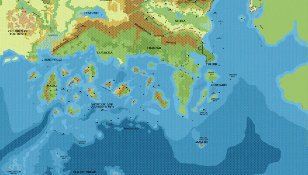
Chimpman’s Known World 1720 BC, 8 miles per hex v2
As with his concurrent 1700 BC and 1750 BC maps, John produced the first version of his 1720 BC Known World map in September 2011, and the first version is lost to us now. He described its major features in his thread at The Piazza at the time as follows:
1) The major geological events of the BC 1700s are over and most of the shorlines in southern Brun are identical to those in the modern era.
2) The Great Plateau is completely destroyed in BC 1720.
3) The Thanegioth Archipelago is in its modern day formation with many separate islands. The power of Adhuza is broken in the area at this time.
4) Ethengar is an interesting place during this time. Akkila Khan (southern steppes) allies with the Ethengar to fight off Loark’s Great Horde which is moving in from the north (through Norwold and Antalian territory). Later Akkila is betrayed by his own allies.
The map below is the earliest remaining copy I could find, and it’s the second version (though there were also at least two minor updates besides these two main versions). This one itself was also a pretty minor change, judging by John’s explanation at the time:
Again, I’ve updated this map with labels for the Makai and the Toralai. The Makai would be solidly ensconced on the Ierendi islands during this time, coexisting with the lizardmen populations there. The Toralai would be feeling pressures from the Children of the Horse at this point – possibly being driven to the easternmost reaches of their territory.
In terms of content, 1720 is of course a stepping stone between the 1750 and 1700 maps. By this time, the coastlines had settled into their familiar shapes, and the terrain also looks closer than the previous map’s. However, this was still pre-Broken Lands — the disaster there did not occur until 1700, so this map depicts the last years before that major change.
John revisited the whole series 10 years later for another pass.
Fan-made Map by John Calvin (January 2012)
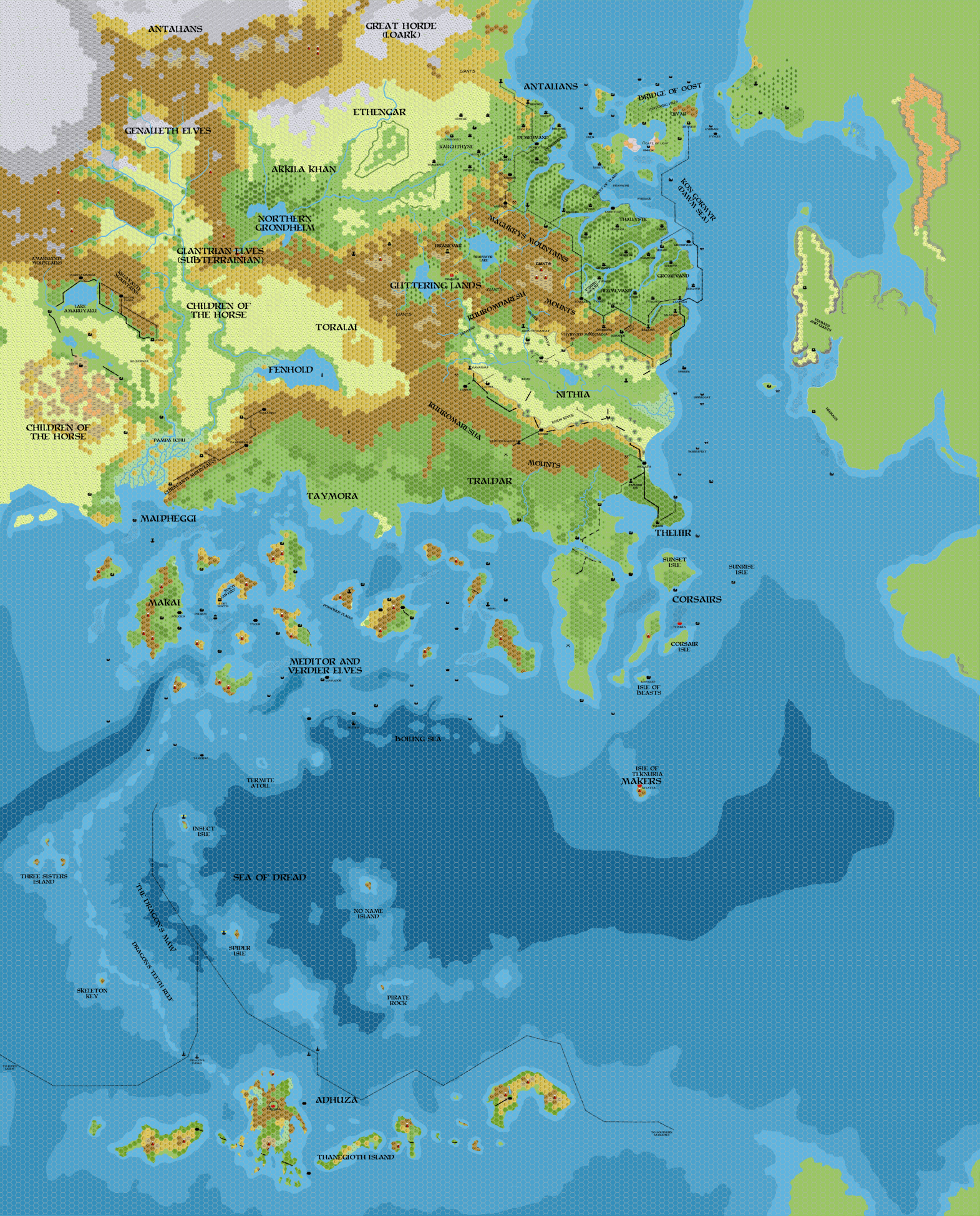
This is an original map created by one of Mystara’s excellent fan cartographers. For more information on the cartographer, including a gallery of all their maps, see also Appendix M: Mappers of Mystara.
Sources
Fan Sources
- Historical: Known World BC 1700, 8mph discussion thread at The Piazza (September 2011)
- Chimpman’s Known World 1700 BC, 8 miles per hex v2 (January 2012)
- Chimpman’s Known World 1750 BC, 8 miles per hex v2 (January 2012)
References
- All of John’s maps at the Atlas of Mystara
- John’s entry in Appendix M: Mappers of Mystara (upcoming)
- John’s author page at the Vaults of Pandius
Chronological Analysis
This is a fan-made map. It was published in January 2012. The updated Atlas version of this map is not yet available. See also Appendix C for annual chronological snapshots of the area. For the full context of this map in Mystara’s publication history, see the upcoming Let’s Map Mystara 2012.
The following lists are from the Let’s Map Mystara project. Additions are new features, introduced in this map. Revisions are changes to previously-introduced features. Hex Art & Fonts track design elements. Finally, Textual Additions are potential features found in the related text. In most cases, the Atlas adopts these textual additions into updated and chronological maps.
Under Construction! Please check back again soon for updates.