Chimpman’s Known World 2000 BC, 8 miles per hex v2
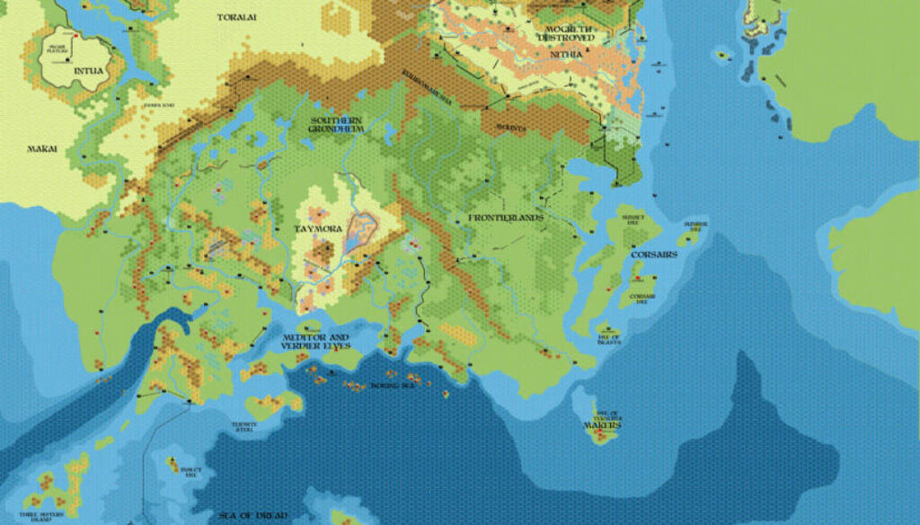
The fourth in a set of historical maps John began in September 2011, this one dealt with the Known World area in 2000 BC — between his 2300 BC campaign setting and the upheavals of 1750/1720/1700 BC. As with all of those maps, the original 2011 version is lost to us; this is the second version, from early 2012. John gave an overview of the original map in his post at The Piazza:
1) This should be just after the time of the Mogreth Flood. Much of inland Mogreth has been swept away, but I’m not sure what I have is the best way to portray this. I do envision the landscape recovering a fair amount.
2) I’ve actually left the ruins of Isshum on this map. I figure it might be nice to play with those ruins for the following 250 years or so, before the event that sinks Taymora also removes the last remnants of Isshum.
3) The Great Plateau is still intact at this point – it will crumble circa BC 1750.
4) Most of the BC 2300 shoreline is still intact at this time.
5) I’ve also melted off some of the northern glaciers – the terrain changes may still need to be tweaked.
A few days later he updated the map with some extra labels, and posted another list of points about the time period.
Then in January 2012 he posted a second version, explaining:
I’ve gone back to BC 2000 and inserted the Makai and Toralai. I’m thinking that the Makai were in the area pre-BC 2000, but that the Toralai would be relative newcomers. They were probably pushed out of their native lands to the north by the Ethengari.
This was the same change he made to his other revised maps of this time.
Due to its staging in 2000 BC, this map was a bridge between 2300 BC and the later, more familiar looking maps. Although it bore most resemblance to the 2300 BC map, it was clearly already a step toward the present era, and the map as a whole feels closer to the Known World that’s so familiar to us all.
John would return to revise all four of these maps a decade later, in 2022.
Fan-made Map by John Calvin (January 2012)
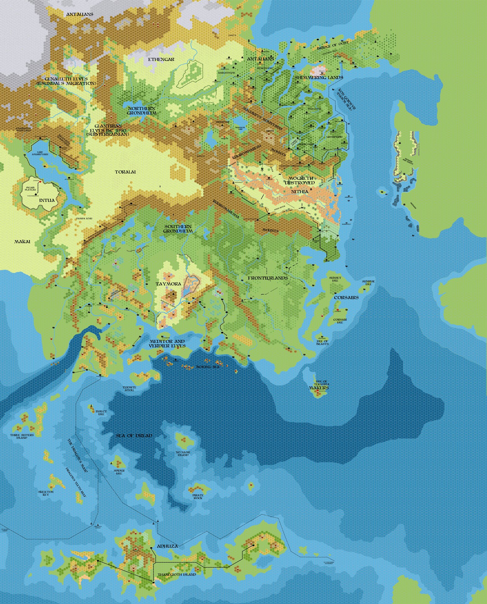
This is an original map created by one of Mystara’s excellent fan cartographers. For more information on the cartographer, including a gallery of all their maps, see also Appendix M: Mappers of Mystara.
Sources
Fan Sources
- Historical: Known World BC 2000, 8mph discussion thread at The Piazza (September 2011)
- Chimpman’s Known World 1700 BC, 8 miles per hex v2 (January 2012)
- Chimpman’s Known World 1720 BC, 8 miles per hex v2 (January 2012)
- Chimpman’s Known World 1750 BC, 8 miles per hex v2 (January 2012)
References
- All of John’s maps at the Atlas of Mystara
- John’s entry in Appendix M: Mappers of Mystara (upcoming)
- John’s author page at the Vaults of Pandius
Chronological Analysis
This is a fan-made map. It was published in January 2012. The updated Atlas version of this map is not yet available. See also Appendix C for annual chronological snapshots of the area. For the full context of this map in Mystara’s publication history, see the upcoming Let’s Map Mystara 2012.
The following lists are from the Let’s Map Mystara project. Additions are new features, introduced in this map. Revisions are changes to previously-introduced features. Hex Art & Fonts track design elements. Finally, Textual Additions are potential features found in the related text. In most cases, the Atlas adopts these textual additions into updated and chronological maps.
Under Construction! Please check back again soon for updates.