Chimpman’s Vaniae Work-in-progress
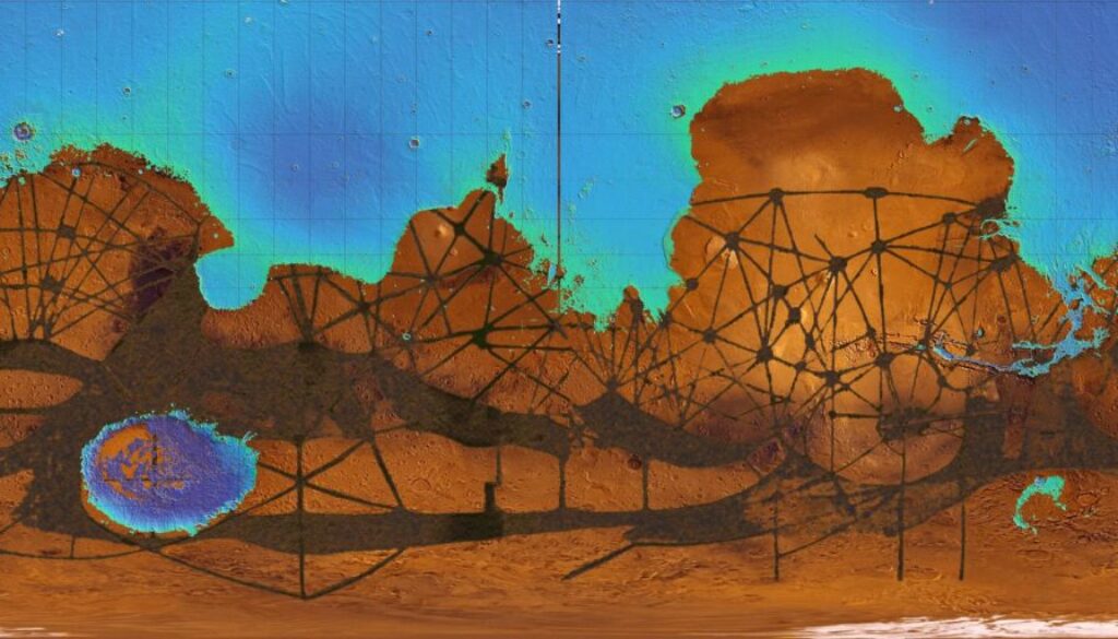
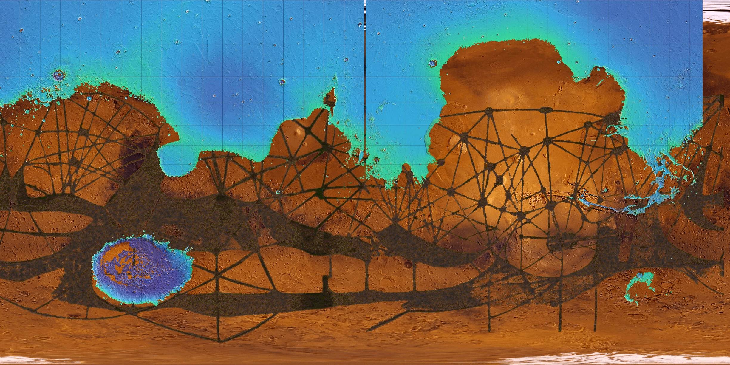
In mid-August 2009, while working on his Hollow Moon project, John was inspired to take a shot at another planet in Mystara’s solar system. Using a map of Mars as his base, he iterated ideas for mapping Mystara’s version of the red planet, which he called Vaniae. He explained his first concept map (first below) in his thread at The Piazza:
What you see here is basically an overlay of 3 different maps. The bottommost is a straight projection map. Layered on top of that is Lowell’s map of the canals on Mars. Then finally the topmost layer is a portion of a topographical map where I’ve taken the lowest level topography (the portions that would most likely be sea if water was present).
I’m not sure whether to go with one idea over the other (seas vs canals) or to go with some combination of the two.
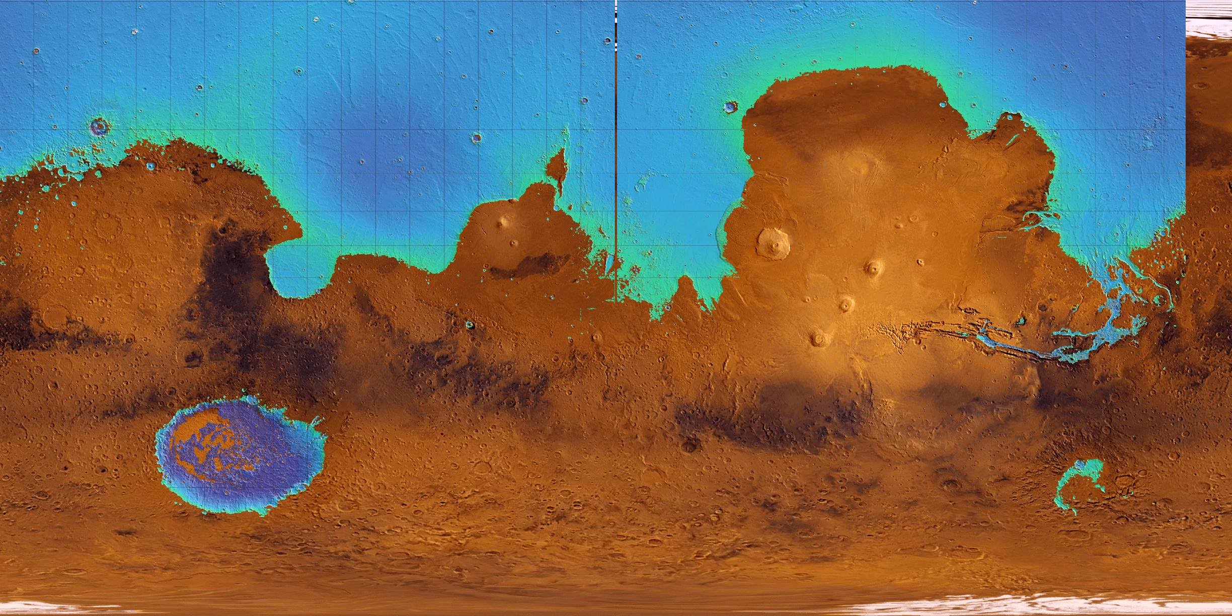
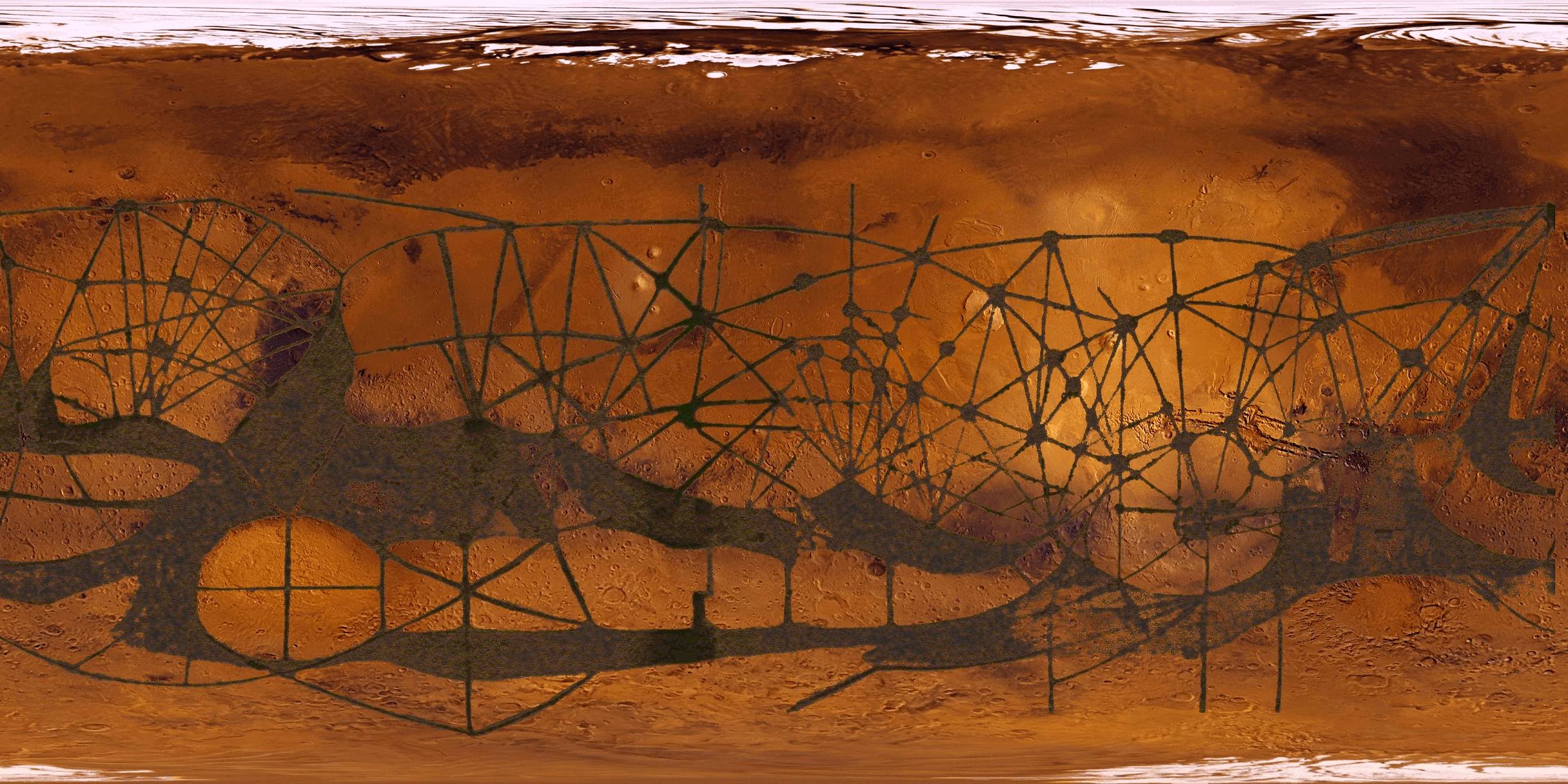
The second and third maps were separated layers of the first map, displaying the seas and canals (respectively) by themselves. John continued his explanations:
Canals only is the classic representation of Mars – a dying frozen world, where water is shipped to the equatorial cities from the polar regions through a massive canal system. It’s what Percival Lowell though he saw when he was observing the planet.
M-Mars_Seas
This is a more modern view of Mars – what it might look like after it’s been terraformed to the point where liquid water is viable on the surface of the planet.
A great brainstorming session followed these maps, with a lot of ideas for developing the planet.
John would return for another pass early the following year.
Fan-made Maps by John Calvin (August 2009)
This is an original map created by one of Mystara’s excellent fan cartographers. For more information on the cartographer, including a gallery of all their maps, see also Appendix M: Mappers of Mystara.
Sources
- None
Fan Sources
- [Mystaraspace] Map of M-Mars discussion thread at The Piazza
References
- All of John’s maps at the Atlas of Mystara
- John’s entry in Appendix M: Mappers of Mystara (upcoming)
- John’s author page at the Vaults of Pandius
Chronological Analysis
This is a fan-made map. It was published in August 2009. The updated Atlas version of this map is not yet available. See also Appendix C for annual chronological snapshots of the area. For the full context of this map in Mystara’s publication history, see the upcoming Let’s Map Mystara 2009.
The following lists are from the Let’s Map Mystara project. Additions are new features, introduced in this map. Revisions are changes to previously-introduced features. Hex Art & Fonts track design elements. Finally, Textual Additions are potential features found in the related text. In most cases, the Atlas adopts these textual additions into updated and chronological maps.
Under Construction! Please check back again soon for updates.